Filtered by:
- Sale Section
- List
- Grid
A subscription to the Price Guide is required to view results for auctions ten days or older. Click here for more information
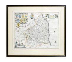

Willem Blaeu (Willem Janszoon Blaeu)(1571-1638)"Comitatus Northumbria; Vernacule Northumberland", map of Northumberland, with eleven family coats ...
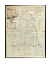
Thomas Kitchin(1719-1784)"A New and Improved Map of Northumberland",circa 1764, copper plate engraving, hand coloured,73 x 55cms, in frame.
20th Century American - Historic and Scenic Reaches of the Nation's Capital | mixed media print
20th Century American"Historic and Scenic Reaches of the Nation's Capital"; map of Washington USA,National Geographic Society, 1938Gilbert Grosven...
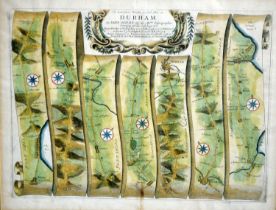
John Ogilby(1600-1676)"The Road from Whitby to Durham", strip map,copper plate engraving, hand coloured,34 x 46cms, in frame.
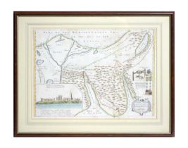
Thomas Shaw(1694-1757)A map of the Sinai Peninsula, with the Mediterranean Sea to the north and the Red Sea to the south, originally issued in "Re...
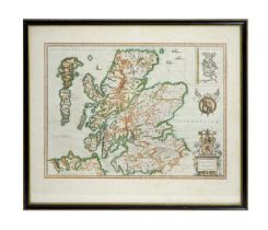
Willem Blaeu (Willem Janszoon Blaeu)(1571-1638)"Scotia Regnum", map of Scotland, with inset map of the Orkneys,published in the 1646 Dutch edition...