
Filtered by:
- Category
- List
- Grid
A subscription to the Price Guide is required to view results for auctions ten days or older. Click here for more information
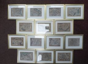

Fourteen framed 17thC and later coloured miniature maps: to include 'Poland' 'Gasconia' 'Italy'
Fourteen framed 17thC and later coloured miniature maps: to include 'Poland' 'Gasconia' 'Italy' and 'China' approx. 3.25" x 4.5"
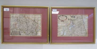
An 18thC coloured map 'Penborchia Comitatus et Comitatus Caermaridvnvm' incorporating a pictorial
An 18thC coloured map 'Penborchia Comitatus et Comitatus Caermaridvnvm' incorporating a pictorial cartouche, the arms of noble families and a scal...
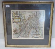
A 17thC Christopher Saxton coloured map 'Glocestriae Comitatus Olim fedes Dobvnorum' incorporating a
A 17thC Christopher Saxton coloured map 'Glocestriae Comitatus Olim fedes Dobvnorum' incorporating a banner cartouche, compass and scale with pri...

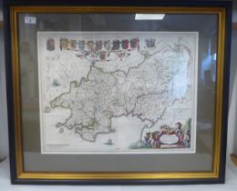
A 17thC John Speed coloured county map 'Buckingham Both Shyre and Shire' incorporating birdseye
A 17thC John Speed coloured county map 'Buckingham Both Shyre and Shire' incorporating birdseye views of Buckingham and Redding, the arms of honou...
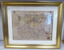
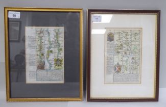
A 18thC coloured county map 'Barkshire Described' in a figural cartouche, incorporating an elevation
A 18thC coloured county map 'Barkshire Described' in a figural cartouche, incorporating an elevation view of Windsor Castle and surrounds, anotate...
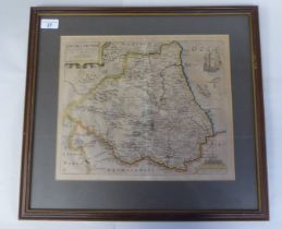
A 17thC Christopher Saxton coloured county map 'Dvnelmensis....Brigantvm' incorporating a ship in
A 17thC Christopher Saxton coloured county map 'Dvnelmensis....Brigantvm' incorporating a ship in the Sea and a scale 11" x 13" framed
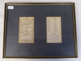
A 19thC coloured road map 'Northumberland' and a schedule of locations on-route 13" x 17" overall framed
A 17th/18thC coloured road map, an extract from London to Portsmouth with text and continued verso 7" x 5"; and another, London to St Albans with...
Two 17thC French coloured regional maps, viz. 'Cadurcium' and 'La Partie Serpentvionale du Langue'
Two 17thC French coloured regional maps, viz. 'Cadurcium' and 'La Partie Serpentvionale du Langue' with a scrolled title cartouche, compass and sc...
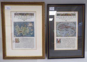
Two 16th/17thC Italian coloured maps, viz. 'Maiorea' and 'Venetia' each with attendant text, co
Two 16th/17thC Italian coloured maps, viz. 'Maiorea' and 'Venetia' each with attendant text, continued verso 4" x 5.5" framed
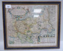
An early 17thC Johannes Morden coloured county map 'Middlesex' with a title cartouche, index and
An early 17thC Johannes Morden coloured county map 'Middlesex' with a title cartouche, index and compass 9.5" x 11" framed