Filtered by:
- Sale Section,
- Category
- List
- Grid
A subscription to the Price Guide is required to view results for auctions ten days or older. Click here for more information
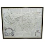

AFTER EMANUEL BOWEN; an 18th century map of Chester, 'An Accurate Map of the County Palatine of Chester', circa 1753, with original outline colour...
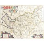
AFTER JAN JANSSON; map of Chester, Cestria Comitatus Palatinus, published Amsterdam circa 1648,
AFTER JAN JANSSON; map of Chester, Cestria Comitatus Palatinus, published Amsterdam circa 1648, engraved map with hand colouring, 38 x 50cm, frame...
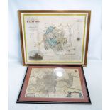
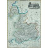
GREENWOOD & CO; 'Map of The County of Hereford from an Actual Survey made in the year 1831',
GREENWOOD & CO; 'Map of The County of Hereford from an Actual Survey made in the year 1831', later coloured, 58 x 70cm, and another of the South-E...
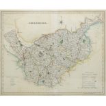
An early 19th century engraved and coloured map of Cheshire, 35 x 42cm, framed and glazed.
AFTER ROBERT MORDEN;
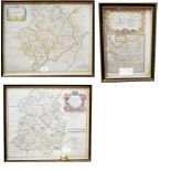
AFTER ROBERT MORDEN; a map of the county of Monmouth circa 1722 together with a map of Shropshire from the same series and a small hand coloured b...
A mid-19th century and later coloured map of Lancashire, 30.5 x 22.5cm, framed and glazed.

RAILWAY INTEREST; a Southern Regions Suburban Services mirrored map, 40.5 x 61cm. CONDITION REPORT: Some loss to the finish particularly to the...