
Sortieren nach:
- Kategorie
- Liste
- Galerie
Ein Abonnement der Preisliste ist notwendig um Ergebnisse, von Auktionen die vor einem längeren Zeitraum als 10 Tagen stattgefunden haben, ansehen zu können. Klicken Sie hier für mehr Informationen
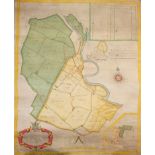

Rare early 18th century hand-scribed and polychrome painted Estate map on vellum depicting 'Bieleigh (sic) Abbey and Grange in the Parish of St. P...
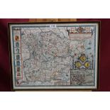
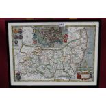
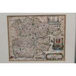
John Speede (1552 - 1629), hand-coloured engraved map of Essex, published by Bassett & Chiswell,
John Speede (1552 - 1629), hand-coloured engraved map of Essex, published by Bassett & Chiswell, circa 1676, English text, in double-sided glazed ...
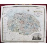
17th century hand-coloured engraved map after Christopher Saxton by Kig & Hale - Norfolk, from Camden's "Britannia", 1673, in glazed gilt frame, 2...

Johannes Blaeu (1599 - 1673), engraved map - "Suffolcia Vernacule Suffolke", circa 1678, in glazed frame, 38cm x 50cm
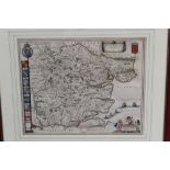
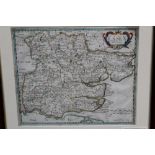
Johannes Blaeu (1599 - 1673), hand-coloured engraved map - "Essexia Comitatus", circa 1678,
Johannes Blaeu (1599 - 1673), hand-coloured engraved map - "Essexia Comitatus", circa 1678, in glazed frame, 42.5cm x 53.5cm
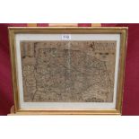
17th century engraved map of Essex by Henry Overton after John Speede, on laid paper (Speede's map of 1676 with roads added), in glazed oak frame,...
17th century hand-coloured engraved map of Suffolk, "Described by C. Saxton Corrected & Amended with many Additions as Roads by P. Lea", in glazed...
1830s hand-coloured engraved map of Norfolk by C & J Greenwood 1831 and 1832, unframed, 63cm x 77cm
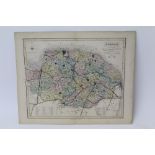
Five antique engraved maps of Norfolk by Kitchin, Fullarton, Walker and Teesdale and one other
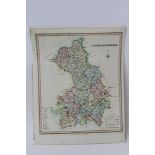
Five antique engraved maps of Cambridgeshire by Fullarton, Teesdale, Morden, Moule, Cary (1806)
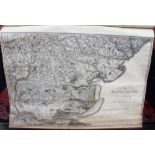
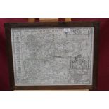
Madge's large scale Ordnance Survey of Essex 1805. "Part the First of the General Survey of Essex and a portion of the Adjoining Counties done by...
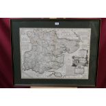
Emanuel Bowen (1693 - 1767), hand-coloured engraved map - "An Accurate Map of the County of Essex,
Emanuel Bowen (1693 - 1767), hand-coloured engraved map - "An Accurate Map of the County of Essex, Divided into Hundreds...", printed for John Bow...
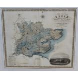
Early 19th century hand-coloured engraved map of Essex, from an Actual Survey Made in the Year 1824.
Early 19th century hand-coloured engraved map of Essex, from an Actual Survey Made in the Year 1824. By C. & I. Greenwood, in glazed gilt frame, ...
Richard Blome (1660 - 1705), hand-coloured engraved map of Essex, circa 1685, framed, 26.5cm x 33cm
Robert Morden (1650 - 1703), hand-coloured engraved map of Essex, in glazed frame, 36cm x 43cm