
Sortieren nach:
- Kategorie
2 items
- Liste
- Galerie
Dieses Auktionshaus möchte seine Ergebnisse nicht veröffentlichen. Bitte kontaktieren Sie das Auktionshaus bei Fragen direkt.
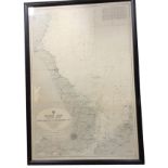

Los 387
A 1960 eastern coast hydrographic map showing sea depths, published by The Admiralty, framed. (
A 1960 eastern coast hydrographic map showing sea depths, published by The Admiralty, framed. (27in x 40in)
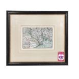
Los 437
An seventeenth century handcoloured map of southern Scotland by Pieter van den Keere, the numbered
An seventeenth century handcoloured map of southern Scotland by Pieter van den Keere, the numbered plate detailing the land from the Solway to the...