Sortieren nach:
- Kategorie,
- Künstler / Marke
- Liste
- Galerie
Dieses Auktionshaus möchte seine Ergebnisse nicht veröffentlichen. Bitte kontaktieren Sie das Auktionshaus bei Fragen direkt.
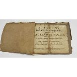

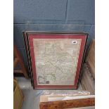
Kitchin (Thomas) : Kitchin's Post-Chaise Companion through England and Wales; Containing all the
Kitchin (Thomas) : Kitchin's Post-Chaise Companion through England and Wales; Containing all the Ancient and New Additional Roads. John Bowles, Ca...
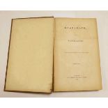
Charles Guthrie : Blood-Vessel Surgery and Its Applications, 1912. 8vo. Hb. Original red-cloth,
Charles Guthrie : Blood-Vessel Surgery and Its Applications, 1912. 8vo. Hb. Original red-cloth, gilt. The uncommon 1st edition of Charles Guthrie'...
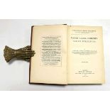
Frances Rolleston : Mazzaroth or The Constellations, Parts I, II, III & IV, 1862 - 1865. Bound as
Frances Rolleston : Mazzaroth or The Constellations, Parts I, II, III & IV, 1862 - 1865. Bound as one volume. Tall slim 8vo. Hb. Original cloth b...
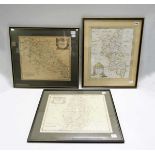
Robert Morden : Buckinghamshire, Northamptonshire ( both partially hand-coloured - outline, detail &
Robert Morden : Buckinghamshire, Northamptonshire ( both partially hand-coloured - outline, detail & cartouche ) and Nottinghamshire, C.1720 ( bu...
Emanuel Bowen : Map of the County of Northamptonshire, C. 1775. A copper-engraved map with vignette of Peterborough Cathedral and surrounded by d...
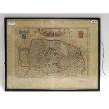
Johannes Blaeu : C. mid 17th century hand coloured engraved map of Norfolk - Nortfolcia, ( Norfolke ). Hand - coloured titular scroll work and He...
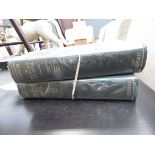
Thomas Stamford Raffles : The History of Java, 1965. Vols. I & II. OUP Facsimile. Large Qto. Hb,
Thomas Stamford Raffles : The History of Java, 1965. Vols. I & II. OUP Facsimile. Large Qto. Hb, Green buckram, gilt. Text with colour and monochr...
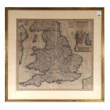
Cornelius Danckerts : Accuratissima Angliae regni et Walliae principatus descriptio Distinete divisa
Cornelius Danckerts : Accuratissima Angliae regni et Walliae principatus descriptio Distinete divisa in Omnes Suas Provincias et editia. Published...
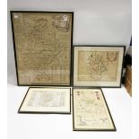
Bedfordshire Cartography : A selection of 4 maps, framed and glazed ( two mounted ) including -
Bedfordshire Cartography : A selection of 4 maps, framed and glazed ( two mounted ) including - Blaeu (Johannes) : Bedfordiensis Comitatus Anglis ...
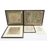
Five 17th. and 18th. County Maps including - John Speed : Northamtonshire (sic) with the printed
Five 17th. and 18th. County Maps including - John Speed : Northamtonshire (sic) with the printed date 1610 ( possibly 1676 with text to verso ) fe...