Sortieren nach:
- Kategorie,
- Künstler / Marke,
- Lostyp
- Liste
- Galerie
Dieses Auktionshaus möchte seine Ergebnisse nicht veröffentlichen. Bitte kontaktieren Sie das Auktionshaus bei Fragen direkt.


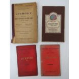
A German c1920s Atlas together with a quantity of mid-late 20thC Atlas books. Six items.
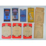
Bartholomews mounted on cloth and other Ordnance Survey maps; Oban District sheet II, Mid-Scotland sheet 45, Pembroke Sheet II, Automobile Map of ...
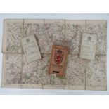
Argentiere (near Chamonix) Gilbert White published by Edward Stanford Ltd London, a twenty section map on cloth by Henri, Joseph et Charles Vallot...
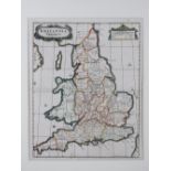
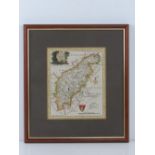
A hand coloured map of 'Britannia Saxonica', engraved by John Stuart for Robert Morden measuring 39.
A hand coloured map of 'Britannia Saxonica', engraved by John Stuart for Robert Morden measuring 39.5 x 32cm in mount, no frame.
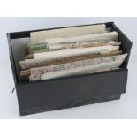
A quantity of assorted ordinance survey maps; three in twenty-one sections, being Cromer post 1912,
A quantity of assorted ordinance survey maps; three in twenty-one sections, being Cromer post 1912, Pwllheli post 1907, Brighton post 1911. Three ...
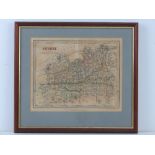
Surrey, drawn and engraved by J Archer for Dugdales England and Wales Delineated, hand coloured,
Surrey, drawn and engraved by J Archer for Dugdales England and Wales Delineated, hand coloured, sight size 24 x 19.5cm, framed and glazed.
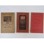
'A Description of Ordinance Survey Large Scale Maps', a c1920s edition, together with a 1955 edition. Also 'Map Reading' by Thomas Pickles publish...
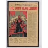
A framed front cover of the Financial Times Survey for 27th October 1986 'The City Revolution' 62 x
A framed front cover of the Financial Times Survey for 27th October 1986 'The City Revolution' 62 x 43cm.
Northamptonshire, a hand coloured map, sight size 16 x 20cm framed and glazed.

Scar Face print, framed and mounted, overall measuring 73 x 53cm.

A sailboat print, framed and mounted.
A quantity of assorted paper maps inc some 1940 War Revision sheets for Tunbridge Wells and Brighton, a post war map of Berlin showing American, R...