Sortieren nach:
- Kategorie
- Liste
- Galerie
Dieses Auktionshaus möchte seine Ergebnisse nicht veröffentlichen. Bitte kontaktieren Sie das Auktionshaus bei Fragen direkt.
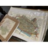

Maps & Books: Collection of Ordnance Survey maps from 1920s-1940s with map associated books including The County Maps of Old England by Thomas Mou...
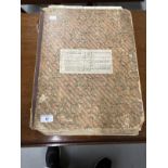
Maps: Ordnance Survey Maps of local interest Devizes, Calne, Moxlen, Farleigh, Colerne, etc. Mounted
Maps: Ordnance Survey Maps of local interest Devizes, Calne, Moxlen, Farleigh, Colerne, etc. Mounted on cardboard. 12ins. x 18ins. (31) Plus nine ...
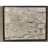
Antiquarian Maps: Late 17th cent. Hand coloured map of Hampshire by Robert Morden, central vertical crease. Framed and glazed. 17ins. x 13ins.
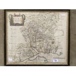
Antiquarian Maps: Early 17th cent. Hand coloured map of Essex, unknown cartographer, annotated in
Antiquarian Maps: Early 17th cent. Hand coloured map of Essex, unknown cartographer, annotated in Latin, central vertical crease. Framed and glaze...
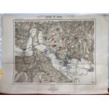
Antiquarian Maps: Two maps Franco-Prussian War Battle of Sedan. 9A depicts the positions of the
Antiquarian Maps: Two maps Franco-Prussian War Battle of Sedan. 9A depicts the positions of the contending forces towards noon, 9B shows the posit...
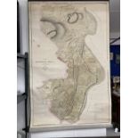
Antiquarian Maps: Large survey map of Heathfield Port and part of Strathspey, Scotland by George
Antiquarian Maps: Large survey map of Heathfield Port and part of Strathspey, Scotland by George Brown 1810. Copied by Alexander Duncan 1843. Scal...
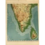
Maps/Atlases: Sectional map of India and adjacent countries, scale 1 inch to 32 miles. Published
Maps/Atlases: Sectional map of India and adjacent countries, scale 1 inch to 32 miles. Published under the direction of Colonel Sir S.G. Burrard K...