Sortieren nach:
- Kategorie
- Liste
- Galerie
Ein Abonnement der Preisliste ist notwendig um Ergebnisse, von Auktionen die vor einem längeren Zeitraum als 10 Tagen stattgefunden haben, ansehen zu können. Klicken Sie hier für mehr Informationen
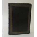

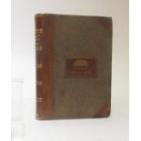
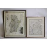
HISTORY OF THE ORIGINAL PARISH OF WHALLEY AND HONOR OF CLITHEROE, Thomas D Whitaker, 1818, 3rd
HISTORY OF THE ORIGINAL PARISH OF WHALLEY AND HONOR OF CLITHEROE, Thomas D Whitaker, 1818, 3rd ed., black crushed morocco, map in pocket to rear, ...
CARY'S NEW UNIVERSAL ATLAS CONTAINING SEPARATE MAPS of all the Kingdoms, States and Countries
CARY'S NEW UNIVERSAL ATLAS CONTAINING SEPARATE MAPS of all the Kingdoms, States and Countries Throughout the World, John Cary [1813] oblong folio,...
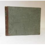
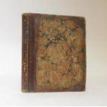
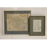
THE BRITISH ATLAS COMPRISING A COMPLETE SET OF COUNTY MAPS, Vernor, Hood and Sharpe, 1810, half
THE BRITISH ATLAS COMPRISING A COMPLETE SET OF COUNTY MAPS, Vernor, Hood and Sharpe, 1810, half calf, re-backed, over marbled boards, 58 hand colo...
THE BRITISH ATLAS COMPRISING SEPARATE MAPS OF EVERY COUNTY IN ENGLAND, 1846, Longman, Rees and Co,
THE BRITISH ATLAS COMPRISING SEPARATE MAPS OF EVERY COUNTY IN ENGLAND, 1846, Longman, Rees and Co, half calf re-backed, over textured cloth. Old d...
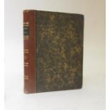
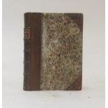
OSTELL'S NEW GENERAL ATLAS… a New Edition, 1833, Baldwin and Cradock; worn half calf over printed
OSTELL'S NEW GENERAL ATLAS… a New Edition, 1833, Baldwin and Cradock; worn half calf over printed paper covered boards. Contemporary coloured maps
CARY'S NEW AND CORRECT ENGLISH ATLAS BEING A NEW SET OF COUNTY MAPS, John Cary, 1809, worn half
CARY'S NEW AND CORRECT ENGLISH ATLAS BEING A NEW SET OF COUNTY MAPS, John Cary, 1809, worn half red morocco over marbled boards, re-backed, new en...
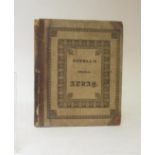
BRITANNIA DEPICTA OR OGILBY IMPROV'D, John Ogilby, Emanuel Bowen engraver, 4th ed., 1736. Engraved
BRITANNIA DEPICTA OR OGILBY IMPROV'D, John Ogilby, Emanuel Bowen engraver, 4th ed., 1736. Engraved title page, pp 273 [1] Engraved strip maps; Wil...

BRITANNIA DEPICTA or Ogilby Improv'd, Emanuel Bowen, 1720, Thomas Bowles, speckled calf, rebacked,
BRITANNIA DEPICTA or Ogilby Improv'd, Emanuel Bowen, 1720, Thomas Bowles, speckled calf, rebacked, WITH Cary's New & Correct English Atlas, 1793, ...
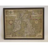
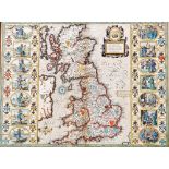
JOHN SPEED (1552-1629), "The Kingdome of Great Britaine & Ireland", hand coloured engraved map
JOHN SPEED (1552-1629), "The Kingdome of Great Britaine & Ireland", hand coloured engraved map published in 1611 with title cartouche, figural sca...
CHRISTOPHER SAXTON (XVI - XVII), "Southamtoniae", hand coloured engraved map with title cartouche,
CHRISTOPHER SAXTON (XVI - XVII), "Southamtoniae", hand coloured engraved map with title cartouche, scale and coat of arms, 16 1/2" x 18 1/4", stai...
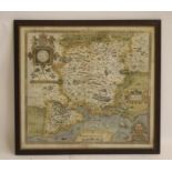
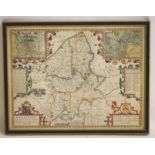
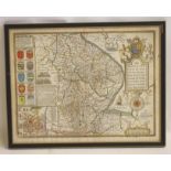
JOHN SPEED (1552-1629), "York Shire", hand coloured engraved map with title cartouche, scale,
JOHN SPEED (1552-1629), "York Shire", hand coloured engraved map with title cartouche, scale, compass rose and Royal Arms, script verso, 15 3/4" x...
JOHN SPEED (1552-1629), "Hant Shire", hand coloured engraved map published in 1611 with Royal Coat
JOHN SPEED (1552-1629), "Hant Shire", hand coloured engraved map published in 1611 with Royal Coat of Arms over title cartouche, plan of Wincheste...
JOHN SPEED (1552-1629), "Stafford Countie And Towne ...", hand coloured engraved map with plans of
JOHN SPEED (1552-1629), "Stafford Countie And Towne ...", hand coloured engraved map with plans of Litchfield and Stafford, title cartouche, simil...
JOHN SPEED (1552-1629), "Britain as it was Divided in the Tyme of the Englishe Saxons especially
JOHN SPEED (1552-1629), "Britain as it was Divided in the Tyme of the Englishe Saxons especially during the Their Heptarchy", hand coloured engrav...
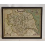
JOHN SPEED (1552-1629), "The West Riding of Yorkshyre ...1610", hand coloured engraved map with
JOHN SPEED (1552-1629), "The West Riding of Yorkshyre ...1610", hand coloured engraved map with title cartouche, six coats of arms, figural scale ...
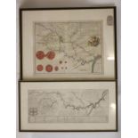
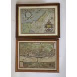
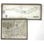
WILLIAM PALMER & PARTNERS, "A map of the River Ouse from its Rise ... to its Falling into Trent
WILLIAM PALMER & PARTNERS, "A map of the River Ouse from its Rise ... to its Falling into Trent and Humber", uncoloured engraved map dated 1725 wi...
JOHN CARY (1754-1834), "Principal Roman Camps, Fort Walls between the River Tyne ... Scotland", hand
JOHN CARY (1754-1834), "Principal Roman Camps, Fort Walls between the River Tyne ... Scotland", hand coloured engraved map 1806, 16 1/4" x 19", fr...
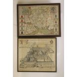
JOHN OWEN AND EMANUEL BOWEN (1693-1767), Road Map from Allerton to Knaresoborough, and verso from
JOHN OWEN AND EMANUEL BOWEN (1693-1767), Road Map from Allerton to Knaresoborough, and verso from Shepton to Lancaster, engraved and hand coloure...
ABRAHAM ORTELIUS (1527-1598), "Palestine ... Tilemanno Stella Sigenens", hand coloured engraved
ABRAHAM ORTELIUS (1527-1598), "Palestine ... Tilemanno Stella Sigenens", hand coloured engraved map c.1595, with title cartouche and Latin text wi...
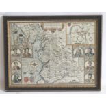
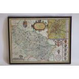
JOHN SPEED (1552-16290, "The Countie Pallatine of Lancaster Described and Divided into its Hundreds 1610", hand coloured, engraved map with plan o...
JOHN SPEED (1552-1629), "The Countie & Citie of Lyncolne described .....", hand coloured engraved
JOHN SPEED (1552-1629), "The Countie & Citie of Lyncolne described .....", hand coloured engraved map with title cartouche, figural scale and comp...
WILLIAM KIP (16th/17th Century), "Cornwall Olim Pars Danmoniorum, handcoloured engraved map with
WILLIAM KIP (16th/17th Century), "Cornwall Olim Pars Danmoniorum, handcoloured engraved map with title cartouche, scale and view of Launceston, sc...