Sortieren nach:
- Kategorie
- Liste
- Galerie
Ein Abonnement der Preisliste ist notwendig um Ergebnisse, von Auktionen die vor einem längeren Zeitraum als 10 Tagen stattgefunden haben, ansehen zu können. Klicken Sie hier für mehr Informationen
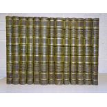

Gavard (Charles, Publisher), Galeries Historiques de Versailles, 11 Serie in 13 vol, engr plts, teg,
Gavard (Charles, Publisher), Galeries Historiques de Versailles, 11 Serie in 13 vol, engr plts, teg, hf green mor gt, elephant fo (59 x 43cm), boo...
Ledermuller (Martin Frobene), Deuxième Cinquantaine des Amusemens Microscopiques, 50 hd-col engr
Ledermuller (Martin Frobene), Deuxième Cinquantaine des Amusemens Microscopiques, 50 hd-col engr plts, cf gt, new cf spine, me, 4to, Adam Wolfgang...
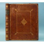
Du Halde (Jean Baptiste), a Description of the Empire of China and Chinese Tartary Together with the
Du Halde (Jean Baptiste), a Description of the Empire of China and Chinese Tartary Together with the Kingdoms of Korea and Tibet, 2 vols, fldg hd ...
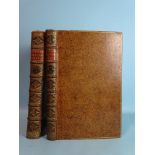
Beattie (William), The Waldenses or Protestant Valleys of Piedmont and Dauphiny by William Beattie, MA, engr pot, tp and plts, ge, hf blue mor gt,...
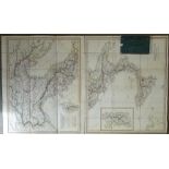
Maps: Italy & Scotland, Cramer (I A), Italie Antiquae et Novae, in two fldg hd col maps, each in
Maps: Italy & Scotland, Cramer (I A), Italie Antiquae et Novae, in two fldg hd col maps, each in 18 sections, 64 x 76cm, linen-backed with slip ca...
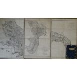
Maps: Italy, Rizzi-Zannoni, (Giovanni Antonio), Carta Geografica Della Sicilia Prima O sia Regno
Maps: Italy, Rizzi-Zannoni, (Giovanni Antonio), Carta Geografica Della Sicilia Prima O sia Regno di Napoli, in 3 fldg maps, each in 8 sections, 70...
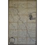
Sansom (Nicholas), Carte Nouvelle de l'Archevesche et Eslectorat de Cologne, in 18 line-coloured
Sansom (Nicholas), Carte Nouvelle de l'Archevesche et Eslectorat de Cologne, in 18 line-coloured sections, 99 x 61cm, pub: Pierre Mortier, Amsterd...
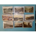
A quantity of topographical postcards, British Isles and Ireland, including many RP's, (370 approximately).
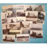
Postcards, approximately 130 mainly RP topographical postcards, UK, including some of Iona and other
Postcards, approximately 130 mainly RP topographical postcards, UK, including some of Iona and other Scottish Isles.
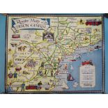
A 1930's "Route Map of the Devon General", showing a map of Devon with caricatures of people and
A 1930's "Route Map of the Devon General", showing a map of Devon with caricatures of people and artefacts associated with a town, 35 x 43.5cm, (s...