Sortieren nach:
- Auktionshaus-Kategorie,
- Kategorie
- Liste
- Galerie
Ein Abonnement der Preisliste ist notwendig um Ergebnisse, von Auktionen die vor einem längeren Zeitraum als 10 Tagen stattgefunden haben, ansehen zu können. Klicken Sie hier für mehr Informationen
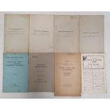

Four old Ordnance Survey 'South Wales and the Border in the 14th Century' folding maps by William
Four old Ordnance Survey 'South Wales and the Border in the 14th Century' folding maps by William Rees and other ephemera Condition ReportMaps - S...
Printed linen flag, England, Scotland and Ireland, in red, yellow and black, Maps to include a
Printed linen flag, England, Scotland and Ireland, in red, yellow and black, Maps to include a Geological map of Gloucester and Stroud, horseshoe ...
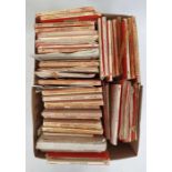
Large quantity of Ordnance Survey maps, 1950's and others (1 box)
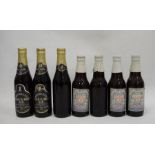
Seven bottles of 1977 Silver Jubilee ale
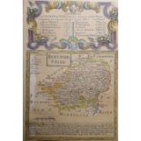
Two maps of Herefordshire, a strip map 'The Road from London to Holyhead' and a map published 1799
Two maps of Herefordshire, a strip map 'The Road from London to Holyhead' and a map published 1799 by J Baker (4)
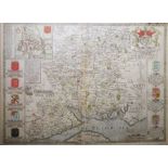
John Speed Handcoloured map"Hantshire", published I Sudbury & G Humbell, 40cm x 52cm
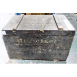
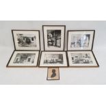
Painted box, written to top 'Lt Col F M Bucher D.S.O., Manor House, Cristow, Thetford, Norfold, N.
Painted box, written to top 'Lt Col F M Bucher D.S.O., Manor House, Cristow, Thetford, Norfold, N.F.O - P.O.D - U.K', 79cm x 49cm