Sortieren nach:
- Kategorie
- Liste
- Galerie
Ein Abonnement der Preisliste ist notwendig um Ergebnisse, von Auktionen die vor einem längeren Zeitraum als 10 Tagen stattgefunden haben, ansehen zu können. Klicken Sie hier für mehr Informationen
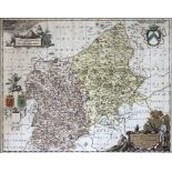

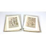
SCHENK ET VALK; a late 17th century hand coloured map of Shropshire and Staffordshire, published
SCHENK ET VALK; a late 17th century hand coloured map of Shropshire and Staffordshire, published circa 1680, 41.5 x 51.5cm, framed and glazed.
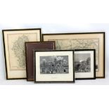
Two engraved maps of Cheshire and Staffordshire, a print of Macclesfield and two woven Macclesfield silks, all framed and glazed (5).
A collection of 20th century coloured maps with Bartholomew's examples including Aberystwyth,
A collection of 20th century coloured maps with Bartholomew's examples including Aberystwyth, English lakes, New Forest etc, ordnance survey examp...
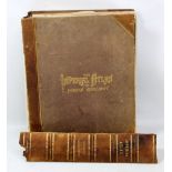
BLACKIE, W G; 'The Imperial Atlas of Modern Geography', a group of engraved and later coloured
BLACKIE, W G; 'The Imperial Atlas of Modern Geography', a group of engraved and later coloured International maps, pub. Blackie and Son, London 18...
AFTER OGILBY; a set of ten early 18th century road route maps, mounted but unframed.
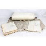
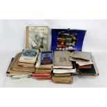
A collection of ordnance survey maps and deeds.