
Sortieren nach:
- Kategorie
- Liste
- Galerie
Ein Abonnement der Preisliste ist notwendig um Ergebnisse, von Auktionen die vor einem längeren Zeitraum als 10 Tagen stattgefunden haben, ansehen zu können. Klicken Sie hier für mehr Informationen
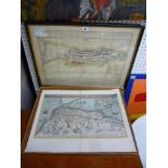

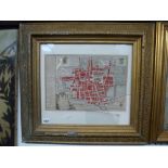
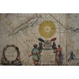
An antique engraved and hand-coloured map 'Barbariae et Biledulgerid Nova Discription', and a map of
An antique engraved and hand-coloured map 'Barbariae et Biledulgerid Nova Discription', and a map of Gibraltar (largest 44 x 54 cm), both framed (...
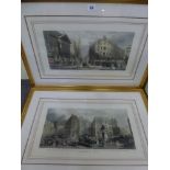
After G. Chambers, a coloured print, 'The City of London', and after J.H. Nixon, a coloured print, 'The Bank of England 1840' (each 20 x 41 cm), ...
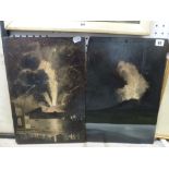
Naples Provincial school, a pair of oils on panel with two views of Vesuvius erupting (45 x 31
Naples Provincial school, a pair of oils on panel with two views of Vesuvius erupting (45 x 31 cm), unframed TO BID ON THIS LOT AND FOR VIEWING A...
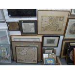
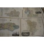
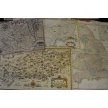
A selection of 13 framed maps comprising antique and Victorian examples, etc., and including an
A selection of 13 framed maps comprising antique and Victorian examples, etc., and including an antique engraved and hand-coloured map of Wales, o...
A rare and early 18th century map of 'La Haie' by N. de Fer (1705) (23 x 33 cm), framed TO BID ON
A rare and early 18th century map of 'La Haie' by N. de Fer (1705) (23 x 33 cm), framed TO BID ON THIS LOT AND FOR VIEWING APPOINTMENTS CONTACT B...
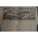
Two 1963 copies of Buck's 'Cities and Chief Towns in England and Wales' (1774) (2) TO BID ON THIS
Two 1963 copies of Buck's 'Cities and Chief Towns in England and Wales' (1774) (2) TO BID ON THIS LOT AND FOR VIEWING APPOINTMENTS CONTACT BAINBR...
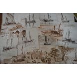
A collection of 12 Kingston and Chiswick Thames views by Desmond Winissett, all titled and signed (
A collection of 12 Kingston and Chiswick Thames views by Desmond Winissett, all titled and signed (largest 22 x 16 cm) (12) TO BID ON THIS LOT AN...
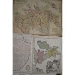
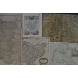
A small collection of antique and vintage maps including a Robert Morden map of Norfolk, Magna
A small collection of antique and vintage maps including a Robert Morden map of Norfolk, Magna Brittania, Angliae, Scotiae et..., and others such ...
'The Sea Atlas', with six maps and charts by John Seller TO BID ON THIS LOT AND FOR VIEWING APPOINTMENTS CONTACT BAINBRIDGES. WE DO NOT TAKE CRE...
C. & I. Greenwood, nine county maps of Britain, engraved and coloured, circa 1830 TO BID ON THIS LOT
C. & I. Greenwood, nine county maps of Britain, engraved and coloured, circa 1830 TO BID ON THIS LOT AND FOR VIEWING APPOINTMENTS CONTACT BAINBRI...
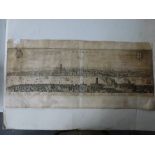
Matthaus Merrian (1593-1650), 17th Century engraved map of London TO BID ON THIS LOT AND FOR VIEWING
Matthaus Merrian (1593-1650), 17th Century engraved map of London TO BID ON THIS LOT AND FOR VIEWING APPOINTMENTS CONTACT BAINBRIDGES. WE DO NO...
A good lot of antique and other maps of the British Isles, including county maps by Robert Morden
A good lot of antique and other maps of the British Isles, including county maps by Robert Morden and others, street maps of cities, maps of Scotl...
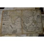
Hermon Moll, an engraved and hand-coloured map of the East Indies, together with many more antique
Hermon Moll, an engraved and hand-coloured map of the East Indies, together with many more antique and vintage maps and charts of many countries, ...
Robert Morden, maps of Kent and Middlesex, together with a large collection of maps relating to
Robert Morden, maps of Kent and Middlesex, together with a large collection of maps relating to the British Isles, including Ioh. Bapt. Homan's ma...
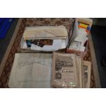
A folding map on fabric backing of Grey's Thurrock down to Kent, produced by Edward Stanford Ltd. of
A folding map on fabric backing of Grey's Thurrock down to Kent, produced by Edward Stanford Ltd. of Longacre, London, a small collection of postc...