Filtered by:
- Categoria
- Elenco
- Grid
A subscription to the Price Guide is required to view results for auctions ten days or older. Click here for more information
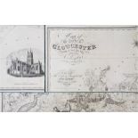

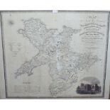
A map of the County of Gloucester from the Actual Survey by A Bryant in the Years 1823/4, published by A Bryant 1824, in three sections laid on li...
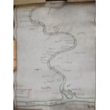
19th or earlier hand painted map on vellum of the River Avon from Stratford to the River Severn
19th or earlier hand painted map on vellum of the River Avon from Stratford to the River Severn noting nearby towns and villagers sluices (14) and...
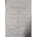
NASH Tredway - Collection of the History of Worcestershire, two volumes, printed by John Nichols,
NASH Tredway - Collection of the History of Worcestershire, two volumes, printed by John Nichols, 1781/2 - leather bound with illustrations and ma...
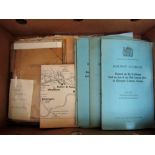
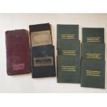
A box containing a collection of miscellaneous railway diagrams, maps, pamphlets, etc
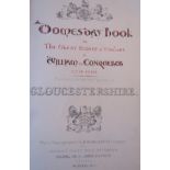
Domesday Book or The Great Survey of England of William the Conquerer - facsimile of the part
Domesday Book or The Great Survey of England of William the Conquerer - facsimile of the part relating to Gloucestershire Ordnance Survey Office S...

A collection of books about foreign travel together with a number of titles about maps and map
A collection of books about foreign travel together with a number of titles about maps and map makers, etc (approx 22 volumes)

A 19th century engraved map showing the southern part of the North Sea, by AG Findlay, published
A 19th century engraved map showing the southern part of the North Sea, by AG Findlay, published by RH Laurie, 1883, 112 x 152cm (incomplete) toge...
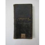
A leather bound pocket folio Cheltenham and Swindon Railway proposed route map 1835, with seven hand
A leather bound pocket folio Cheltenham and Swindon Railway proposed route map 1835, with seven hand coloured linen backed maps of the route scale...
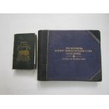
The Great Western, Cheltenham and Great Western and Bristol and Exeter Railway Guides, published
The Great Western, Cheltenham and Great Western and Bristol and Exeter Railway Guides, published by James Wyld 1839, with maps and illustrations, ...

A collection of folding maps - Archaeological map of Gloucestershire, Plan of the Druids Lodge
A collection of folding maps - Archaeological map of Gloucestershire, Plan of the Druids Lodge Estate, Wills, Oxford and Environs 1884, Beaufort F...

COOKE G A - Topographical and Statistical disc of the County of Gloucester, A New Guide to the
COOKE G A - Topographical and Statistical disc of the County of Gloucester, A New Guide to the City of Gloucester, Blacks Guide of Gloucester 186...

DEFNOS Chas - A Petit Atlas - Le Roy Denmark and Norway 1770, with 32 hand coloured maps
A collection of 19th century pocket county maps engraved by Sidney Hall, published by Chapman
A collection of 19th century pocket county maps engraved by Sidney Hall, published by Chapman Hall, Worcester Herefordshire, Oxfordshire, Warwicks...
A map of the Northwest Circuit of the Principality of Wales by C & J Greenwood, published 1834, 65 x
A map of the Northwest Circuit of the Principality of Wales by C & J Greenwood, published 1834, 65 x 75.5cm approx visible sheet size, framed ......