
Filtered by:
- Categoria
- Elenco
- Grid
A subscription to the Price Guide is required to view results for auctions ten days or older. Click here for more information

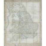
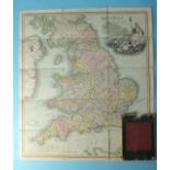
Wallis (John), Wallis's Pocket Itinerary, being a New and Accurate Guide to all the Principal Direct
Wallis (John), Wallis's Pocket Itinerary, being a New and Accurate Guide to all the Principal Direct and Cross Roads Throughout England, Wales and...
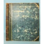
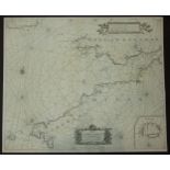
Norden (John), Speculi Britanniae Pars: A Topographical and Historical Description of Cornwall, engr
Norden (John), Speculi Britanniae Pars: A Topographical and Historical Description of Cornwall, engr tp, printed tp, engr dedication plate, table ...
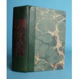
Antoninus (Augustus), Antonini Iter Britanniarum Commentariis Illustratum Thomae Gale, fldg map, 2
Antoninus (Augustus), Antonini Iter Britanniarum Commentariis Illustratum Thomae Gale, fldg map, 2 plts, text illus, re-backed, cf gt, 4to, 1709.
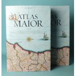
Blaeu (Joan), Atlas Major of 1665, facsimile reprint by Taschen, col illus, dwrp, bds, slip case,
Blaeu (Joan), Atlas Major of 1665, facsimile reprint by Taschen, col illus, dwrp, bds, slip case, fo, nd.
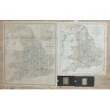
Cary (John), Cary's Reduction of his Large Map of England and Wales with Part of Scotland.....
Cary (John), Cary's Reduction of his Large Map of England and Wales with Part of Scotland..... Turnpike Roads..... hand-coloured outlines sectiona...
Wyld (James), Wyld's Road Director through England and Wales, hand-coloured outlines, sectionalised in fifteen sections, laid on linen, 1858, 63 x...
Cruchley (F), Cruchley's Railway and Station Tourist Map of Devon, hand-coloured, sectionalised in
Cruchley (F), Cruchley's Railway and Station Tourist Map of Devon, hand-coloured, sectionalised in twenty-eight sections, laid on linen, cl cover,...
Mudge (Lt Col. William), Ordnance Survey Map Sheet XXVIII, Island of Lundy, sectionalised and laid
Mudge (Lt Col. William), Ordnance Survey Map Sheet XXVIII, Island of Lundy, sectionalised and laid on linen, 65 x 94cm, The Tower, 1820, bearing G...
Brookes' Travelling Companion through England and Wales, pub: William Darton, 2nd edn, sectionalised
Brookes' Travelling Companion through England and Wales, pub: William Darton, 2nd edn, sectionalised and laid on linen, 59.5 x 52.5cm, with slip c...
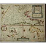
John Thomas & William Denys, A New Chart of Mounts Bay in Cornwall, with the Adjacent Coast, from
John Thomas & William Denys, A New Chart of Mounts Bay in Cornwall, with the Adjacent Coast, from Cape Lizard to Cape Cornwall, printed for Robt S...
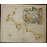
Seller, John, A Chart of the Channell of Bristoll, from Scilly to St Davids Head, in Wales, Newly
Seller, John, A Chart of the Channell of Bristoll, from Scilly to St Davids Head, in Wales, Newly corrected and published, Sold at his Shop, at th...
Van Keulen, GH, Nieuwe Paskaert Vande Verkeerde Canael Of De Kust Van Engelant, (Bristol Channel &
Van Keulen, GH, Nieuwe Paskaert Vande Verkeerde Canael Of De Kust Van Engelant, (Bristol Channel & South Coast of Wales), Amsterdam 1681, early ou...
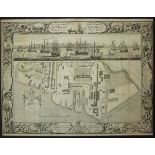
Milton, Thomas, A Geometrical plan and West Elevation of His Majesty's Dockyard near Plymouth,
Milton, Thomas, A Geometrical plan and West Elevation of His Majesty's Dockyard near Plymouth, with the Ordnance Wharf, etc, Feb. 2nd 1756, elabor...
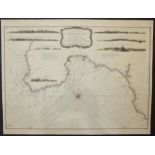
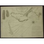
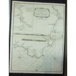
Collins, Grenville, Untitled, coast from Exmouth to Newton Ferry, from Collins' Coasting Pilot,
Collins, Grenville, Untitled, coast from Exmouth to Newton Ferry, from Collins' Coasting Pilot, London, 1693, engraved by I Harris, numbered '2', ...
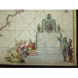
Collins, Grenville, The Severn or Channell of Bristol, Dedicated to Sir Robt Southwell who accompanied King William III on his Irish Expedition, w...
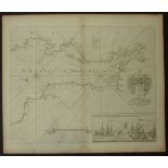
Laurie & Whittle, A Chart of The Isle, Roads and Race of Portland, with the Shambles, 53 Fleet
Laurie & Whittle, A Chart of The Isle, Roads and Race of Portland, with the Shambles, 53 Fleet Street, London, 1794, uncoloured, text in lower rig...
Van Keulen, Joannes, Pas-Kaert van de Canael, tusschen Engelandt en Vrancryck, Amsterdam, 1680,
Van Keulen, Joannes, Pas-Kaert van de Canael, tusschen Engelandt en Vrancryck, Amsterdam, 1680, the French coast is at the to, the English coast s...
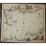
Doncker, Hendrick, Cust van Engelandt, van Lezard tot Engelandt eynde, Amsterdam, no date, uncoloured, showing southern tip of Ireland, South Wale...
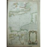
![Knapton, [A Draught of English Harbours], 1728, untitled, six small charts on one sheet, as follows:](https://portal-images.azureedge.net/auctions-2018/sreld10096/images/a9300e07-7d06-48f6-91c9-0ea6ace1dd74.jpg?w=155&h=155)
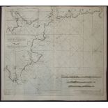
Knapton, [A Draught of English Harbours], 1728, untitled, six small charts on one sheet, as follows:
Knapton, [A Draught of English Harbours], 1728, untitled, six small charts on one sheet, as follows: Thames from Shooberry ness to London, Isle of...
Theunisz, Jacob, Cust van Engelant van Lezard tot Engelands cynd.........., Amsterdam, 1664, Plate
Theunisz, Jacob, Cust van Engelant van Lezard tot Engelands cynd.........., Amsterdam, 1664, Plate W13, coloured boundaries, showing Bristol Chann...
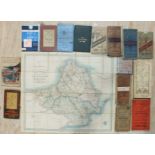
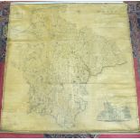
A hand-drawn map of Devonshire divided into Hundreds, William Salter 1850 and other Devon and
A hand-drawn map of Devonshire divided into Hundreds, William Salter 1850 and other Devon and Plymouth-related maps and 18th century coastal chart...
Degaulle Ballanger Sculpt. 1810, Nouvelle Carte Réduite De La Manche De Bretagne (En Trois Feuilles), 97 x 66cm and other Ministre De La Marine co...
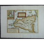
Ortelius, Abraham, Sicilae Veteris Typus, 1696, early colour, centre fold, inset map of Syracuse
Ortelius, Abraham, Sicilae Veteris Typus, 1696, early colour, centre fold, inset map of Syracuse in top left corner, text box in lower left corner...
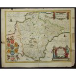
A C&J Greenwood map of The County of Devon, From an Original Survey......... publ.1827, with
A C&J Greenwood map of The County of Devon, From an Original Survey......... publ.1827, with engraving of Exeter Cathedral and map of Lundy inset,...
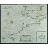
Jansson, Joannes, The Description of Devon-Shire, Amsterdam, no date, early colour in outline and wash, 54.5 x 43cm, Lootsman, Jacob and Theunis, ...
Van Keulen, GH, A New Gradually Encreasing Compass Map of a Part of the Sea Coasts of England, etc.
Van Keulen, GH, A New Gradually Encreasing Compass Map of a Part of the Sea Coasts of England, in which is contained the Coasts of Devonshire exte...
Brion, Deux Siciles avec les Metropoles Ecclesiastiques, Paris 1790, From Geographie Moderne, Historique et Politique, coloured boundaries, text i...