
Filtered by:
- Categoria
- Elenco
- Grid
A subscription to the Price Guide is required to view results for auctions ten days or older. Click here for more information
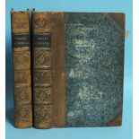

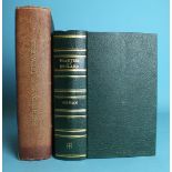
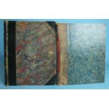
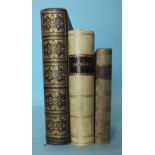
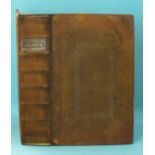
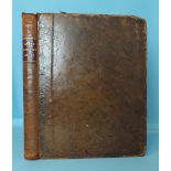
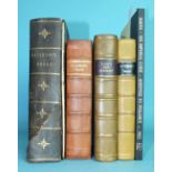
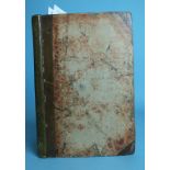
Stafford (Thomas), Pacata Hibernia or a History of the Wars in Ireland, 2 vols, 2 ports, 18 fldg
Stafford (Thomas), Pacata Hibernia or a History of the Wars in Ireland, 2 vols, 2 ports, 18 fldg maps and plts, hf cf gt, 8vo, 1810.
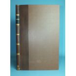
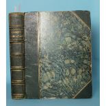
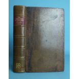
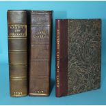
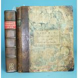
Carte (Thomas) A collection of Original Letters and Papers.....Found Among the Duke of Ormonde's
Carte (Thomas) A collection of Original Letters and Papers.....Found Among the Duke of Ormonde's Papers, 2 vols, vig tp, hf cf gt, 8vo, 1739; Urba...
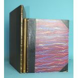
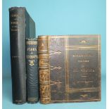
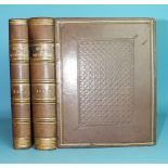
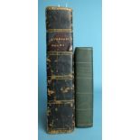
Gibbon (Edward), The History of the Decline and Fall of the Roman Empire, 8 vols, frontis, 12 fldg
Gibbon (Edward), The History of the Decline and Fall of the Roman Empire, 8 vols, frontis, 12 fldg maps, me, hf mor gt, 8vo, 1887.
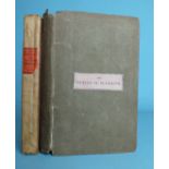
Hamilton (Sir William), Observations on Mount Vesuvius, Mount Etna and other Volcanos in a Series of
Hamilton (Sir William), Observations on Mount Vesuvius, Mount Etna and other Volcanos in a Series of Letters, fldg map, 5 plts, rebound hf cf gt, ...
Oliver (George), Monasticon Dioecesis Exoniensis....... In the Counties of Cornwall and Devon,
Oliver (George), Monasticon Dioecesis Exoniensis....... In the Counties of Cornwall and Devon, chromo frontis, plts, fldg map, me, hf mor gt, fo, ...
Britton (John) and Brayley (Edward Wedlake), Devonshire Illustrated In a Series of Views....... and,
Britton (John) and Brayley (Edward Wedlake), Devonshire Illustrated In a Series of Views....... and, Cornwall Illustrated In a Series of Views, 2 ...
Tunnicliff (William), A Topographical Survey of the Counties of Hants, Wilts, Dorset, Somerset,
Tunnicliff (William), A Topographical Survey of the Counties of Hants, Wilts, Dorset, Somerset, Devon and Cornwall, 6 fldg maps, (no map of Devon)...
Woodley (Rev. George), A View of the Present State of the Scilly Islands, ......... Fisheries,
Woodley (Rev. George), A View of the Present State of the Scilly Islands, ......... Fisheries, fldg hd col chart, hf cf gt, 8vo, 1822.
Cornwall & Devonshire, a cl-bound volume of articles from the English Illustrated Magazine, with
Cornwall & Devonshire, a cl-bound volume of articles from the English Illustrated Magazine, with over 100 engr views and 15 maps, (some fldg), ge,...
Camden's Britannia - An Extract: Devonshire, pp33-67, rebound and inter-leaved with a d-p map and
Camden's Britannia - An Extract: Devonshire, pp33-67, rebound and inter-leaved with a d-p map and many engr views of Devon tipped-in and stuck dow...
Camden's Britannia - an extract, pp199-208 'Denshire' with dp hd col map by William Kip, rebound
Camden's Britannia - an extract, pp199-208 'Denshire' with dp hd col map by William Kip, rebound cf gt, fo, nd, (1610), together with two other b...
Norden (John), Speculi Britanniae Pars: A Topographical and Historical Description of Cornwall, engr
Norden (John), Speculi Britanniae Pars: A Topographical and Historical Description of Cornwall, engr tp, printed tp, engr dedication plate, table ...
Cox (Rev. Thomas), Magna Britannia - Devon, pp465-546, later tp, engr hd col fldg map by Robert
Cox (Rev. Thomas), Magna Britannia - Devon, pp465-546, later tp, engr hd col fldg map by Robert Morden, hf mor gt, sm 4to, 1720 and another copy, ...
Rawlinson (Robert), Report to the General Board of Health...... into the Sewage, Drainage and Supply
Rawlinson (Robert), Report to the General Board of Health...... into the Sewage, Drainage and Supply of Water and the Sanitary Condition of the In...
Rowe (J Brooking), The Ecclesiastical History of Old Plymouth, plts, ge, dec mor gt, by Walker,
Rowe (J Brooking), The Ecclesiastical History of Old Plymouth, plts, ge, dec mor gt, by Walker, Binders, Plymouth, 8vo, 1876; Briggs (T R Archer),...
Lysons (Rev. Daniel & Samuel), Magna Britannia, Vol III - Cornwall, fldg map, 37 plts (complete),
Lysons (Rev. Daniel & Samuel), Magna Britannia, Vol III - Cornwall, fldg map, 37 plts (complete), teg, green, hf mor gt, 4to, 1814.
Moore (Rev. Thomas), The History of Devonshire, 2 vols, engr tp, engr plan, map and 90 plts,
Moore (Rev. Thomas), The History of Devonshire, 2 vols, engr tp, engr plan, map and 90 plts, tissue gds, cf gt, 4to, 1829.
Izacke (Richard), Remarkable Antiquities of the City of Exeter, now very much enlarged and continued
Izacke (Richard), Remarkable Antiquities of the City of Exeter, now very much enlarged and continued to the year 1723, by Samuel Izacke, engr fron...
Izacke (Richard), Antiquities of the City of Exeter, 1677, 1st Edn, engr frontis, armorials in text,
Izacke (Richard), Antiquities of the City of Exeter, 1677, 1st Edn, engr frontis, armorials in text, d-p, map of Exeter, re-backed cf gt, 8vo, 167...
Izacke (Richard), Remarkable Antiquities of the City of Exeter, 2nd Edn Now Very Much Enlarged and
Izacke (Richard), Remarkable Antiquities of the City of Exeter, 2nd Edn Now Very Much Enlarged and Continued to the Year 1723 by Samuel Izacke, en...
Heath (Robert), A Natural and Historical Account of the Islands of Scilly, engr fldg map (repaired),
Heath (Robert), A Natural and Historical Account of the Islands of Scilly, engr fldg map (repaired), fldg plt, rebacked hf cf gt, 8vo, 1750.
Woodley, Rev George), A View of the Present State of the Scilly Islands......Fisheries, hd col
Woodley, Rev George), A View of the Present State of the Scilly Islands......Fisheries, hd col fldg map, me, rebacked cf gt, 8vo, 1822.
Matthews (William), Harbour of Refuge Inquiry, North Coast of Devon and Cornwall, Report, 23rd
Matthews (William), Harbour of Refuge Inquiry, North Coast of Devon and Cornwall, Report, 23rd June 1906, 6 fldg maps and charts and appendix by C...
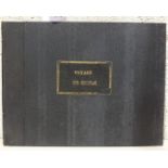
Swinburne (Henry), Travels in the Two Sicilies, Vo I only (of 2), fldg engr map, table and 8 plts,
Swinburne (Henry), Travels in the Two Sicilies, Vo I only (of 2), fldg engr map, table and 8 plts, cf gt, 4to, 1783.
Morogues (Victe Alphonse de), Souvenirs de la Sicile, engr vig tp, 19 engr views on 18 plts,
Morogues (Victe Alphonse de), Souvenirs de la Sicile, engr vig tp, 19 engr views on 18 plts, tissue gds, no text, hf mor gt, lge ob 4to, 1836.
Artaud (Le Chevalier), Italie, bound with Salle (de la), Sicilie, fldg maps, plts, water-marked, me,
Artaud (Le Chevalier), Italie, bound with Salle (de la), Sicilie, fldg maps, plts, water-marked, me, mor gt, 8vo, 1835; Paterno (Ignazio), Viaggio...
Hill (Rev. Brian), Observations and Remarks in a Journey Through Sicily and Calabria in the Year
Hill (Rev. Brian), Observations and Remarks in a Journey Through Sicily and Calabria in the Year 1791, hd col in outline, fldg map (reinforced), r...
Gourbillon (M), Travels in Sicily and to Mount Etna in 1819, engr vig tp, 2 plts, 1 map, rebound
Gourbillon (M), Travels in Sicily and to Mount Etna in 1819, engr vig tp, 2 plts, 1 map, rebound hf cf gt, 8vo, 1820.
Hoare (Sir Richard Colt), A Classical Tour Through Italy and Sicily, engr map, rebacked cf gt,
Hoare (Sir Richard Colt), A Classical Tour Through Italy and Sicily, engr map, rebacked cf gt, 4to, 1819.
Callejo y Angulo (Pierre de), Description de L'Isle de Sicile et de Ses Cotes Maritimes avec Le
Callejo y Angulo (Pierre de), Description de L'Isle de Sicile et de Ses Cotes Maritimes avec Le Plans de Toutes Ses Forteresses......, with 2 fldg...
Sandys (George), A Relation of a Journey begun An Dom 1610, Foure Bookes containing a Description of
Sandys (George), A Relation of a Journey begun An Dom 1610, Foure Bookes containing a Description of the Turkish Empire, of ?gypt, of the Holy Lan...
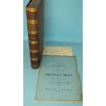
Ogilby (John) and Senex (John), The Roads Through England Delineated or, Ogilby's Survey Revised,
Ogilby (John) and Senex (John), The Roads Through England Delineated or, Ogilby's Survey Revised, Improved and Reduced to a Size portable for the ...
Gray (George Carrington), Gray's New Book of Roads, hd col fldg map, 48 engr maps, (2 fldg), hf
Gray (George Carrington), Gray's New Book of Roads, hd col fldg map, 48 engr maps, (2 fldg), hf mor gt, square 8vo, 1824.
Salmon (Thomas), A New Geographical and Historical Grammar, 9th edn, red and black tp, engr fldg
Salmon (Thomas), A New Geographical and Historical Grammar, 9th edn, red and black tp, engr fldg maps as listed and one extra of North Wales, cf g...
Keere (Pieter Van Den), England, Wales, Scotland and Ireland Described and Abridged..... 1668, tp
Keere (Pieter Van Den), England, Wales, Scotland and Ireland Described and Abridged..... 1668, tp and first 8pp all facsimiles, 61 (of 63) engr ma...
Dodsley (R & J, Publishers), England Illustrated or a Compendium of the Natural History, Geography, Topography and Antiquities Ecclesiastical and ...
Burlington (Charles) and others, The Modern Universal British Traveller, or a New Complete and
Burlington (Charles) and others, The Modern Universal British Traveller, or a New Complete and Accurate Tour Through England, Wales, Scotland and ...
Dodsley (Robert) and Cowley (John), The Geography of England Done in the Manner of Gordon's
Dodsley (Robert) and Cowley (John), The Geography of England Done in the Manner of Gordon's Geographical Grammar....... also a Separate Mapp of En...
Mogg (Edward), Paterson's Roads, 18th edn, fldg engr Map of England and Wales, frontis, 12 maps on 9
Mogg (Edward), Paterson's Roads, 18th edn, fldg engr Map of England and Wales, frontis, 12 maps on 9 fldg sheets, me, hf mor gt, 8vo, nd and Mogg'...
Wightwick (George), Nettleton's Guide to Plymouth, Stonehouse, Devonport and to the Neighbouring
Wightwick (George), Nettleton's Guide to Plymouth, Stonehouse, Devonport and to the Neighbouring Country, frontis, 3 fldg maps, 10 plts, cl with l...
Hall (Sidney), A Travelling County Atlas: With all the Railroads Accurately Laid down and Coloured, 46 d-p maps, hd col in outline, some fldg, reb...
Butler (Samuel), An Atlas of Ancient Geography, 21 d-p map plts, mainly hd col lining, hf mor gt,
Butler (Samuel), An Atlas of Ancient Geography, 21 d-p map plts, mainly hd col lining, hf mor gt, 8vo, nd; and Capper, (Benjamin Pitts), A Topogra...
Desnos (Louis Charles), Senex (John) and Bellin (Jacques), Nouvel Atlas D'Angleterre 1767 bound with
Desnos (Louis Charles), Senex (John) and Bellin (Jacques), Nouvel Atlas D'Angleterre 1767 bound with The Roads Through England or, Ogilby Survey (...
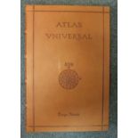
Homen (Diogo), Atlas Universal, facsimile of a medieval manuscript, no.825/987, 19 d-p maps, col and
Homen (Diogo), Atlas Universal, facsimile of a medieval manuscript, no.825/987, 19 d-p maps, col and gt, cf, in cf case, 1 ge fo, Barcelona 2000 a...
Cary's New and Correct English Atlas Being a New Set of County Maps from Actual Surveys......,
Cary's New and Correct English Atlas Being a New Set of County Maps from Actual Surveys......, engr tp, 46 hd col outlined engr maps, (complete), ...
Cary's New Itinerary, or an Accurate Delineation of the Great Roads...... England and Wales, fldg
Cary's New Itinerary, or an Accurate Delineation of the Great Roads...... England and Wales, fldg map, hf cf gt, 8vo 1798, 1st Edn, another editio...
Badeslade (Thomas) and Toms (William Henry), Chorographia Britanniae or, A New Set of Maps of all
Badeslade (Thomas) and Toms (William Henry), Chorographia Britanniae or, A New Set of Maps of all the Counties in England and Wales, 1st Edn, doub...
Worms (Lawrence), and Baynton-Williams (Ashley), British map engravers, illus, dwrps, cl gt, 8vo,
Worms (Lawrence), and Baynton-Williams (Ashley), British map engravers, illus, dwrps, cl gt, 8vo, 2011 and other books on maps.

Pedley (Mary Sponberg), Bel et Utile, the Work of the Robert de Vaugondy Family of Mapmakers, illus,
Pedley (Mary Sponberg), Bel et Utile, the Work of the Robert de Vaugondy Family of Mapmakers, illus, dwrps, cl gt, 4to, 1992 and other modern atla...
Wallis (John), Wallis's New Pocket Edition of the English Counties or Travellers Companion, 44 hd
Wallis (John), Wallis's New Pocket Edition of the English Counties or Travellers Companion, 44 hd col maps, (including unlisted Isle of Wight), re...
Wallis (John), Wallis's Pocket Itinerary, being a New and Accurate Guide to all the Principal Direct
Wallis (John), Wallis's Pocket Itinerary, being a New and Accurate Guide to all the Principal Direct and Cross Roads Throughout England, Wales and...
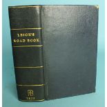
Leigh (Samuel), Leigh's New Atlas of England and Wales, engr tp only, 55 engr maps, bound with
Leigh (Samuel), Leigh's New Atlas of England and Wales, engr tp only, 55 engr maps, bound with Leigh's New Pocket Road Book of England and Wales, ...
Owen (John) and Bowen (Emanuel), Britannia Depicta, or, Ogilby Improv'd, Being a Correct Coppy of Mr
Owen (John) and Bowen (Emanuel), Britannia Depicta, or, Ogilby Improv'd, Being a Correct Coppy of Mr Ogiby's Actual Survey of all Ye Direct and Pr...
Cary (John), Cary's New Itinerary, or, An Accurate Delineation of the Great Roads.... England and
Cary (John), Cary's New Itinerary, or, An Accurate Delineation of the Great Roads.... England and Wales....Scotland, 2nd edn, fldg maps, rebacked ...
Donn (Benjamin), A Map of the County of Devon with the City and County of Devon with the City and
Donn (Benjamin), A Map of the County of Devon with the City and County of Devon with the City and County of Exeter, hd col map of Devon, 11 hd col...
Paterson (Capt. Daniel), Paterson's British Itinerary Being a New and Accurate Delineation and
Paterson (Capt. Daniel), Paterson's British Itinerary Being a New and Accurate Delineation and Description of the Direct and Principal Cross Roads...
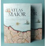
Blaeu (Joan), Atlas Major of 1665, facsimile reprint by Taschen, col illus, dwrp, bds, slip case,
Blaeu (Joan), Atlas Major of 1665, facsimile reprint by Taschen, col illus, dwrp, bds, slip case, fo, nd.
Cary (John), Cary's Traveller's Companion or a Delineation of the Turnpike Roads of England and
Cary (John), Cary's Traveller's Companion or a Delineation of the Turnpike Roads of England and Wales, engr tp, hd col engr fldg map of Yorkshire,...
Kitchin (Thomas), The Traveller's Guide Through England and Wales, engr hd col map in pocket at rear
Kitchin (Thomas), The Traveller's Guide Through England and Wales, engr hd col map in pocket at rear dated 1783, (repaired), hf cf gt, 15.5 x 19.5...
Laurie (Robert) and Whittle (James), New Traveller's Companion: Exhibiting A Complete and Correct
Laurie (Robert) and Whittle (James), New Traveller's Companion: Exhibiting A Complete and Correct Survey of all the Direct and Principal Cross Roa...