Affinez votre recherche
Filtered by:
- Catégorie
- Liste
- Grille
Ce commissaire-priseur a choisi de ne pas publier ses résultats. Veuillez le contacter directement pour toute demande de renseignements.
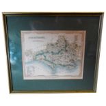

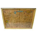
GROUP OF SEVEN FRAMED MAPS comprising two small maps, by Emanuel Bowen, 18th century, Hampshire by
GROUP OF SEVEN FRAMED MAPS comprising two small maps, by Emanuel Bowen, 18th century, Hampshire by Robert Morden, large colour map of Dorsetshire,...
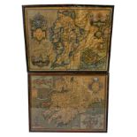
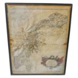
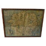
JOHN SPEEDE, HAND COLOURED MAP OF THE PROVINCE OF MOUNSTER (MUNSTER), IRELAND with County Cork,
JOHN SPEEDE, HAND COLOURED MAP OF THE PROVINCE OF MOUNSTER (MUNSTER), IRELAND with County Cork, Clare, Kerry, Limerick and Tipperary, dated 1610, ...
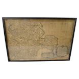
GEORGE SANSON, A MAP OF 'ROYAUME DE WESTSEX' and including Mercia and East Anglia, with Chester,
GEORGE SANSON, A MAP OF 'ROYAUME DE WESTSEX' and including Mercia and East Anglia, with Chester, Darby, Nottingham etc, dated 1654, framed and und...
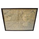
GUILLAME DELISLE, 'CARTE DES PAYS VOISINS DE LA MER CASPIENE' a hand coloured map featuring the
GUILLAME DELISLE, 'CARTE DES PAYS VOISINS DE LA MER CASPIENE' a hand coloured map featuring the Black Sea and Caspian Sea, dated 1723, framed and ...
BAPTISTA BOAZIO, A LATE 19TH CENTURY REPRODUCTION OF A MAP OF IRELANDE, together with an early
BAPTISTA BOAZIO, A LATE 19TH CENTURY REPRODUCTION OF A MAP OF IRELANDE, together with an early 19th century French map of Caucases, framed. 95cms...
G SANSON AND PIERRE MARRIETTE, PARTIE SEPTENTRIONALE DU GOUVERNMENT DE DRONTHEMUS ...DE SALTEN, a
G SANSON AND PIERRE MARRIETTE, PARTIE SEPTENTRIONALE DU GOUVERNMENT DE DRONTHEMUS ...DE SALTEN, a hand coloured map of the coast dated 1668, toget...
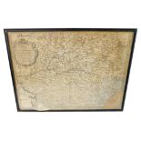
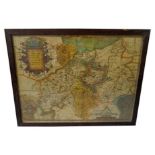
N SANSON, 'GOVERNMENT GENERAL D'ORLEANS', MAP OF FRANCE' including Le Maine, Le Perche, La Beauce,
N SANSON, 'GOVERNMENT GENERAL D'ORLEANS', MAP OF FRANCE' including Le Maine, Le Perche, La Beauce, Le Gastinois, dated 1650, framed and glazed; an...
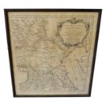
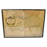
ROBERT DE VAUGONDY, A HAND COLOURED MAP 'CARTE DES ENVIRONS DE LA MER-NOIRE', dated 1783, framed and
ROBERT DE VAUGONDY, A HAND COLOURED MAP 'CARTE DES ENVIRONS DE LA MER-NOIRE', dated 1783, framed and glazed. 56cms x 51cms ...[more]
JOHN SPEEDE, A HAND COLOURED MAP OF 'THE PROVINCE OF ULSTER' with a small cartouche of 'Enis Kelling
JOHN SPEEDE, A HAND COLOURED MAP OF 'THE PROVINCE OF ULSTER' with a small cartouche of 'Enis Kelling Fort', framed and glazed. 38cms x 52cms .....
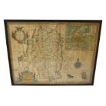
JOHN SPEEDE, A MAP OF 'THE COUNTY OF LEINSTER WITH THE CITIE OF DUBLIN', published by Richard
JOHN SPEEDE, A MAP OF 'THE COUNTY OF LEINSTER WITH THE CITIE OF DUBLIN', published by Richard Chiswell and Thomas Bassett, dated 1610, framed and ...
GEORGE SANSON, A MAP OF THE 'PROVINCES D'WEST AUTRES FOIS ROYAUME D'WESTSEX' including South Wales
GEORGE SANSON, A MAP OF THE 'PROVINCES D'WEST AUTRES FOIS ROYAUME D'WESTSEX' including South Wales and the South West, dated 1654, framed and glaz...
CHRISTOPHER SAXTON, A RARE HAND COLOURED MAP OF NORTH HAMPTON AND ADJACENT COUNTIES FROM THE ATLAS
CHRISTOPHER SAXTON, A RARE HAND COLOURED MAP OF NORTH HAMPTON AND ADJACENT COUNTIES FROM THE ATLAS OF ENGLAND AND WALES DATED 1576, glazed and fra...
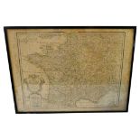
GUILLAUME DE L'ISLE, HAND COLOURED MAP OF FRANCE, 'Carte de France', dated 1800, framed and glazed. 53cms x 72cms