Affinez votre recherche
Filtered by:
- Catégorie
- Liste
- Grille
A subscription to the Price Guide is required to view results for auctions ten days or older. Click here for more information


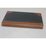
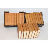
FIRST WORLD WAR INTEREST BOOKS to include Peter Chasseaud - 'Topography of Armageddon A British Tre
FIRST WORLD WAR INTEREST BOOKS to include Peter Chasseaud - 'Topography of Armageddon A British Trench Map Atlas of the Western Front 1914 - 1918'...

T & A. D. POYSER BIRD BOOKS various editions including 'The Migration Atlas Movements of the Birds
T & A. D. POYSER BIRD BOOKS various editions including 'The Migration Atlas Movements of the Birds of Britain and Ireland' 2002 (13) ...[more]
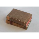
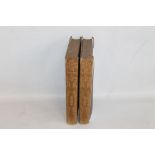
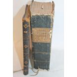
THE GENTLEMAN'S MAGAZINE, AND HISTORICAL CHRONICLE' Volume XXXIX For the Year M.DCC.LXIX (1769) and
THE GENTLEMAN'S MAGAZINE, AND HISTORICAL CHRONICLE' Volume XXXIX For the Year M.DCC.LXIX (1769) and Volume XLIV For the Year M.DCCLXXIV (1774), in...
TOMBLESON'S VIEWS OF THE RHINE', together with 'Tombleson's Upper Rhine', Black & Armstrong, London
TOMBLESON'S VIEWS OF THE RHINE', together with 'Tombleson's Upper Rhine', Black & Armstrong, London (2) ...[more]
BEETON'S DICTIONARY OF GEOGRAPHY', Ward Lock & Tyler 19th Century, includes folding maps with outli
BEETON'S DICTIONARY OF GEOGRAPHY', Ward Lock & Tyler 19th Century, includes folding maps with outline colour and engravings, together with Bacon's...

THOMAS DUGDALE - 'ENGLAND & WALES DELINEATED', eight volumes including Archer maps and engravings,
THOMAS DUGDALE - 'ENGLAND & WALES DELINEATED', eight volumes including Archer maps and engravings, together with various British topographical boo...

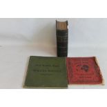
A QUANTITY OF BURTON ON TRENT INTEREST BOOKS TOGETHER WITH ORDNANCE SURVEY MAPS
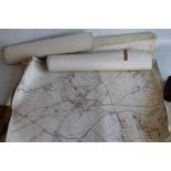
WOLVERHAMPTON AND THE BLACK COUNTRY 25" TO 1 MILE O. S. MAPS - 18 first editions 1880s, including t
WOLVERHAMPTON AND THE BLACK COUNTRY 25" TO 1 MILE O. S. MAPS - 18 first editions 1880s, including the very limited issues with hand colouring of b...
AN ATLAS OF MAPS ENGRAVED FOR J. BRADLEY'S "ELEMENTS OF GEOGRAPHY", many engraved by J. H. Franks,
AN ATLAS OF MAPS ENGRAVED FOR J. BRADLEY'S "ELEMENTS OF GEOGRAPHY", many engraved by J. H. Franks, c.1820, 48 maps in total with original outline ...

W. G. BLACKIE - 'THE COMPREHENSIVE ATLAS & GEOGRAPHY OF THE WORLD', 1882 together with Bartholomew
W. G. BLACKIE - 'THE COMPREHENSIVE ATLAS & GEOGRAPHY OF THE WORLD', 1882 together with Bartholomew 'The Citizen's Atlas of the World' (x 2), 'The ...
WILLIAM GUTHRIE - 'A GEOGRAPHICAL, HISTORICAL AND COMMERCIAL GRAMMAR; exhibiting the present state
WILLIAM GUTHRIE - 'A GEOGRAPHICAL, HISTORICAL AND COMMERCIAL GRAMMAR; exhibiting the present state of the world', 23rd edition 1819 together with ...

POCKET ATLASES, MAPS ETC. to include Asprey & Co. Reference Library, Bridgman's Cycling Road-Map of
POCKET ATLASES, MAPS ETC. to include Asprey & Co. Reference Library, Bridgman's Cycling Road-Map of Wolverton, Northampton & Bedford District, 'Th...

A QUANTITY OF MODERN MAP REFERENCE BOOKS to include Donald Hodson - 'County Atlases of The British
A QUANTITY OF MODERN MAP REFERENCE BOOKS to include Donald Hodson - 'County Atlases of The British Isles' Vol. I and R.V. Tooley - 'Maps & Map-mak...
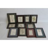
STAFFORDSHIRE MAPS - A COLLECTION OF 17TH - 19TH CENTURY FRAMED MINIATURE MAPS to include Van Den K
STAFFORDSHIRE MAPS - A COLLECTION OF 17TH - 19TH CENTURY FRAMED MINIATURE MAPS to include Van Den Keere, Luffman, Van Langeren with distance chart...
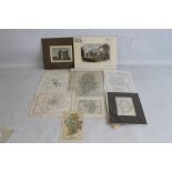
H. MOLL MAP OF STAFFORDSHIRE WITH ANTIQUITIES together with various other Staffordshire county maps
H. MOLL MAP OF STAFFORDSHIRE WITH ANTIQUITIES together with various other Staffordshire county maps including Aikin 1798, John Seller, Phillips, 1...
THE GEOGRAPHICAL JOURNAL 27 ANNUAL VOLS. 1960S - 80S, hundreds of maps, plans and plates

AN ADAM ROUILLY AND COMPANY AMERICAN FROHSE ANATOMICAL CHART, together with a similar median sectio
AN ADAM ROUILLY AND COMPANY AMERICAN FROHSE ANATOMICAL CHART, together with a similar median section through the Head, The Kidney, and an Insects ...