

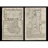

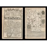
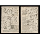
Title: Bowen 290 Yrs Old Detailed Road Map Whitby to Durham Newcastle North East. Description: Bowen 290 Yrs Old Detailed Road Map ...
100 item(s)
Filtered by:
- Primary Category,
- Item Type
- List
- Grid
-
100 item(s)/page
British Late 17th Century A carved polychrome and giltwood heraldic pediment Provenance: Ossowski, Pimlico Road Dimensions: 15 in. (H) x 12 in. (W)

British 19th Century A carved cherub and dolphin fragment Provenance: Ossowski, Pimlico Road To be sold without reserve Dimensions: 18 in. (H) x 1...

British Early 18 Century A carved giltwood Neptune architectural element Provenance: Ossowski, Pimlico Road Dimensions: 14 in. (H) x 9.5 in. (W)
Lot 13
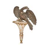
British, Late 18th/Early 19th Century, A carved giltwood eagle and bracket, Along with a circa 1960
British Late 18th/Early 19th Century A carved giltwood eagle and bracket Along with a Circa 1960 copy Provenance: Ossowski, Pimlico Road Dimension...
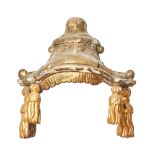
British 18th/19th Century Manner of Chippendale A carved giltwood canopy Provenance: Ossowski, Pimlico Road To be sold without reserve Dimensions:...

British 19th century and later A group of six architectural elements Provenance: Ossowski, Pimlico Road, where carved after the antique Dimensions...

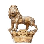
British 18th Century A pair of large carved angels Likely part of a larger architectural element Provenance: Ossowski, Pimlico Road

British 19th/20th Century A group of six carved floral architectural elements Provenance: Ossowski, Pimlico Road To be sold without reserve Dimens...
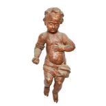
British 17th Century A large carved putti Provenance: Ossowski, Pimlico Road Dimensions: 27.5 in. (H) x 12 in. (W)

British 19th/20th Century A group of seven carved architectural elements Provenance: Ossowski, Pimlico Road To be sold without reserve Dimensions:...

British Circa 1960 A group of three architectural elements Provenance: Ossowski, Pimlico Road To be sold without reserve Dimensions: [a] 13.5 in. ...

British 19th/20th Century A group of seven architectural elements Provenance: Ossowski, Pimlico Road Dimensions: [a] 11 in. (H) x 14.5 in. (W) [b]...
Lot 264
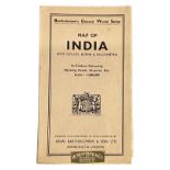
MAP OF INDIA WITH CEYLON, BURMA & BALUCHISTAN. IN CONTOUR COLOURING, SHOWING ROADS, AIRPORTS, ETC.
SCALE 1 : 4,000,000 Map of India with Ceylon, Burma & Baluchistan. In Contour Colouring, showing roads, airports, etc. Scale 1 : 4,000,000 Barth...

Lot 2117
A quantity of assorted 20thC Bartholomew road maps to include Cambridge, Dorset, New Forest, Sussex,
A quantity of assorted 20thC Bartholomew road maps to include Cambridge, Dorset, New Forest, Sussex, Warwickshire, Merseyside, Norfolk, English La...

Lot 301
5 framed maps and prints
5 framed maps and prints - 'The Road from Nottingham to Grimsby', 'Universi', 'Boston', 'Buxton and Matlock' and 'Haworth Castle Cumberland'
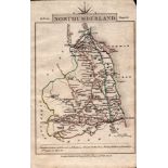
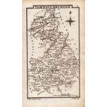
Title: Northumberland John Cary’s 1792 Antique Coloured Engraved Map. Description: Northumberland John Cary’s 1792 Antique Coloured En...
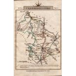
Title: Cambridgeshire John Cary’s 1792 Antique George III Coloured Engraved Map. Description: Cambridgeshire John Cary’s 1792 Antique ...
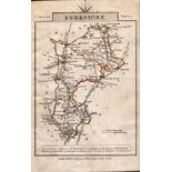
Title: Berkshire John Cary’s 1792 Antique George III Coloured Engraved Map. Description: Berkshire John Cary’s 1792 Antique George III...

Title: Northamptonshire John Cary’s 1792 Antique George III Coloured Engraved Map. Description: Northamptonshire John Cary’s 1792 Anti...
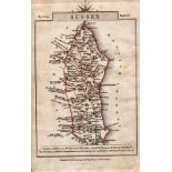
Title: Sussex John Cary’s 1792 Antique George III Coloured Engraved Map. Description: Sussex John Cary’s 1792 Antique George III Colou...

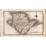
Title: John Cary’s 1791 Antique Copper Engraved Map Westmorland & Wiltshire. Description: John Cary’s 1791 Antique Copper Engraved Map...

Lot 295
ROAD MAP OF INDIA
Road Map of India Map Sales Office Calcutta Canvas-backed map in wrappers. English Good, used condition.

Lot 776
Southend Broken Pier 23rd Nov 1908, Station, German Air Raid on West Road and London Road, Fire,
Southend Broken Pier 23rd Nov 1908, Station, German Air Raid on West Road and London Road, Fire, Brockman & Shepherd, etc (15)
Lot 225
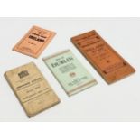
A collection of Early 20th Century maps of Ireland and Northern Ireland. Map of Dublin issued by the
A collection of Early 20th Century maps of Ireland and Northern Ireland. Map of Dublin issued by the Irish Tourist Association. Geographia Road Ma...
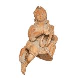
British 20th Century An angelic harpist Elf on the shelf? Provenance: Ossowski, Pimlico Road To be sold without reserve Dimensions: 14 in. (H) x 7...

Lot 238
Anonymous Original manuscript plan of the Conduit Mead Estate, before construction of Conduit Str...
London.- Mayfair.- Anonymous (probably early to mid-18th century) Original manuscript plan of the environs of the Conduit Mead Estate, before co...

Title: Cumbria & Lake District John Cary’s 1792 Antique George III Engraved Map. Description: Cumbria & Lake District John Cary’s 179...
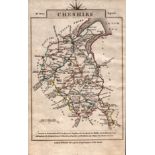
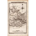
Title: Cheshire John Cary’s 1792 Antique George III Coloured Engraved Map. Description: Cheshire John Cary’s 1792 Antique George III C...
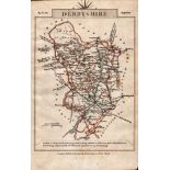
Title: Derbyshire John Cary’s 1792 Antique George III Coloured Engraved Map. Description: Derbyshire John Cary’s 1792 Antique George...
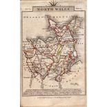
Title: North Wales John Cary’s 1792 Antique George III Coloured Engraved Map. Description: North Wales John Cary’s 1792 Antique George...
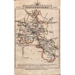
Title: Oxfordshire John Cary’s 1792 Antique George III Coloured Engraved Map. Description: Oxfordshire John Cary’s 1792 Antique George...
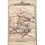
Title: Monmouthshire John Cary’s 1792 Antique George III Coloured Engraved Map. Description: Monmouthshire John Cary’s 1792 Antique Ge...

Title: Norfolk John Cary’s 1792 Antique George III Coloured Engraved Map. Description: Norfolk John Cary’s 1792 Antique George III Col...
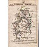
Title: Nottinghamshire John Cary’s 1792 Antique George III Coloured Engraved Map. Description: Nottinghamshire John Cary’s 1792 Antiqu...
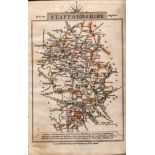
Title: Staffordshire John Cary’s 1792 Antique George III Coloured Engraved Map. Description: Staffordshire John Cary’s 1792 Antique Ge...
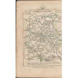
Title: John Cary’s 1791 Antique Copper Engraved Map Shropshire & Rutlandshire. Description: John Cary’s 1791 Antique Copper Engraved M...

Lot 434
CHATTERJI, TAPANMOHAN
The Road to Plassey Orient Longmans Calcutta 1960 Hardback with dust jacket. 157 pages, 4 maps English Wear to the dust jacket, internally clean P...

Lot 2115
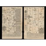
Map: An 18thC engraved strip map with hand colouring titled The Road from Oxford to Salisbury by
2115Map: An 18thC engraved strip map with hand colouring titled The Road from Oxford to Salisbury by
Map: An 18thC engraved strip map with hand colouring titled The Road from Oxford to Salisbury by Thomas Gardner. Approx. 7 1/4" x 10 3/4" Please ...

Title: Bowen 290 Yrs Old Detailed Road Map London-Norwich Puckeridge, Newmarket. Description: Bowen 290 Yrs Old Detailed Road Map L...
Title: Bowen 290 Yrs Old Detailed Road Map Derbyshire High Peak Buxton Derby. Description: Bowen 290 Yrs Old Detailed Road Map Derb...
Title: Bowen 290 Yrs Old Detailed Road Map Oxford Buckingham, Bedford, Cambridge. Description: Bowen 290 Yrs Old Detailed Road Map ...
Title: Bowen 290 Yrs Old Detailed Road Map Cornwall Padstow Camleford. Description: Bowen 290 Yrs Old Detailed Road Map Cornwall Pa...
Title: Bedfordshire Antique Copper Engraved King George IV Map by Sidney Hall. Description: Bedfordshire Antique Copper Engraved Georg...
Title: Cambridgeshire Antique Copper Engraved George IV Map by Sidney Hall. Description: Cambridgeshire Antique Copper Engraved George...

Title: England & Wales Antique Large Coloured Detailed Copper Engraved Map. Description: England & Wales Antique Large Coloured Detail...
Title: Wales Anglesey Antique Copper Engraved George IV Map by Sidney Hall. Description: Wales Anglesey Antique Copper Engraved George...
Title: Wales Brecknockshire Antique Copper Engraved George IV Map by Sidney Hall. Description: Wales Brecknockshire Antique Copper Eng...

Title: Wales Radnorshire Antique Copper Engraved George IV Map by Sidney Hall. Description: Wales Radnorshire Antique Copper Engraved ...

Lot 1131
Maarten Meuldijk
Maarten Meuldijk (1894-1972) Man and woman on dirt road through cornfield, canvas 54x65 cm

Lot 101
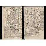
John Ogilby, an original strip road map, the road from Monmouth to Llanbeder, hand coloured. 33.
John Ogilby, an original strip road map, the road from Monmouth to Llanbeder, hand coloured. 33.5x44cm approx., together with Thomas Kitchen, 'an...

Lot 307
3 albums containing more than 440 standard-size postcards Portsmouth and Southsea. The main album of
3 albums containing more than 440 standard-size postcards Portsmouth and Southsea. The main album of 150 cards has around 77 different views of th...
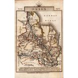
Title: Essex John Cary’s 1792 Antique George III Coloured Engraved Map. Description: Essex John Cary’s 1792 Antique George III Colou...
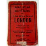
A vintage Road Atlas and Route Guide 100 miles round London

A Collection of Local Road Maps. Ordnance Survey maps.

Lot 83
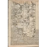
London.- Ogilby (John) The Road from London to Aberistwith...; The Continuation of ye Road from L...
London.- Ogilby (John) The Road from London to Aberistwith...; The Continuation of ye Road from London to Aberistwith, Plate ye Second...; T...
Title: Bowen 290 Yrs Old Detailed Road Map Whitby Malton Scarborough. Description: Bowen 290 Yrs Old Detailed Road Map Whitby Malto...
Title: Bowen 290 Yrs Old Road Whitby Morton Durham Sunderland Tynemouth Map. Description: Bowen 290 Yrs Old Road Whitby Morton Durham...
Title: Bowen 290 Yrs Old Detailed Road Map Arms of the City of Durham & Newcastle. Description: Bowen 290 Yrs Old Detailed Road Map...
Title: Bowen 290 Yrs Old Road Map Scotland Cumberland Northumberland Kelso. Description: Bowen 290 Yrs Old Road Map Scotland Cumberla...