
Lot 516
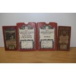
TWENTY-TWO VINTAGE MAPS, some cloth-backed, to include Ordnance Survey, Bartholomew's, R.A.F and
TWENTY-TWO VINTAGE MAPS, some cloth-backed, to include Ordnance Survey, Bartholomew's, R.A.F and Duckham's
TWENTY-TWO VINTAGE MAPS, some cloth-backed, to include Ordnance Survey, Bartholomew's, R.A.F and Duckham's
Two David & Charles reprints of Ordnance Survey maps illustrating Kendal, & Lancaster & Blackpool, together with two others illustrating Lancaster...
A collection of various Ordnance
BOX OF ORDNANCE SURVEY MAPS AND OTHERS
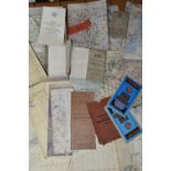
Collection of maps to include WWII era ordnance survey War office maps including canvas backed examples covering the British Isles.
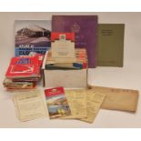
Collection of vintage ordnance survey and other maps together with books and other ephemera.
A handcoloured map of Helstone, two handcoloured maps of field boundaries in the Helston area, a copy map of the River Fal, various Helston relat...
Selection of vintage ordnance survey maps to include ' The Peak District' etc
A box of Ordnance Survey maps
Collection of assorted vintage and contemporary mostly OS Ordnance Survey maps. Including some Bartolomew's canvas back road maps, etc.
A large collection of assorted vintage and modern Ordnance Survey OS maps. Including Wales, Scotland, Ireland and England.
A Collection of Local Road Maps. Ordnance Survey maps.
Ordnance Survey of Scotland: Complete set. 92 colour maps , each dissected into 4 sections laid on linen, with numbering tabs, preserved in...
Ordnance Survey of England and Wales: Complete set of the 7th Series. 190 one-inch colour maps , each dissected into 6 sections laid on li...
An Ordnance Survey Map, Sheet SD37, illustrating Cartmel Sands and surrounding area, scale 1:25,000, framed and under glass, measuring 45cm x 55cm...
A COLLECTION OF VINTAGE ROAD MAPS TO INCLUDE ORDNANCE SURVEY AND BARTHOLOMEW'S
A LARGE ASSORTMENT OF BRITISH AND FOREIGN MAPS TO INCLUDE ORDNANCE SURVEY MAPS