
Filtered by:
- Category
2 items
- List
- Grid
This auctioneer has chosen to not publish their results. Please contact them directly for any inquiries.
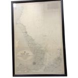

Lot 387
A 1960 eastern coast hydrographic map showing sea depths, published by The Admiralty, framed. (
A 1960 eastern coast hydrographic map showing sea depths, published by The Admiralty, framed. (27in x 40in)
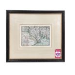
Lot 437
An seventeenth century handcoloured map of southern Scotland by Pieter van den Keere, the numbered
An seventeenth century handcoloured map of southern Scotland by Pieter van den Keere, the numbered plate detailing the land from the Solway to the...