Filtered by:
- Category
- List
- Grid
A subscription to the Price Guide is required to view results for auctions ten days or older. Click here for more information
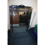

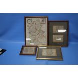
A LARGE MIRROR APPROX. 120 X 77 CM A/F TOGETHER WITH TWO REPRODUCTION MAPS AND AN AVIATION PRINT
A LARGE MIRROR APPROX. 120 X 77 CM A/F TOGETHER WITH TWO REPRODUCTION MAPS AND AN AVIATION PRINT
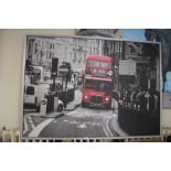
A LARGE MODERN PRINT OF A LONDON BUS NO. 38
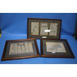
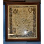
OWEN & BOWEN COUNTY MAP OF STAFFORDSHIRE double framed with two Owen & Bowen road strips showing
OWEN & BOWEN COUNTY MAP OF STAFFORDSHIRE double framed with two Owen & Bowen road strips showing Lichfield together with a 1930s reproduction of O...
WILLIAM KIP MAP OF STAFFORDSHIRE, c.1637, uncoloured, 43 x 54 cm including frame
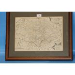
ROBERT PLOT MAP OF STAFFORDSHIRE c.1686, map surrounded by shields, later hand colouring, framed and
ROBERT PLOT MAP OF STAFFORDSHIRE c.1686, map surrounded by shields, later hand colouring, framed and glazed, frame size 80 x 71 cmCondition Report...
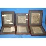
EIGHTEENTH CENTURY MAPS OF STAFFORDSHIRE to include Badeslade & Toms, Robert Morden, John Rocque,
EIGHTEENTH CENTURY MAPS OF STAFFORDSHIRE to include Badeslade & Toms, Robert Morden, John Rocque, Thomas Conder, Kitchin/Jeffries and Thomas Osbor...
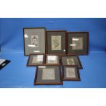
UNUSUAL PERROT MAP OF WORCESTER, SHROPSHIRE AND STAFFORDSHIRE c.1823, known as the 'Gravestone
UNUSUAL PERROT MAP OF WORCESTER, SHROPSHIRE AND STAFFORDSHIRE c.1823, known as the 'Gravestone Map' together with seven other miniature maps of St...
EMANUEL BOWEN MAP OF STAFFORDSHIRE c.1760 from 'The Large English Atlas', cartouche dedicated to '
EMANUEL BOWEN MAP OF STAFFORDSHIRE c.1760 from 'The Large English Atlas', cartouche dedicated to 'The Noble and Right Honourable John Gower', has ...
RICHARD BLOME MAP OF STAFFORDSHIRE c.1673 hand colour, 38 x 29 cm including frame together with
RICHARD BLOME MAP OF STAFFORDSHIRE c.1673 hand colour, 38 x 29 cm including frame together with three other 17th Century maps of Staffordshire - V...
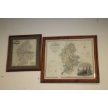
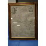
GREENWOOD MAP OF STAFFORDSHIRE c.1830, with vignette of Lichfield cathedral, 73 x 83 cm including
GREENWOOD MAP OF STAFFORDSHIRE c.1830, with vignette of Lichfield cathedral, 73 x 83 cm including frame together with a framed Robert Morden map o...
A COLLECTION OF ATLASES, LATE 19TH CENTURY AND EARLY 20TH CENTURY
A TRAY OF OF OS MAPS (NOT INCLUDING TRAY)