Filtered by:
- Category
- List
- Grid
A subscription to the Price Guide is required to view results for auctions ten days or older. Click here for more information
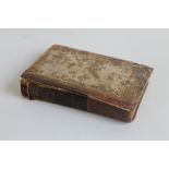

GEORGE KEATE - TO THE CHAIRMAN AND DIRECTORS OF THE HONOURABLE EAST INDIA COMPANY, THIS ACCOUNT OF
GEORGE KEATE - TO THE CHAIRMAN AND DIRECTORS OF THE HONOURABLE EAST INDIA COMPANY, THIS ACCOUNT OF THE PELEW ISLANDS, LONDON 1788. Front cover and...
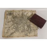
CARY'S NEW ITINERARY; or, an Accurate Delineation of the Great Roads...', 1798, includes folding ma
CARY'S NEW ITINERARY; or, an Accurate Delineation of the Great Roads...', 1798, includes folding map of England, Wales and part of Scotland A/F, r...
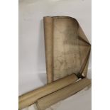
AN ACCOUNT OF THE IMPROVEMENTS ON THE ESTATES OF THE MARQUESS OF STAFFORD', c.1820, disbound and mi
AN ACCOUNT OF THE IMPROVEMENTS ON THE ESTATES OF THE MARQUESS OF STAFFORD', c.1820, disbound and missing title page but includes folding map of co...

A LARGE QUANTITY OF LARGE SCALE ORDNANCE SURVEY MAPS MAINLY STAFFORDSHIRE including 1:2500, 6 inche
A LARGE QUANTITY OF LARGE SCALE ORDNANCE SURVEY MAPS MAINLY STAFFORDSHIRE including 1:2500, 6 inches to the mile etc, mainly 20th Century 1920s, 3...

A QUANTITY OF STAFFORDSHIRE INTEREST MAPS MAINLY ORDNANCE SURVEY LATE 1800S, includes Alton Towers
A QUANTITY OF STAFFORDSHIRE INTEREST MAPS MAINLY ORDNANCE SURVEY LATE 1800S, includes Alton Towers, Leek area, Croxden, Stoke-on-Trent, Newcastle...
A PLAN OF LANDS BELONGING TO THE FREE GRAMMAR SCHOOL OF DILHORN IN THE PARISHES OF DILHORN AND CAVE
A PLAN OF LANDS BELONGING TO THE FREE GRAMMAR SCHOOL OF DILHORN IN THE PARISHES OF DILHORN AND CAVERSWALL IN THE COUNTY OF STAFFORD AND PARISH OF ...
TWELVE LARGE SCALE 19TH CENTURY ORDNANCE SURVEY MAPS OF WINDSOR IN BERKSHIRE & BUCKINGHAMSHIRE,
TWELVE LARGE SCALE 19TH CENTURY ORDNANCE SURVEY MAPS OF WINDSOR IN BERKSHIRE & BUCKINGHAMSHIRE, 1:2500 and 1:1056 covering Windsor Castle, Windsor...
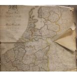
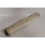
A LARGE WALL MAP OF THE NETHERLANDS AND LUXEMBOURG, E. Maaskamp 1816, engraved map with hand colour
A LARGE WALL MAP OF THE NETHERLANDS AND LUXEMBOURG, E. Maaskamp 1816, engraved map with hand colouring in six sections, linen backed on roller
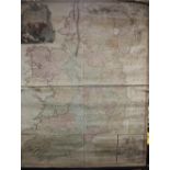
JOHN ROCQUE - A MAP OF THE KINGDOM OF IRELAND c.1794, large engraved map with hand colouring in fou
JOHN ROCQUE - A MAP OF THE KINGDOM OF IRELAND c.1794, large engraved map with hand colouring in four sections backed on linen, wall map on wooden ...
EDWARD QUIN - 'AN HISTORICAL ATLAS; in a series of maps of the world as known at different periods;
EDWARD QUIN - 'AN HISTORICAL ATLAS; in a series of maps of the world as known at different periods; constructed upon an uniform scale. and coloure...
MAPA METALOGENETICO DEL PERU 1969' A LARGE FOLIO OF MAPS OF PERU