
Lot 516
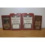
TWENTY-TWO VINTAGE MAPS, some cloth-backed, to include Ordnance Survey, Bartholomew's, R.A.F and
TWENTY-TWO VINTAGE MAPS, some cloth-backed, to include Ordnance Survey, Bartholomew's, R.A.F and Duckham's
TWENTY-TWO VINTAGE MAPS, some cloth-backed, to include Ordnance Survey, Bartholomew's, R.A.F and Duckham's
A vintage metal tube containing old maritime navigational charts, comprising 'Approaches to Plymouth', 'South & West Coast of England' ana an Ordn...
A collection of various Ordnance
Two David & Charles reprints of Ordnance Survey maps illustrating Kendal, & Lancaster & Blackpool, together with two others illustrating Lancaster...
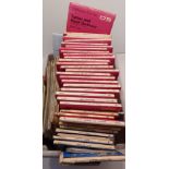
BOX OF ORDNANCE SURVEY MAPS AND OTHERS
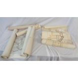
A collection of old Ordnance Survey rolled monochrome map charts including local coastal examples - sold with rolled architectural plans of church...
A large Ordnance Survey map of Cornwall - a central belt between Padstow, Newquay, Truro and St Austell, linen backed, 1800cm x 2100cm
Collection of maps to include WWII era ordnance survey War office maps including canvas backed examples covering the British Isles.
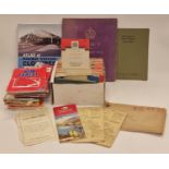
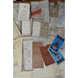
Collection of vintage ordnance survey and other maps together with books and other ephemera.
Bartholemew and Ordnance survey maps, for Spalding and region Bartholemew's Dorset, North Yorkshire coast, and others, a miniature cricket bat, ji...
A group of modern Ordnance survey maps, UK and Ireland. (2 shelves)
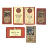
A collection of ordnance survey maps of England and Wales, to include one inch tourist maps of Coventry & Rugby, the Lake District, Birmingham, an...
Selection of vintage ordnance survey maps to include ' The Peak District' etc
A Collection of Local Road Maps. Ordnance Survey maps.
A handcoloured map of Helstone, two handcoloured maps of field boundaries in the Helston area, a copy map of the River Fal, various Helston relat...
An Ordnance Survey Map, Sheet SD37, illustrating Cartmel Sands and surrounding area, scale 1:25,000, framed and under glass, measuring 45cm x 55cm...