Writing Instruments Auctions
Discover vintage and rare fountain pens, pencils, inkwells, ballpoint pens, typewriters, writing boxes, ink stands, letter racks, ink bottles, ink blotters, quills, stationary boxes, and more on the saleroom today. With so many reputable auction houses selling on our online auction marketplace, you can find the vintage and collectable writing instruments you're looking for with ease. Browse through thousands of items listed in hundreds of live and timed auctions. Speed up your search by filtering by brand, item type, country, auction type, auction house, and more. Discover writing instruments from brands like Monte Blanc, Parker, Conway Stewart, Mabie Todd, Sheaffer, Cartier, and more. Compile a list of your favourites by adding items to your watch list and place your bids on the ones you love. Find your next collectable writing instrument on the saleroom today.
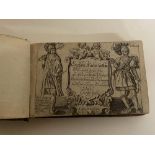


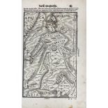


![[DEVON] BLAEU, Joan.](https://portal-images.azureedge.net/auctions-2024/bearne10150/images/9bf08fd8-a4c6-4b36-a926-b15000fc8d1a.jpg?w=155&h=155)
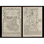
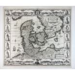
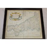
![[ATLAS] COLE and ROPER. Nightingale, Joseph.](https://portal-images.azureedge.net/auctions-2024/bearne10150/images/4bd431a9-b8cb-49bb-9b6a-b15000fc8b3f.jpg?w=155&h=155)


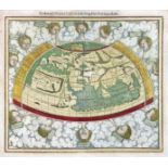
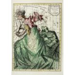
![CHATELAIN, HENRI. 1684-1743. Carte De La Nouvelle France.... [Amsterdam: 1719.]](https://portal-images.azureedge.net/auctions-2024/bonham10926/images/184d5f4b-af1d-466b-9196-b155000e2273.jpg?w=155&h=155)

