Filtered by:
- Category
- List
- Grid
A subscription to the Price Guide is required to view results for auctions ten days or older. Click here for more information
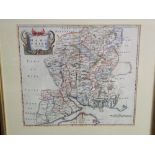

An 18th century coloured map of Wiltshire by Robert Morden, 36 x 42.5cm visible sheet size, a
An 18th century coloured map of Wiltshire by Robert Morden, 36 x 42.5cm visible sheet size, a further late 18th century coloured map of Wiltshire ...
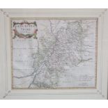
An 18th century coloured map of Gloucestershire by Robert Morden, 35 x 42cm approx visible sheet
An 18th century coloured map of Gloucestershire by Robert Morden, 35 x 42cm approx visible sheet size, framed
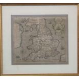
William Hole - 17th century map of England and Wales inscribed Englalond Anglia Anglosaxonum
William Hole - 17th century map of England and Wales inscribed Englalond Anglia Anglosaxonum Heptarachia, 28 x 32.5cm approx visible sheet size, f...
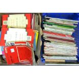
A large collection of miscellaneous ordnance survey maps and guide books including some of the local
A large collection of miscellaneous ordnance survey maps and guide books including some of the local area
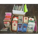
A collection of mixed ordnance survey maps including some Bartholomew's examples, together with
A collection of mixed ordnance survey maps including some Bartholomew's examples, together with mixed guide books, etc
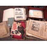
A miscellaneous collection of items to include a small suitcase containing a scrap album documenting
A miscellaneous collection of items to include a small suitcase containing a scrap album documenting various aviation feats, etc, Royal Aeronautic...
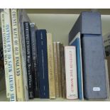
A quantity of books about maps and map makers together with a vintage boxed RAC route master
A quantity of books about maps and map makers together with a vintage boxed RAC route master