Filtered by:
- Category
- List
- Grid
A subscription to the Price Guide is required to view results for auctions ten days or older. Click here for more information

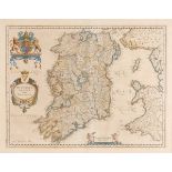
1584 Map of Ireland by Ortelius. A hand-coloured, engraved map, Hiberniae Britannicae Insulae Nova
1584 Map of Ireland by Ortelius. A hand-coloured, engraved map, Hiberniae Britannicae Insulae Nova Descripto. Framed. 12 by 16.50in. (30.5 by 4...
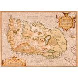
1646 Map of Connaught, by Joannes Jansson. A hand-coloured engraved map, `Provincia Connachtiae -
1646 Map of Connaught, by Joannes Jansson. A hand-coloured engraved map, `Provincia Connachtiae - The Province of Connaugt`, based on Speed`s earl...
1654 Map of Ireland by Blaeu. A hand-coloured, engraved map, Hiberno Regnum Vulgo Ireland in the
1654 Map of Ireland by Blaeu. A hand-coloured, engraved map, Hiberno Regnum Vulgo Ireland in the first state as published in the 1654 fifth volume...
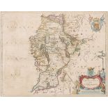
1659 Map of Connaught by Joan Blaeu. A hand-coloured, engraved map of 'Connachtia Vulgo Connaughty',
1659 Map of Connaught by Joan Blaeu. A hand-coloured, engraved map of 'Connachtia Vulgo Connaughty', in the first state, as published in the 1659 ...
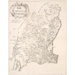
1685 Petty map of Wexford. An engraved map of The County of Wexford by William Petty, unframed. 19
1685 Petty map of Wexford. An engraved map of The County of Wexford by William Petty, unframed. 19 by 14.50in. (48.3 by 36.8cm) ...[more]
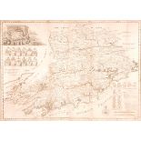
1750 Map of Co. Cork, by Charles Smith. An engraved map, A New and Correct Map of the County Cork,
1750 Map of Co. Cork, by Charles Smith. An engraved map, A New and Correct Map of the County Cork, the cartouche showing a gentleman in breeches a...
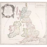
1770 and 1772 Maps of Les Isles Britanniques by Robert de Vaugondy. Two hand coloured engraved maps,
1770 and 1772 Maps of Les Isles Britanniques by Robert de Vaugondy. Two hand coloured engraved maps, Britannicae Insulae and Les Isles Britannique...
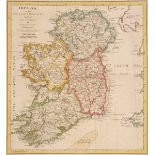
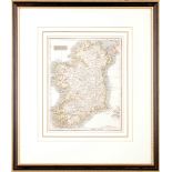
1774 Map of Ireland by Samuel Dunn. A hand-coloured, engraved map, Ireland Divided into its Four
1774 Map of Ireland by Samuel Dunn. A hand-coloured, engraved map, Ireland Divided into its Four Provinces; subdivided into Counties by Samuel Dun...
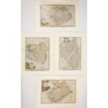
1780 Maps of the four provinces of Ireland by Thomas Kitchin. Four hand-coloured, engraved maps of
1780 Maps of the four provinces of Ireland by Thomas Kitchin. Four hand-coloured, engraved maps of the four provinces, from Walpoole's New British...
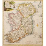
1780 Map of Ireland by Thomas Kitchin. A hand-coloured, engraved map Ireland Divided into its
1780 Map of Ireland by Thomas Kitchin. A hand-coloured, engraved map Ireland Divided into its Provinces and Counties, Drawn from the Latest Survey...
Early 19th century maps of Ireland. A hand-coloured, engraved map, Ireland from the best Authorities, published in 'A General View of the World' 1...
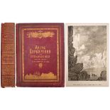
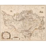
Smith, David Murray FRGS. Arctic Expeditions from British and Foreign Shores: From the Earliest
Smith, David Murray FRGS. Arctic Expeditions from British and Foreign Shores: From the Earliest Times to the Expedition of 1875-76. Thomas C. Jack...