Filtered by:
- Category
- List
- Grid
A subscription to the Price Guide is required to view results for auctions ten days or older. Click here for more information
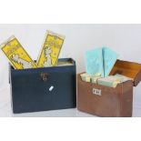

Complete Set of Bartholomew's Maps of Scotland (1-29) Scale: 2 miles to an inch plus ' The Contour
Complete Set of Bartholomew's Maps of Scotland (1-29) Scale: 2 miles to an inch plus ' The Contour Road Book of Scotland ' all contained in a Leat...
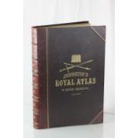
A large leather hard back book 'Johnsons Royal Atlas Of Modern Geography' published by W & AK
A large leather hard back book 'Johnsons Royal Atlas Of Modern Geography' published by W & AK Johnstone, 1911
Early 19th Century folio folding map, England & Wales with part of Scotland. By G Allen Stone,
Early 19th Century folio folding map, England & Wales with part of Scotland. By G Allen Stone, Staffordshire 1806
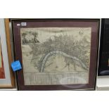
A titled A PLAN OF THE CITY OF LONDON LONDON WESTMINSTER AND BOROUGH OF SOUTHWARK 18th century
A titled A PLAN OF THE CITY OF LONDON LONDON WESTMINSTER AND BOROUGH OF SOUTHWARK 18th century hand coloured map by S Parker.
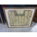
An antique coloured map THE ROAD FROM Oxford to Chichester by John Ogilby
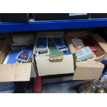
Three Boxes of Mixed Vintage Folded Ordnance Survey Maps including Bartholomew's