Filtered by:
- Category
- List
- Grid
This auctioneer has chosen to not publish their results. Please contact them directly for any enquiries.
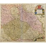

Frederick De Wit, Dutch 1610-1698- “Regnum Bohemia”, c.1681; hand-coloured engraved map, 54x63.
Frederick De Wit, Dutch 1610-1698- “Regnum Bohemia”, c.1681; hand-coloured engraved map, 54x63.5cm (sheet): Willem Janszoon Blaeu, Dutch 1571-1638...
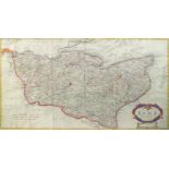
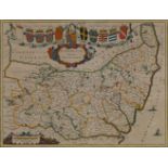
Robert Morden, British 1650-1703- Kent; hand-coloured engraved map, 36x74cm
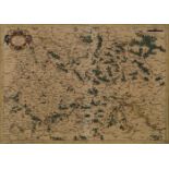
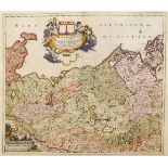
Gerhard Mercator, Flemish 1512-1594- Saxoniae map of Saxony circa 1600; copper engraving with hand-
Gerhard Mercator, Flemish 1512-1594- Saxoniae map of Saxony circa 1600; copper engraving with hand-colouring, Latin text verso, 35x48.5cm, (unfram...
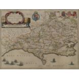
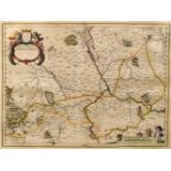
Johannes Blaeu, Dutch 1599-1673 - Comitatus Dorcestria, sive Dorsettia; vulgo Anglice Dorset
Johannes Blaeu, Dutch 1599-1673 - Comitatus Dorcestria, sive Dorsettia; vulgo Anglice Dorset Shire, map of Dorset, circa 1662; copper engraving wi...
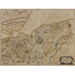
Joan Blaeu, Dutch 1596-1673- Moravia Scotiae provincia, ex Timothei Pont / scedis descripta et aucta
Joan Blaeu, Dutch 1596-1673- Moravia Scotiae provincia, ex Timothei Pont / scedis descripta et aucta per Robert: Gordonium a Strathloch map of Mor...
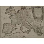
Gilles Robert de Vaugondy, French 1686-1766- Imperium Carolimagni, map of Ancient Europe circa 1745;
Gilles Robert de Vaugondy, French 1686-1766- Imperium Carolimagni, map of Ancient Europe circa 1745; copper engraving with hand-colouring, 48x65cm...
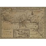
Herman Moll, German/English 1654-1732- A Map of Guinea, Loango etc & A Map of Zaara of the Desart,
Herman Moll, German/English 1654-1732- A Map of Guinea, Loango etc & A Map of Zaara of the Desart, Negroland & Cape Verde Islands etc, circa 1711;...
Joan Blaeu, Dutch 1596-1673- Suffolicia Vernacule Suffolke, map of Suffolk 1645; copper engraving
Joan Blaeu, Dutch 1596-1673- Suffolicia Vernacule Suffolke, map of Suffolk 1645; copper engraving with hand-colouring, Latin text verso, 38.2x50.2...
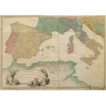
William Faden, British 1749-1836- “A Map of the Mediterranean Sea with the Adjacent Regions and Seas
William Faden, British 1749-1836- “A Map of the Mediterranean Sea with the Adjacent Regions and Seas in Europe, Asia and Africa”, c.1785; hand-col...
Nicholas Visscher, Dutch 1618-1679- “Viennese Territorium Ob Res Bellicas Inter Christianos…”;
Nicholas Visscher, Dutch 1618-1679- “Viennese Territorium Ob Res Bellicas Inter Christianos…”; hand-coloured engraved map, 54x62.5cm (sheet): Joan...
Frederick De Wit, Dutch 1610-1698- “Ducatus Meklenburgicus”…”; hand-coloured engraved map, 54x62.5cm
Frederick De Wit, Dutch 1610-1698- “Ducatus Meklenburgicus”…”; hand-coloured engraved map, 54x62.5cm (sheet):Nicolaus Rittershausen, 1597-1670- “T...
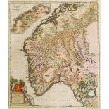
Frederick De Wit, Dutch 1610-1698- Norvegia; hand-coloured engraved map, 62.8x54cm (sheet): Frederick De Wit, Dutch 1610-1698- Circuli Saxoniae Su...