Filtered by:
- Category
- List
- Grid
A subscription to the Price Guide is required to view results for auctions ten days or older. Click here for more information
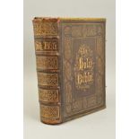

THE PRACTICAL AND DEVOTIONAL FAMILY BIBLE...., with the marginal Readings and Original and Selected Parallel references printed at length and The ...
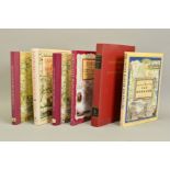
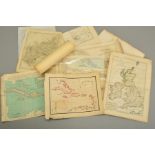
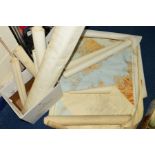
OGILBY'S ROAD MAPS OF ENGLAND AND WALES, from Ogilby's 'Britannia', 1675, together with five other
OGILBY'S ROAD MAPS OF ENGLAND AND WALES, from Ogilby's 'Britannia', 1675, together with five other facsimile map books
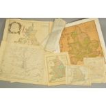
COX, THOMAS, Magna Britannia, Nutt, 1720, disbound in thirteen sections with maps by Robert Morden
COX, THOMAS, Magna Britannia, Nutt, 1720, disbound in thirteen sections with maps by Robert Morden
A MID 18TH CENTURY EMANUEL BOWEN MAP, 'A New and Accurate Map of The Northern Parts of Italy....',
A MID 18TH CENTURY EMANUEL BOWEN MAP, 'A New and Accurate Map of The Northern Parts of Italy....', hand tinted, 32cm x 23cm, mounted, framed and g...
18TH/19TH AND EARLY 20TH CENTURY MAPS OF THE BRITISH ISLES AND WEST INDIES, all unframed, including 'Mappa Insularum Britannicarum Antiquarum' by ...
A LATE 18TH CENTURY FOLDED MAP BY J. MENZIES, 'A Correct Map of England With all The Principal and
A LATE 18TH CENTURY FOLDED MAP BY J. MENZIES, 'A Correct Map of England With all The Principal and Cross Roads', published by Thomas Brown, Edinbu...
WARWICKSHIRE, a collection of 17th, 18th, 19th and 20th Century unframed county maps and bookplates,
WARWICKSHIRE, a collection of 17th, 18th, 19th and 20th Century unframed county maps and bookplates, some hand tinted, together with facsimile pro...
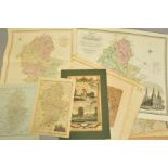
WARWICKSHIRE, a collection of fifteen unframed 18th and 19th Century maps, including 'An Accurate
WARWICKSHIRE, a collection of fifteen unframed 18th and 19th Century maps, including 'An Accurate Map of the County of Warwick divided into its hu...
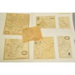
WARWICKSHIRE, a collection of nine unframed 17th and 18th Century engraved maps by Henry Beighton
WARWICKSHIRE, a collection of nine unframed 17th and 18th Century engraved maps by Henry Beighton and Robert Vaughan, 'The Mapp of Barichway Hundr...
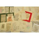
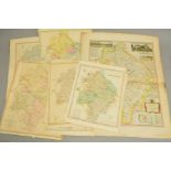
STAFFORDSHIRE, a collection of approximately fifty one county maps, all unframed, several in card
STAFFORDSHIRE, a collection of approximately fifty one county maps, all unframed, several in card mounts, mostly 18th and 19th Century bookplates ...
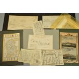
A COLLECTION OF UNFRAMED MAPS, mostly 18th and 19th Century, including 'The Continuation of The Road
A COLLECTION OF UNFRAMED MAPS, mostly 18th and 19th Century, including 'The Continuation of The Road from London to Holyhead by John Ogilby commen...
A 17TH CENTURY MAP OF STAFFORDSHIRE BY MICHAEL DRAYTON, with allegorical figures, hand tinted,
A 17TH CENTURY MAP OF STAFFORDSHIRE BY MICHAEL DRAYTON, with allegorical figures, hand tinted, unmounted and unframed, 28.5cm x 35cm, together wit...
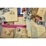
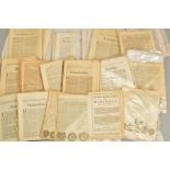
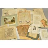
A LARGE COLLECTION OF EPHEMERA, consisting of scrapbook, postcards, music scores, Ordnance Survey
A LARGE COLLECTION OF EPHEMERA, consisting of scrapbook, postcards, music scores, Ordnance Survey maps, photographs, pictures and prints (unframed...
A QUANTITY OF RAILWAY BOOKS AND POSTCARDS, including a collection of books on the Great Central
A QUANTITY OF RAILWAY BOOKS AND POSTCARDS, including a collection of books on the Great Central Railway, a quantity of Ordnance Survey and other m...
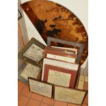
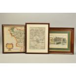
A COLLECTION OF FRAMED MAPS to include J Gibson map of Prussia and Polish Prussia, approximate
A COLLECTION OF FRAMED MAPS to include J Gibson map of Prussia and Polish Prussia, approximate size 20cm x 28cm, Richard Blome, a map of Warwicksh...
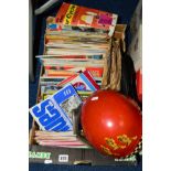
A BOX OF SUNDRIES, to include a Cromwell Headwear Motorcycling helmet with goggles, ordnance
A BOX OF SUNDRIES, to include a Cromwell Headwear Motorcycling helmet with goggles, ordnance survey maps, records, magazines and programmes relati...
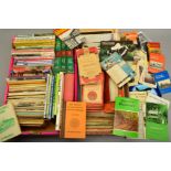
A BOX OF ROLLED ORDNANCE SURVEY MAPS AND COUNTY INDEX MAPS, includes Staffordshire villages and
A BOX OF ROLLED ORDNANCE SURVEY MAPS AND COUNTY INDEX MAPS, includes Staffordshire villages and towns and other Midlands Counties and Scottish Mil...