Filtered by:
- Category
4 items
- List
- Grid
A subscription to the Price Guide is required to view results for auctions ten days or older. Click here for more information
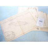

Lot 384
A set of sea charts from 'S.S. Essex Lance' including 'River St. Lawrence and Andros Island among
384A set of sea charts from 'S.S. Essex Lance' including 'River St. Lawrence and Andros Island among
A set of sea charts from 'S.S. Essex Lance' including 'River St. Lawrence and Andros Island among others.
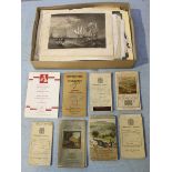
Lot 405
A quantity of folding Ordnance Survey maps together with a quantity of unframed book plates etc
A quantity of folding Ordnance Survey maps together with a quantity of unframed book plates etc
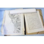
A portfolio of unframed 19th and early 20th century British maps
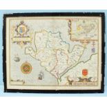
After John Speed, a 17th century hand coloured map of Anglesey, dated 1610. 41 x 54cm.