
Filtered by:
- Category
- List
- Grid
A subscription to the Price Guide is required to view results for auctions ten days or older. Click here for more information
![[Battle of Liberty Place], "Battle of New Orleans for Freedom, September 14. 1874", hand-colored](https://portal-images.azureedge.net/auctions-2018/srne10028/images/5b6b1511-50d9-4322-a4f7-3c0afed70e0f.jpg?w=155&h=155)

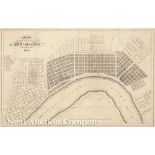
[Battle of Liberty Place], "Battle of New Orleans for Freedom, September 14. 1874", hand-colored
[Battle of Liberty Place], "Battle of New Orleans for Freedom, September 14. 1874", hand-colored lithographed map, by T.S. Hardee, lithographed an...
Attributed to Jacques Tanesse, "Plan of the City and Suburbs of New Orleans From Actual Surveys
Attributed to Jacques Tanesse, "Plan of the City and Suburbs of New Orleans From Actual Surveys 1834", [no place], 1834, lithographed map, scarce ...
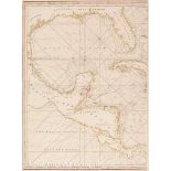
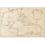
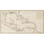
Robert Sayer, "A New General Chart of the West Indies from the Latest Marine Journals and Surveys...", London, 1790, hand-colored in outline, prin...
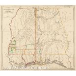
Mathew Carey, "The State of Mississippi and Alabama Territory", Philadelphia, 1818, hand-colored
Mathew Carey, "The State of Mississippi and Alabama Territory", Philadelphia, 1818, hand-colored in outline, one of the earliest maps to show Alab...
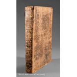
Laet, Jean de (Johannes de). L'Histoire du Nouveau Monde ou Description des Indes Occidentales...,
Laet, Jean de (Johannes de). L'Histoire du Nouveau Monde ou Description des Indes Occidentales..., Leiden, Chez Bonaventure & Abraham Elzevier, 16...
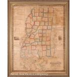
Monumental Map of Mississippi, Louisiana and Alabama by John La Tourette, "An Accurate Map Or
Monumental Map of Mississippi, Louisiana and Alabama by John La Tourette, "An Accurate Map Or Delineation of the State of Mississippi, with a larg...
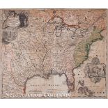
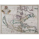
Pieter Covens and Corneliu Mortier, "L'Amerique Septentrionale.../America Septentrionali...",
Pieter Covens and Corneliu Mortier, "L'Amerique Septentrionale.../America Septentrionali...", Amsterdam, c. 1740, hand-colored engraved map, after...
Johann Baptiste Homann, "Amplissimae regionis Mississipi seu Provinciae Ludovicianae...", Nuremberg,
Johann Baptiste Homann, "Amplissimae regionis Mississipi seu Provinciae Ludovicianae...", Nuremberg, 1720, hand-colored map, 19 1/2 in. x 22 5/8 i...
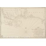
Nicholas Bellin, "Carte Reduite du Golphe du Mexique et des Isles de l'Amerique...Par Ordre de M. Le
Nicholas Bellin, "Carte Reduite du Golphe du Mexique et des Isles de l'Amerique...Par Ordre de M. Le Comte de Maurepas", Paris, 1749, outline colo...
Bertius/Tavernier, "Carte de L'Amerique Corrigee, et augmentee, dessus toutes les aultres cy
Bertius/Tavernier, "Carte de L'Amerique Corrigee, et augmentee, dessus toutes les aultres cy devant faictes par P. Bertius", 1627, hand-colored ma...
Philippe Buache, "Carte d'Une Partie de l'Amerique pour la Navigation des Isles et du Golfe du
Philippe Buache, "Carte d'Une Partie de l'Amerique pour la Navigation des Isles et du Golfe du Mexique avec l'interieur des Terres depuis Bermude ...
Matthaus Seutter, "Mappa Geographica Regionem Mexicanam et Floridam...", Augsburg, c. 1740, hand-
Matthaus Seutter, "Mappa Geographica Regionem Mexicanam et Floridam...", Augsburg, c. 1740, hand-colored, with inset maps of Havana, Portobell, Ca...
![Reinier and Joshua Ottens, "Untitled" [Gulf of Mexico], Amsterdam, 1741, hand-colored sheet from the](https://portal-images.azureedge.net/auctions-2018/srne10028/images/b100d00b-a884-4344-94b0-eb221b460d11.jpg?w=155&h=155)
Reinier and Joshua Ottens, "Untitled" [Gulf of Mexico], Amsterdam, 1741, hand-colored sheet from the
Reinier and Joshua Ottens, "Untitled" [Gulf of Mexico], Amsterdam, 1741, hand-colored sheet from the large map "Grand Theatre de la Guerre en Amer...
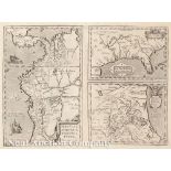
Abraham Ortelius, "La Florida/ Peruviae Auriferae Regionis Typus/ Guastecan", Antwerp, 1598, three
Abraham Ortelius, "La Florida/ Peruviae Auriferae Regionis Typus/ Guastecan", Antwerp, 1598, three maps on one sheet, the earliest map illustratin...
Jean Baptiste Bourguignon D'Anville, "Amerique Septentrionale Publiee Sous les Auspices De Monsiegneur Le Duc d'Orleans Premier Prince du Sang", P...
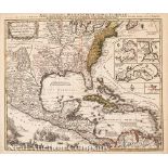
Antoine Sartine, "Carte d'une Partie des Cotes de la Floride et de la Louisiana contenant le Cours
Antoine Sartine, "Carte d'une Partie des Cotes de la Floride et de la Louisiana contenant le Cours du Mississipi", Paris, 1778, engraved Revolutio...
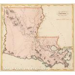
Mathew Carey, "Louisiana", London, 1814, hand-colored map from Carey's General Atlas, one of the
Mathew Carey, "Louisiana", London, 1814, hand-colored map from Carey's General Atlas, one of the earliest maps of Louisiana to appear in an atlas,...
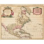
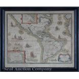
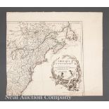
Edward Wells, "A New Map of North America Shewing its Principal Divisions, Chief Cities, Townes,
Edward Wells, "A New Map of North America Shewing its Principal Divisions, Chief Cities, Townes, Rivers, Mountains", Oxford, 1700, hand-colored ma...