
Filtered by:
- Category
- List
- Grid
This auctioneer has chosen to not publish their results. Please contact them directly for any enquiries.

Maps of Ireland. 1844 Map of Ireland showing the Round Towers of Ireland, a hand-coloured engraved
Maps of Ireland. 1844 Map of Ireland showing the Round Towers of Ireland, a hand-coloured engraved map published by The Society for the Diffusion ...

Mitford, Nancy. Voltaire in Love. Hamish Hamilton, London, 1957, first edition, 8vo, red cloth
Mitford, Nancy. Voltaire in Love. Hamish Hamilton, London, 1957, first edition, 8vo, red cloth with blue label, gilt, publisher's dust jacket. .....

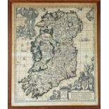
1744-1860s Maps of Ireland, Dublin and Wicklow. A hand-coloured engraved map, Nieuwe Kaart van
1744-1860s Maps of Ireland, Dublin and Wicklow. A hand-coloured engraved map, Nieuwe Kaart van Ierland. Te Amsterdam, as publised in Nieuwe en Bek...
1733 Map of Ireland by Carol Allard, a hand-coloured, engraved map, Hyberniae Regni in Provincias
1733 Map of Ireland by Carol Allard, a hand-coloured, engraved map, Hyberniae Regni in Provincias Ultoniam, Connach am Lageniam Momoniamq divisi T...
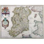
1654 Map of Ireland by Blaeu. A hand-coloured, engraved map, Hiberno Regnum Vulgo Ireland in the
1654 Map of Ireland by Blaeu. A hand-coloured, engraved map, Hiberno Regnum Vulgo Ireland in the first state as published in the 1654 fifth volume...
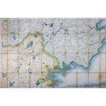
1899 Ordnance Survey, Counties Clare and Galway, original colour, sectioned and linen backed,
1899 Ordnance Survey, Counties Clare and Galway, original colour, sectioned and linen backed, marbled retailer's boards for Sifton, Praed & Co. Lo...

1750s Chart of Ireland by Jacques Nicolas Bellin. A hand-coloured, engraved chart, Carte Reduite des
1750s Chart of Ireland by Jacques Nicolas Bellin. A hand-coloured, engraved chart, Carte Reduite des Isles Britanniques. Cinquieme Feuille Contena...
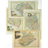
1787 Maps of the four Provinces of Ireland by Alexander Hogg. A set of four hand-coloured, engraved maps, New and Correct Map(s) of the Province(s...

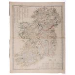
1851 Map of Ireland by John Tallis. A hand-coloured engraved map of Ireland with vignettes of St
1851 Map of Ireland by John Tallis. A hand-coloured engraved map of Ireland with vignettes of St Patrick's Dublin, Limerick Castle, The Holy Well,...

1811 British Colonies in North America and 1830 Map of North America. A hand-coloured engraved map
1811 British Colonies in North America and 1830 Map of North America. A hand-coloured engraved map of North Americas published by William Hole Liz...
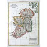
1766 Map of Ireland by Rigobert Bonne. A hand-coloured, engraved map Royaume D'Irlande, 14" x 9½" (
1766 Map of Ireland by Rigobert Bonne. A hand-coloured, engraved map Royaume D'Irlande, 14" x 9½" (35.5 x 24cm) loose. ...[more]

1573 Map of Ireland by Ortelius. A hand-coloured, engraved map, Eyrn Hiberniae, Britannicae, Insulae
1573 Map of Ireland by Ortelius. A hand-coloured, engraved map, Eyrn Hiberniae, Britannicae, Insulae Nova Descripto, Irlandt, orientated to the We...
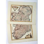
1789 Map of Ireland by Franz von Reilly. A pair of hand-coloured, engraved maps Das Konigreich
1789 Map of Ireland by Franz von Reilly. A pair of hand-coloured, engraved maps Das Konigreich Ireland.., showing Ireland North and South, 9" x 11...