Filtered by:
- Category
3 items
- List
- Grid
A subscription to the Price Guide is required to view results for auctions ten days or older. Click here for more information

Lot 161
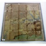
STAMFORDS GEOLOGICAL MAP OF LONDON showing superficial deposits by R W Mylne esq. and W Whitaker
STAMFORDS GEOLOGICAL MAP OF LONDON showing superficial deposits by R W Mylne esq. and W Whitaker esq. BA, framed and glazed, 59cm x 65cm
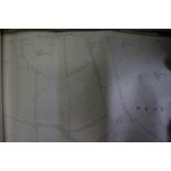
A COLLECTION OF APPROXIMATELY FIFTY 1950'S OXFORDSHIRE AND BERKSHIRE BOUNDARY MAPS
Lot 586
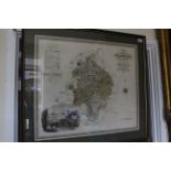
A 19TH CENTURY MAP OF THE COUNTY OF WARWICK by C & J Greenwood, with hand coloured detailing, 58cm x
A 19TH CENTURY MAP OF THE COUNTY OF WARWICK by C & J Greenwood, with hand coloured detailing, 58cm x 69cm