
Filtered by:
- Category
- List
- Grid
This auctioneer has chosen to not publish their results. Please contact them directly for any enquiries.
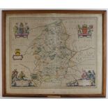

Blaeu (Johannes), Staffordiensis comitatus vulgo Stafford Shire (Staffordshire), published Amsterdam, circa 1648, hand-coloured engraved map, fram...
![[Wells, Edward]. Hand coloured engraved map, 'A new map of the British Isles shewing their Antient](https://portal-images.azureedge.net/auctions-2019/lo10117/images/21795491-6864-4774-9212-aa4f01183e14.jpg?w=155&h=155)
[Wells, Edward]. Hand coloured engraved map, 'A new map of the British Isles shewing their Antient
[Wells, Edward]. Hand coloured engraved map, 'A new map of the British Isles shewing their Antient People, Cities and Towns of Note in the time of...
Bacon (George W., publisher). New Large Scale Ordnance Atlas of the British Isles with Plans of
Bacon (George W., publisher). New Large Scale Ordnance Atlas of the British Isles with Plans of Towns..., circa late 19th Century, numerous double...
Cellarius (Christoph). Geographia Antiqua, Recognita denuo, & ad veterum novorumque, scriptorum
Cellarius (Christoph). Geographia Antiqua, Recognita denuo, & ad veterum novorumque, scriptorum fidem, historicorum maxime, identidem castigata......
Folding Maps. Three folding maps, circa 19th Century, comprising Carta Corografica, dello Stato
Folding Maps. Three folding maps, circa 19th Century, comprising Carta Corografica, dello Stato Pontiticio...; France, Routiere, Physique et Admin...
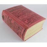
Kelly's Directory of Cambridgeshire, Norfolk & Suffolk for 1929 (some damage to inside of spine) .
Kelly's Directory of Cambridgeshire, Norfolk & Suffolk for 1929 (some damage to inside of spine) . All 3 maps included. Overall condition is goo...
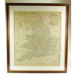
Kitchin (Thomas). England & Wales, Accuarately Delineated From the Latest Surveys, 1783, large map
Kitchin (Thomas). England & Wales, Accuarately Delineated From the Latest Surveys, 1783, large map hand coloured in outline, mounted, framed and g...
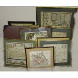
Maps. A collection of eight engraved maps,, including Creta Seu Candiae, Insula et Regnum cum
Maps. A collection of eight engraved maps,, including Creta Seu Candiae, Insula et Regnum cum Diverersis Aliis Archipelagi Insulis, by Nicolaum Vi...
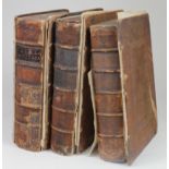
Three volumes of the Magna Britannia, circa 1727, including folding engraved maps by Robert
Three volumes of the Magna Britannia, circa 1727, including folding engraved maps by Robert Morden, areas covered include Middlesex, Norfolk, Nott...