Filtered by:
- Category
- List
- Grid
A subscription to the Price Guide is required to view results for auctions ten days or older. Click here for more information

Arrowsmith, Aaron. Map of the Railways, showing the various stations with the hills, rivers,
Arrowsmith, Aaron. Map of the Railways, showing the various stations with the hills, rivers, canals and principal roads, large hand-coloured foldi...
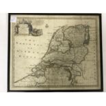
Blaeu, Willem. Europa recens descripta, hand-coloured engraved map, faded, evidence of repair to
Blaeu, Willem. Europa recens descripta, hand-coloured engraved map, faded, evidence of repair to fold, some soiling, 550mm x 407mm, [Amsterdam: 16...
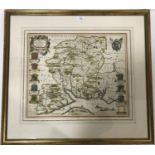
Blaeu, Willem. Hantonia, sive Southamptonensis comitatus Vulgo Hantshire, hand-coloured engraved
Blaeu, Willem. Hantonia, sive Southamptonensis comitatus Vulgo Hantshire, hand-coloured engraved map, highlighted in gilt, light spotting, 500mm x...
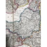
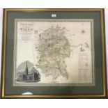
Bowen, Emanuel. An Improved Map of Wilt Shire, divided into its Hundreds, engraved map, hand-
Bowen, Emanuel. An Improved Map of Wilt Shire, divided into its Hundreds, engraved map, hand-coloured in outline, slightly faded, 692mm x 530mm, L...
Bowen, Emanuel and Thomas Bowen. Atlas Anglicanus, Or A Complete Sett of Maps of the Counties of
Bowen, Emanuel and Thomas Bowen. Atlas Anglicanus, Or A Complete Sett of Maps of the Counties of South Britain, engraved title, 45 engraved maps, ...
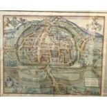
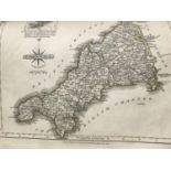
Braun, Georg. Civitas Exoniae (vulgo Execester), hand-coloured engraved view of Exeter, faded, Latin
Braun, Georg. Civitas Exoniae (vulgo Execester), hand-coloured engraved view of Exeter, faded, Latin text verso, 405mm x 320mm, [Cologne, c.1617];...
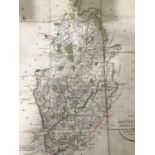
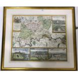
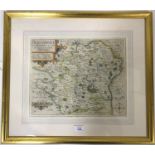
Bryant, A. Map of the County of Hertford, large hand-coloured folding map backed on linen, in four
Bryant, A. Map of the County of Hertford, large hand-coloured folding map backed on linen, in four sheets of 12 sections, edged with red linen, ea...
![Cary, John. [Map of England - South only], large folding engraved map in 27 sections, backed on](https://portal-images.azureedge.net/auctions-2020/srlawre10140/images/4d4f3670-b3cd-4dff-afe4-ac1f01809131.jpg?w=155&h=155)
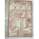
Cary, John. [Map of England - South only], large folding engraved map in 27 sections, backed on
Cary, John. [Map of England - South only], large folding engraved map in 27 sections, backed on linen, hand-coloured, faded, soiled and sections w...
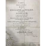
Cary, John. New Map of England and Wales, with Parts of Scotland, 80 engraved leaves, the majority
Cary, John. New Map of England and Wales, with Parts of Scotland, 80 engraved leaves, the majority hand-coloured in outline, a few with minor repa...
Cary, John. Cary's New and Correct English Atlas: Being a New Set of County Maps, engraved title,
Cary, John. Cary's New and Correct English Atlas: Being a New Set of County Maps, engraved title, engraved general map and 46 engraved county maps...
Cary, John. Cary's Reduction of His Large Map of England and Wales, with Part of Scotland, folding
Cary, John. Cary's Reduction of His Large Map of England and Wales, with Part of Scotland, folding engraved map in 20 sections, backed on linen, h...
Cary, John. New Map of England and Wales, with Part of Scotland, second edition, large hand-coloured
Cary, John. New Map of England and Wales, with Part of Scotland, second edition, large hand-coloured folding engraved map on 3 linen-backed sheets...
Cary, John. A New Map of Surry, hand-coloured folding engraved map, in 15 sections, backed on linen,
Cary, John. A New Map of Surry, hand-coloured folding engraved map, in 15 sections, backed on linen, 60cm x 52cm, in slipcase, worn, London: J. Ca...
Coltman, Nath. Laurie and Whittle's New Map of All the Coach Roads, Both Direct and Cross of England
Coltman, Nath. Laurie and Whittle's New Map of All the Coach Roads, Both Direct and Cross of England and Wales, folding engraved map in 20 section...
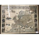
Europe. L'Europe divisée en ses Etats, Empires, Royaumes et Républiques..., large folding engraved
Europe. L'Europe divisée en ses Etats, Empires, Royaumes et Républiques..., large folding engraved map on 32 sections, backed on linen, hand-colou...
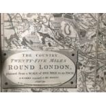
Faden, William. The Country Twenty-Five Miles Round London, large folding engraved map, backed on
Faden, William. The Country Twenty-Five Miles Round London, large folding engraved map, backed on linen, on 36 sections, partly hand-coloured, 127...
Germany. Post-Reise-Karte von Deutschland und den angranzenden Staaten nach den neuesten und
Germany. Post-Reise-Karte von Deutschland und den angranzenden Staaten nach den neuesten und zuverlassigsten Karten und zwar, das nordliche Deutsc...
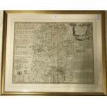
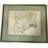
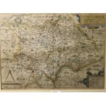
Greenwood, Charles and James. Map of the County of Wilts., hand-coloured engraved map, 674mm x
Greenwood, Charles and James. Map of the County of Wilts., hand-coloured engraved map, 674mm x 560mm, London: Greenwood & Co., 4th July 1829, fram...
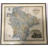
Greenwood, Christopher and John. Map of the County of Devon, hand-coloured engraved map, slightly
Greenwood, Christopher and John. Map of the County of Devon, hand-coloured engraved map, slightly faded, 690mm x 610mm, London: Greenwood & Co., J...
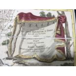
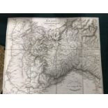
Heymann, Ignazio. Italia, cioe tutte le grandi e le piccole Sovranità e Repubbliche d'Italia
Heymann, Ignazio. Italia, cioe tutte le grandi e le piccole Sovranità e Repubbliche d'Italia divisi nelli nuovi loro Confini comprese le Strade pu...
Homann, Johan Baptiste. Accurater Grundriss u Gegend der Koenigl: Gross-Britannischen Haupt und
Homann, Johan Baptiste. Accurater Grundriss u Gegend der Koenigl: Gross-Britannischen Haupt und Residentz-Stadt London..., hand-coloured engraved ...
Italy. A folding engraved map of Italy by Epimaco and Pasquale Artaria, on ten sheets, each with
Italy. A folding engraved map of Italy by Epimaco and Pasquale Artaria, on ten sheets, each with multiple sections, backed on linen, the general m...
Italy. Carta administrativa del Regno d'Italia co suoi stabilimento politici, militari, civili, e
Italy. Carta administrativa del Regno d'Italia co suoi stabilimento politici, militari, civili, e religiosi… G. Bordiga, large folding engraved ma...
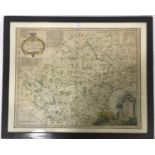
Kip, Wihelm. Hertfordiae Comitatus, engraved map, hand-coloured in outline, 344mm x 280mm, [
Kip, Wihelm. Hertfordiae Comitatus, engraved map, hand-coloured in outline, 344mm x 280mm, [London, c.1637], framed and glazed
Kitchin, Thomas. A New Improved Map of Hartfordshire, hand-coloured engraved map, spotted, 655mm x
Kitchin, Thomas. A New Improved Map of Hartfordshire, hand-coloured engraved map, spotted, 655mm x 530mm, London: Robert Sayer et al., [c.1750],...
Morden, Robert. Middlesex, hand-coloured engraved map, 422mm x 365mm, [London, Abel Swale et al.,
Morden, Robert. Middlesex, hand-coloured engraved map, 422mm x 365mm, [London, Abel Swale et al., c.1722]; Harrison, John. A Map of Middlesex, han...
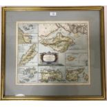
Modern, Robert. The Smaller Islands of the British Ocean, hand-coloured engraved map, 422mm x 356mm,
Modern, Robert. The Smaller Islands of the British Ocean, hand-coloured engraved map, 422mm x 356mm, [London] Abel Swale, Awnsham and John Churchi...
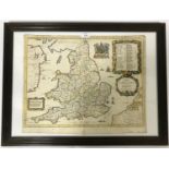
Ogilby, John. A New Map of the Kingdom of England and Dominion of Wales, Whereon are Projected all
Ogilby, John. A New Map of the Kingdom of England and Dominion of Wales, Whereon are Projected all ye Principal Roads, engraved map, hand-coloured...
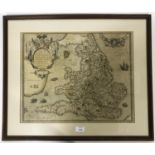
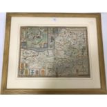
Ortelius, Abraham. Angliae Regni florentissimi nova descriptio..., hand-coloured engraved map,
Ortelius, Abraham. Angliae Regni florentissimi nova descriptio..., hand-coloured engraved map, faded, occasional light browning, 470mm x 380mm, [A...
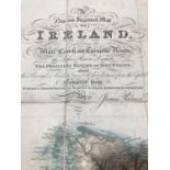
Palmer, James. A New and Improved Map of Ireland..., hand-coloured folding engraved map on 24
Palmer, James. A New and Improved Map of Ireland..., hand-coloured folding engraved map on 24 sections, backed on linen, 64cm x 76.5cm, in slipcas...
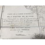
Russia. Carte de da partie europeenne de l'empire de Russie: avec l'indication des chemins de poste,
Russia. Carte de da partie europeenne de l'empire de Russie: avec l'indication des chemins de poste, ainsi que des douanes frontieres et de la rep...
Rome and Naples. Carta de contorni di Napoli per uso de'forestieri e viaggiatori di Giov. Enrico
Rome and Naples. Carta de contorni di Napoli per uso de'forestieri e viaggiatori di Giov. Enrico Westpahl, folding engraved map in 24 sections, ba...
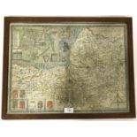
Saxton, Christopher and William Kip. Staffordiae Comitatus Pars Oilm Cornauiorum, hand-coloured
Saxton, Christopher and William Kip. Staffordiae Comitatus Pars Oilm Cornauiorum, hand-coloured engraved map, browned, 375mm x 265mm, [London, c.1...
Slater, Isaac. I. Slater's New British Atlas, comprising the Counties of England, (Upon which are
Slater, Isaac. I. Slater's New British Atlas, comprising the Counties of England, (Upon which are laid down all Railways Completed and in Progress...
Smith, C. Smith's New and Accurate Map of the Lakes, in the Counties of Cumberland, Westmorland, and
Smith, C. Smith's New and Accurate Map of the Lakes, in the Counties of Cumberland, Westmorland, and Lancaster, hand-coloured folding engraved map...
Speed, John. Wales, hand-coloured engraved map, English text verso, minor repair to fold, 508mm x
Speed, John. Wales, hand-coloured engraved map, English text verso, minor repair to fold, 508mm x 380mm, London: Sudbury and Humble, 1610, framed ...
Speed, John. Flintshire, hand-coloured engraved map, paper crease from lower margin extending into
Speed, John. Flintshire, hand-coloured engraved map, paper crease from lower margin extending into printed image, 505mm x 380mm, London: Thomas Ba...
Speed, John. Somerset-Shire Described, hand-coloured engraved map, browning around fold, some repair
Speed, John. Somerset-Shire Described, hand-coloured engraved map, browning around fold, some repair to lower right corner, lightly soiled, 515mm ...
Speed, John. Somerset-Shire Described...., hand-coloured engraved map, some staining to lower
Speed, John. Somerset-Shire Described...., hand-coloured engraved map, some staining to lower edge, wormed with slight loss, 520mm x 390mm, [Londo...
Stucchi, S. Carta Statistica e Postale Dell'Italia, folding engraved map on 24 sections, backed on
Stucchi, S. Carta Statistica e Postale Dell'Italia, folding engraved map on 24 sections, backed on linen, hand-coloured in outline, 81cm x 93cm, i...
Turkey. Stanford's Map of Turkey in Europe and Her Tributary States; together with such Parts of
Turkey. Stanford's Map of Turkey in Europe and Her Tributary States; together with such Parts of Russia, Austria, Turkey in Asia and Persia as are...
Visscher, Nicolaus. Galliae seu Franciae Tabula, engraved map, hand-coloured in outline, repairs
Visscher, Nicolaus. Galliae seu Franciae Tabula, engraved map, hand-coloured in outline, repairs to fold, 568mm x 466mm, Amsterdam: N. Visscher, [...
Weller, Edward. The Dispatch Atlas, 246 single-page maps and 14 double-page, the majority hand-
Weller, Edward. The Dispatch Atlas, 246 single-page maps and 14 double-page, the majority hand-coloured in outline, some margins torn, occasionall...