Filtered by:
- Category
- List
- Grid
A subscription to the Price Guide is required to view results for auctions ten days or older. Click here for more information

Gaultier, A.E.C. A Course of Geography, by Means of Instructive Games, 3 parts in one volume, new
Gaultier, A.E.C. A Course of Geography, by Means of Instructive Games, 3 parts in one volume, new edition, 15 double-page engraved maps, hand-colo...
Guthrie, William. A New Geographical, Historical and Commercial Grammar, twentieth edition, 26 [of
Guthrie, William. A New Geographical, Historical and Commercial Grammar, twentieth edition, 26 [of 27] folding engraved maps, engraved plate of sp...
London. Abercrombie, Patrick. Greater London Plan 1944, folding maps and plans, plates, original
London. Abercrombie, Patrick. Greater London Plan 1944, folding maps and plans, plates, original cloth, 4to, London: H.M.S.O., 1945; Report Improv...
Rooke, Octavius. The Channel Islands, first edition, engraved illustrations, 3 engraved maps,
Rooke, Octavius. The Channel Islands, first edition, engraved illustrations, 3 engraved maps, original cloth gilt, all edges gilt, 8vo, London: L....
Baedeker, Karl. Egypt. Handbook for Travellers, second edition, maps, original cloth gilt, 8vo,
Baedeker, Karl. Egypt. Handbook for Travellers, second edition, maps, original cloth gilt, 8vo, Leipzig: Karl Baedeker, 1885; Paris and Environs, ...
Baines, Thomas. Explorations in South-West Africa, first edition, half-title, coloured frontispiece,
Baines, Thomas. Explorations in South-West Africa, first edition, half-title, coloured frontispiece, tissue guard, 3 folding engraved maps, hand-c...
Heylyn, Peter. Cosmographie..., 3 [of 4] folding engraved maps, all loose, lacks all before B1, B1-
Heylyn, Peter. Cosmographie..., 3 [of 4] folding engraved maps, all loose, lacks all before B1, B1-B3 torn with significant loss to lower corner, ...
Rennell, James. Memoir of a Map of Hindoostan, second edition, 7 engraved maps, including 2 large
Rennell, James. Memoir of a Map of Hindoostan, second edition, 7 engraved maps, including 2 large folding, some hand-coloured in outline, some min...
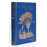
Stuart, Villiers. Adventures Amidst the Equatorial Forests and Rivers of South America, first
Stuart, Villiers. Adventures Amidst the Equatorial Forests and Rivers of South America, first edition, 2 folding maps, plates, some spotting, orig...
Blaeu, Johannes. Guiana sive Amazonum regio, hand-coloured engraved map, 485mm x 373mm, English text
Blaeu, Johannes. Guiana sive Amazonum regio, hand-coloured engraved map, 485mm x 373mm, English text verso, framed and double-glazed, [c.1635]
Blaeu, Jan. Herefordia comitatus, Hereford-shire, hand-coloured engraved map, Latin text verso,
Blaeu, Jan. Herefordia comitatus, Hereford-shire, hand-coloured engraved map, Latin text verso, 502mm x 408mm, [Amsterdam, c.1645 or later], frame...
Blaeu, Jan. Glamorganensis comitatvs, hand-coloured engraved map, 505mm x 382mm, framed and double-
Blaeu, Jan. Glamorganensis comitatvs, hand-coloured engraved map, 505mm x 382mm, framed and double-glazed, c.1645 or later]
Blome, Richard. A Generall Mapp of the Coast of Barbarie where in are the Kingdoms and Estates of
Blome, Richard. A Generall Mapp of the Coast of Barbarie where in are the Kingdoms and Estates of Morocco, Fez..., hand-coloured engraved map, one...
Butler, Samuel. An Atlas of Modern Geography, engraved title, 19 [of 21] engraved maps, hand-
Butler, Samuel. An Atlas of Modern Geography, engraved title, 19 [of 21] engraved maps, hand-coloured in outline, one folding, the remainder doubl...
Cary, John. A New Map of Lincolnshire, Divided into Hundreds; exhibiting the whole of the Turnpike
Cary, John. A New Map of Lincolnshire, Divided into Hundreds; exhibiting the whole of the Turnpike and Cross Roads, folding engraved map, hand-col...
Darton, William. Northamptonshire, Divided into Hundreds and the Parliamentary Divisions, hand-
Darton, William. Northamptonshire, Divided into Hundreds and the Parliamentary Divisions, hand-coloured folding engraved map, backed on linen, in ...
Delisle, Guillaume. Carte D'Amerique dressee pour l'usage du Roy, hand-coloured engraved map, slight
Delisle, Guillaume. Carte D'Amerique dressee pour l'usage du Roy, hand-coloured engraved map, slight spotting and soiling, small tears along fold,...
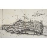
Faden, William. Plan of the Bay, Rock and Town of Gibraltar, from an actual survey by an officer who
Faden, William. Plan of the Bay, Rock and Town of Gibraltar, from an actual survey by an officer who was at Gibraltar from 1769 to 1773, engraved ...
Greenwood, Christopher. Map of the County of Somerset, hand-coloured engraved map, some spotting and
Greenwood, Christopher. Map of the County of Somerset, hand-coloured engraved map, some spotting and soiling, 698mm x 580mm, London, 1829, framed ...
Guillou and Nicolas, Surveyors. Cote Occidentale d'Afrique. Croquis de l'Ogowe de Lambarene a n'
Guillou and Nicolas, Surveyors. Cote Occidentale d'Afrique. Croquis de l'Ogowe de Lambarene a n'djole et du cours de la riviere n'Gunie, folding e...
Jefferys, Thomas. The East Indies with the Roads, hand-coloured engraved map on 4 sheets, the
Jefferys, Thomas. The East Indies with the Roads, hand-coloured engraved map on 4 sheets, the sheet for the Bay of Bengal with slight loss to corn...
Johnston, Alexander Keith. The Royal Atlas of Modern Geography, new edition, 51 double-page engraved
Johnston, Alexander Keith. The Royal Atlas of Modern Geography, new edition, 51 double-page engraved maps, coloured in outline, some light spottin...
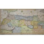
Levanto, Francesco Maria. Costa di Spagna dal Rio di Siviglia sino a Malaga et La Costa di Barbaria da Larache sino al Peñon di Velez, engraved ma...
London. Bowle's New Pocket Plan of the Cities of London and Westminster, with the Borough of
London. Bowle's New Pocket Plan of the Cities of London and Westminster, with the Borough of Southwark, comprehending the New Buildings and other ...
London. Cary's New Pocket Plan of London, Westminster and Southwark; with all the Adjacent buildings
London. Cary's New Pocket Plan of London, Westminster and Southwark; with all the Adjacent buildings in St. George's Fields, &c., &c., folding eng...
London. Bowle's Reduced New Pocket Plan of the Cities of London and Westminster, with the Borough of
London. Bowle's Reduced New Pocket Plan of the Cities of London and Westminster, with the Borough of Southwark, exhibiting New Buildings to the ye...
Maps. A collection of folding maps, including; Africa, George Philip & Son, Bacon's New Map of
Maps. A collection of folding maps, including; Africa, George Philip & Son, Bacon's New Map of London, G.W. Bacon & Co; Mapa Original de la Republ...
Mercator, Gerard. Medius meridianus 16, reliqui ad hunc inclinati sunt pro ratione parallelorum 29 &
Mercator, Gerard. Medius meridianus 16, reliqui ad hunc inclinati sunt pro ratione parallelorum 29 & 34 ad circulum maximum, hand-coloured engrave...
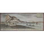
Nicholls, Sutton. Several Prospects of the Rock, Town, Castle, Fortifications, & Bay of Gibraltar
Nicholls, Sutton. Several Prospects of the Rock, Town, Castle, Fortifications, & Bay of Gibraltar also a Plan of ye same w.th ye Approaches of the...
Ogilby, John. Barstable to Truro, hand-coloured engraved strip map, 445mm x 351mm, London, [c.1675],
Ogilby, John. Barstable to Truro, hand-coloured engraved strip map, 445mm x 351mm, London, [c.1675], framed and glazed
Paris. Plan Routier de la ville et Fauxbourgs de Paris, divise en 12 Municipalities 1818, folding
Paris. Plan Routier de la ville et Fauxbourgs de Paris, divise en 12 Municipalities 1818, folding engraved map, hand-coloured in outline, tears to...
Sanson, Nicolas. Duche et governement de Bretagne, engraved map, later hand-colouring, small tear to
Sanson, Nicolas. Duche et governement de Bretagne, engraved map, later hand-colouring, small tear to upper margin, affecting image, 510mm x 370mm,...
Sanson, Nicolas. Graecia Foederata sub Agamemnone, ob Helenae Raptum in Troiam Coniurans, hand-
Sanson, Nicolas. Graecia Foederata sub Agamemnone, ob Helenae Raptum in Troiam Coniurans, hand-coloured engraved map, 503mm x 398mm, Amsterdam, c....
Sayer, Robert. A New Map of the Roads of England and Scotland, folding engraved map, backed on
Sayer, Robert. A New Map of the Roads of England and Scotland, folding engraved map, backed on linen, hand-coloured in outline, lightly browned, s...
Speed, John. Cambridgeshire described..., engraved map, with inset plan of Cambridge, English text
Speed, John. Cambridgeshire described..., engraved map, with inset plan of Cambridge, English text verso, some browning, early manuscript notation...
Speed, John. Essex, devided into hundreds, hand-coloured engraved map, inset plan of Colchester,
Speed, John. Essex, devided into hundreds, hand-coloured engraved map, inset plan of Colchester, English text verso, 512mm x 382mm, c.1611, framed...
Speed, John. Somerset-Shire described: and into Hundreds devided..., hand-coloured engraved map,
Speed, John. Somerset-Shire described: and into Hundreds devided..., hand-coloured engraved map, plan of Bath city inset, browned, laid down, 510m...
Speed, John. Cornwall, hand-coloured engraved map, browned and stained, defective, 510mm x 385mm,
Speed, John. Cornwall, hand-coloured engraved map, browned and stained, defective, 510mm x 385mm, London: Sudbury and Humble, 1610 [but later], fr...
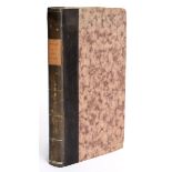
Mavor, William. General View of the Agriculture of Berkshire, 3 folding maps, 2 hand-coloured, 27
Mavor, William. General View of the Agriculture of Berkshire, 3 folding maps, 2 hand-coloured, 27 engraved plates, some spotting, original boards,...
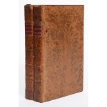
Marshall, William. The Rural Economy of Yorkshire, 2 volumes, first edition, 2 folding engraved
Marshall, William. The Rural Economy of Yorkshire, 2 volumes, first edition, 2 folding engraved maps, some spotting, contemporary tree calf gilt, ...
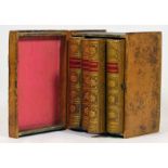
Peacock, W., publisher. A boxed set of four titles, comprising; A Compendious Geographical Dictionary, second edition, 6 folding engraved maps, ha...
Oliver, George. The Antiquities of Free-Masonry, first edition, folding engraved plate, 4 folding
Oliver, George. The Antiquities of Free-Masonry, first edition, folding engraved plate, 4 folding engraved maps, some browning and light spotting,...