Filtered by:
- Category
- List
- Grid
A subscription to the Price Guide is required to view results for auctions ten days or older. Click here for more information
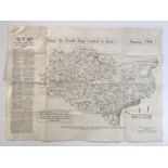

A map entitled "Where the Doodle Bugs Crashed in Kent", published by the Kent Messenger in 1944,
A map entitled "Where the Doodle Bugs Crashed in Kent", published by the Kent Messenger in 1944, 51 cm x 68 cm
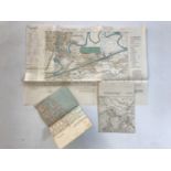
Three Luftwaffe maps of British towns / cities
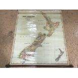
Three late 19th Century Australian wall charts, including Johnston's Series of Large Wall Maps and
Three late 19th Century Australian wall charts, including Johnston's Series of Large Wall Maps and Illustrations; Australia, Political, James Mcke...
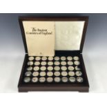
A cased set of Birmingham Mint The Ancient Counties of England limited edition silver collectors'
A cased set of Birmingham Mint The Ancient Counties of England limited edition silver collectors' coins, commemorating the boundary changes to th...
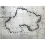
John Bodger (18th Century) A Chart of the Beautiful Fishery of Whittlesea Mere in the County of
John Bodger (18th Century) A Chart of the Beautiful Fishery of Whittlesea Mere in the County of Huntingdon and of such Navigable Rivers with which...
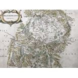
Robert Morden (c.1650-1703) Westmorland, a 17th Century engraved map, hand-tinted, in Hogarth
Robert Morden (c.1650-1703) Westmorland, a 17th Century engraved map, hand-tinted, in Hogarth frame under glass, 38 x 44 cm ...[more]
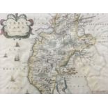
Robert Morden (c.1650-1703) Cumberland, a 17th Century engraved map, hand-tinted, in Hogarth frame
Robert Morden (c.1650-1703) Cumberland, a 17th Century engraved map, hand-tinted, in Hogarth frame under glass, 37 x 44 cm ...[more]
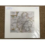
William Kip (fl. 1585-1618) after Christopher Saxton (c.1540-1610) Cumbria sive Cumberlandia, 17th
William Kip (fl. 1585-1618) after Christopher Saxton (c.1540-1610) Cumbria sive Cumberlandia, 17th Century engraved county map, hand-tinted, under...