Filtered by:
- Category
- List
- Grid
This auctioneer has chosen to not publish their results. Please contact them directly for any enquiries.
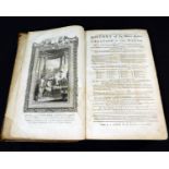

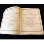
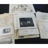
EDWARD KIMPTON: A NEW AND COMPLETE UNIVERSAL HISTORY OF THE HOLY BIBLE..., London for J Cooke, circa
EDWARD KIMPTON: A NEW AND COMPLETE UNIVERSAL HISTORY OF THE HOLY BIBLE..., London for J Cooke, circa 1785, 57 engraved plates, 2 maps, one plan as...
GUILLAUME THOMAS FRANCOIS REYNAL: HISTOIRE PHILOSOPHIQUE ET POLITIQUE DES ETABLISSMENS ET DU
GUILLAUME THOMAS FRANCOIS REYNAL: HISTOIRE PHILOSOPHIQUE ET POLITIQUE DES ETABLISSMENS ET DU COMMERCE DES EUROPEENS DANS LES DEUX INDES, Geneve, J...
GEORGE AUGUSTUS WALPOOLE & OTHERS: THE NEW BRITISH TRAVELLER, OR A COMPLETE MODERN UNIVERSAL DISPLAY
GEORGE AUGUSTUS WALPOOLE & OTHERS: THE NEW BRITISH TRAVELLER, OR A COMPLETE MODERN UNIVERSAL DISPLAY OF GREAT BRITAIN AND IRELAND..., London, for ...
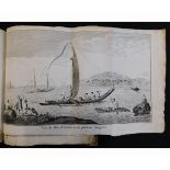
JAMES COOK: CARTES ET FIGURES DU VOYAGE DANS L'HEMISPHERE AUSTRAL ET AUTOUR DU MONDE FAIT SUR LES
JAMES COOK: CARTES ET FIGURES DU VOYAGE DANS L'HEMISPHERE AUSTRAL ET AUTOUR DU MONDE FAIT SUR LES VAISSEAUX DU ROI L'AVENTURE ET LA RESOLUTION EN ...
![[JEAN-JACQUES BARTHELEMY]: MAPS, PLANS, VIEWS, AND COINS, ILLUSTRATIVE OF THE TRAVELS OF](https://portal-images.azureedge.net/auctions-2018/srkey10211/images/83fb625b-6941-41ad-d0cd-0097ee8436f5.jpg?w=155&h=155)
[JEAN-JACQUES BARTHELEMY]: MAPS, PLANS, VIEWS, AND COINS, ILLUSTRATIVE OF THE TRAVELS OF ANACHARSIS THE YOUNGER IN GREECE DURING THE MIDDLE OF THE...
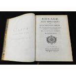
THOMAS FORREST: VOYAGE AUX MOLUQUES ET A LA NOUVELLE GUINEE..., Paris, Hotel de Thou, 1780, 1st
THOMAS FORREST: VOYAGE AUX MOLUQUES ET A LA NOUVELLE GUINEE..., Paris, Hotel de Thou, 1780, 1st French edition, large folding engraved map, 28 map...
JAMES COOK AND JAMES KING: TROISIEME VOYAGE DE COOK, OU VOYAGE A L'OCEAN PACIFIQUE, ORDONNE, PAR
JAMES COOK AND JAMES KING: TROISIEME VOYAGE DE COOK, OU VOYAGE A L'OCEAN PACIFIQUE, ORDONNE, PAR LE ROI D'ANGLETERRE..., translated [Jean Nicolas ...
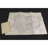
NORTHERN NIGERIA, folding map compiled March 9th 1905, one of two folding maps included in FLORA L
NORTHERN NIGERIA, folding map compiled March 9th 1905, one of two folding maps included in FLORA L SHAW, LADY LUGARD: A TROPICAL DEPENDENCY, publi...
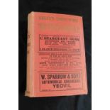
KELLY'S DIRECTORY OF NORFOLK, 1908, 1912, both with folding coloured maps, original cloth worn and
KELLY'S DIRECTORY OF NORFOLK, 1908, 1912, both with folding coloured maps, original cloth worn and soiled, (2)
KELLY'S DIRECTORY OF THE COUNTY OF SOMERSET AND THE CITY OF BRISTOL, 1927, with folding coloured map
KELLY'S DIRECTORY OF THE COUNTY OF SOMERSET AND THE CITY OF BRISTOL, 1927, with folding coloured map (detached), original cloth gilt
One box: assorted folding maps on linen and others later, Ordnance Survey etc
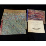
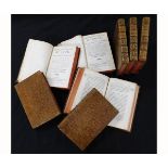
Packet eight 19th century juvenile manuscript penmanship books, one by W Wright dated 1834, 5
Packet eight 19th century juvenile manuscript penmanship books, one by W Wright dated 1834, 5 manuscript pages, oblong folio, marbled wraps, 5 by ...
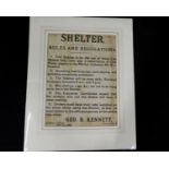
Framed sale particulars for an estate in Foxley and an allotment of land in Bawdeswell belonging
Framed sale particulars for an estate in Foxley and an allotment of land in Bawdeswell belonging to the heirs of the late Rev John Godwin, Decembe...
EMANUEL AND THOMAS BOWEN: ATLAS ANGLICANUS OR A COMPLETE SETT OF MAPS OF THE COUNTIES OF SOUTH
EMANUEL AND THOMAS BOWEN: ATLAS ANGLICANUS OR A COMPLETE SETT OF MAPS OF THE COUNTIES OF SOUTH BRITAIN DIVIDED INTO THEIR RESPECTIVE HUNDREDS, WAP...
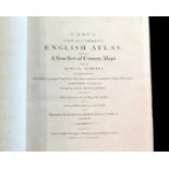
JOHN CARY: CARY'S NEW AND CORRECT ENGLISH ATLAS, BEING A NEW SET OF COUNTY MAPS FROM ACTUAL
JOHN CARY: CARY'S NEW AND CORRECT ENGLISH ATLAS, BEING A NEW SET OF COUNTY MAPS FROM ACTUAL SURVEYS..., London for John Cary, 1793, engraved title...
ROBERT LAURIE & JAMES WHITTLE: LAURIE AND WHITTLE'S NEW AND ELEGANT GENERAL ATLAS..., London,
ROBERT LAURIE & JAMES WHITTLE: LAURIE AND WHITTLE'S NEW AND ELEGANT GENERAL ATLAS..., London, 1808, 5th edition, added engraved vignette title dat...
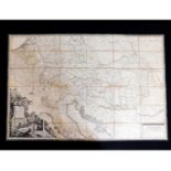
GEORGE INGNAZ VON METZBURG: POSTE CHARTE DER KAISERL KONIGL ERLABANDEN... GESTOCHEN VON MANSFELD, [
GEORGE INGNAZ VON METZBURG: POSTE CHARTE DER KAISERL KONIGL ERLABANDEN... GESTOCHEN VON MANSFELD, [Vienna?], 1782, engraved folding outline colour...
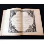
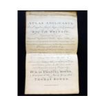
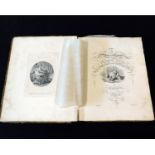
L'ABBE DE GOURNE: ATLAS ABREGE ET PORTATIF..., Paris, 1763,engraved double page title, 5 double page
L'ABBE DE GOURNE: ATLAS ABREGE ET PORTATIF..., Paris, 1763,engraved double page title, 5 double page engraved hand coloured maps as called for, 4t...
JOHN CARY: CARY'S NEW MAP OF ENGLAND AND WALES WITH PART OF SCOTLAND, London, 1794, engraved title
JOHN CARY: CARY'S NEW MAP OF ENGLAND AND WALES WITH PART OF SCOTLAND, London, 1794, engraved title page end dedication leaf, engraved hand coloure...

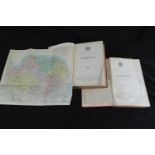
G W BACON (EDITED): COMMERCIAL AND LIBRARY ATLAS OF THE BRITISH ISLES FROM THE ORDNANCE SURVEY
G W BACON (EDITED): COMMERCIAL AND LIBRARY ATLAS OF THE BRITISH ISLES FROM THE ORDNANCE SURVEY WITH INDEX GAZETTEER, PLANS OF TOWNS..., London, G ...
FOLDER OF ASSORTED MAPS including JOHN SPEED PLAN OF LEICESTER circa 1610, approx 145 x 145mm +
FOLDER OF ASSORTED MAPS including JOHN SPEED PLAN OF LEICESTER circa 1610, approx 145 x 145mm + OWEN/BOWEN: THE ROAD FROM KINGS LYN TO NORWICH...,...
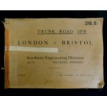
TRUNK ROAD NO 9 LONDON-BRISTOL SOUTHERN ENGINEERING DIVISION PART II WILTSHIRE, SOMERSET, circa
TRUNK ROAD NO 9 LONDON-BRISTOL SOUTHERN ENGINEERING DIVISION PART II WILTSHIRE, SOMERSET, circa 1933, 38 part coloured maps, oblong, folio, origin...
EMANUEL BOWEN: AN ACCURATE MAP OF THE COUNTY OF ESSEX..., engraved hand coloured map circa 1760,
EMANUEL BOWEN: AN ACCURATE MAP OF THE COUNTY OF ESSEX..., engraved hand coloured map circa 1760, approx 520 x 710mm, framed and glazed
![JOHN SPEED: NORFOLKE..., engraved hand coloured map [1676], approx 350 x 490mm, framed and glazed](https://portal-images.azureedge.net/auctions-2018/srkey10211/images/a89230c8-76af-4d99-c4d9-9a5a5496bb8a.jpg?w=155&h=155)
JOHN SPEED: NORFOLKE..., engraved hand coloured map [1676], approx 350 x 490mm, framed and glazed
JOHN SPEED: NORFOLKE..., engraved hand coloured map [1676], approx 350 x 490mm, framed and glazed
EMANUEL BOWEN: AN ACCURATE MAP OF NOTTINGHAMSHIRE DESCRIBING WAPONTAKES AND DIVISIONS..., engraved
EMANUEL BOWEN: AN ACCURATE MAP OF NOTTINGHAMSHIRE DESCRIBING WAPONTAKES AND DIVISIONS..., engraved hand coloured map circa 1780, approx 695 x 535m...
JOHN CARY?: AN ACCURATE MAP OF ENGLAND, SCOTLAND, AND WALES, DRAWN FROM THE LATEST AND BEST SURVEYS,
JOHN CARY?: AN ACCURATE MAP OF ENGLAND, SCOTLAND, AND WALES, DRAWN FROM THE LATEST AND BEST SURVEYS, engraved hand coloured map circa 1810, approx...
JOANNES BLAEU: NORTFOLCIA, NORFOLKE, engraved hand coloured map circa 1646, approx 375 x 495mm,
JOANNES BLAEU: NORTFOLCIA, NORFOLKE, engraved hand coloured map circa 1646, approx 375 x 495mm, framed and glazed
EMANUEL BOWEN: AN ACCURATE MAP OF THE COUNTIES OF LEICESTER AND RUTLAND, DIVIDED INTO THEIR
EMANUEL BOWEN: AN ACCURATE MAP OF THE COUNTIES OF LEICESTER AND RUTLAND, DIVIDED INTO THEIR RESPECTIVE HUNDREDS..., engraved hand coloured map cir...
STANFORD'S GEOGRAPHICAL ESTABLISHMENT (PUBLISHED): MAP OF THE PYTCHLEY HUNT SHEWING FOX COVERS AND
STANFORD'S GEOGRAPHICAL ESTABLISHMENT (PUBLISHED): MAP OF THE PYTCHLEY HUNT SHEWING FOX COVERS AND SPINNEYS, litho map, 1911, approx 595 x 650mm, ...
JOHN CARY: A MAP OF NORTHAMPTONSHIRE FROM THE BEST AUTHORITIES, engraved hand coloured map 1805,
JOHN CARY: A MAP OF NORTHAMPTONSHIRE FROM THE BEST AUTHORITIES, engraved hand coloured map 1805, approx 425 x 475mm, framed and glazed
![CHRISTOPHER SAXTON/WILLIAM KIP: NORTHAMPTONIAE, engraved hand coloured map [1607], approx 280 x](https://portal-images.azureedge.net/auctions-2018/srkey10211/images/65b4a4f7-033a-4c29-9860-6d4b7894455c.jpg?w=155&h=155)
CHRISTOPHER SAXTON/WILLIAM KIP: NORTHAMPTONIAE, engraved hand coloured map [1607], approx 280 x
CHRISTOPHER SAXTON/WILLIAM KIP: NORTHAMPTONIAE, engraved hand coloured map [1607], approx 280 x 350mm, framed and glazed
RICHARD BLOME: A MAPP OF THE COUNTY OF LEICESTER WITH ITS HUNDREDS, engraved hand coloured map circa
RICHARD BLOME: A MAPP OF THE COUNTY OF LEICESTER WITH ITS HUNDREDS, engraved hand coloured map circa 1673, approx 242 x 307mm, framed and glazed
THOMAS KITCHIN: A NEW AND ACCURATE MAP OF THAT DISTRICT OF GREAT BRITAIN CALLED ENGLAND AND WALES,
THOMAS KITCHIN: A NEW AND ACCURATE MAP OF THAT DISTRICT OF GREAT BRITAIN CALLED ENGLAND AND WALES, engraved hand coloured map circa 1784, approx 3...
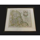
![ROBERT MORDEN: NOTTINGHAMSHIRE, engraved map [1695], approx 335 x 400mm, framed and glazed](https://portal-images.azureedge.net/auctions-2018/srkey10211/images/b719d843-c2a5-44b1-bcef-0a4a6455be03.jpg?w=155&h=155)
ROBERT MORDEN: NOTTINGHAMSHIRE, engraved map [1695], approx 335 x 400mm, framed and glazed
JOHN CARY: HUNTINGDONSHIRE, engraved part hand coloured map, 1787, approx 260 x 210mm, framed and
JOHN CARY: HUNTINGDONSHIRE, engraved part hand coloured map, 1787, approx 260 x 210mm, framed and glazed
GERARD MERCATOR: EBORACUM LINCOLNIA, DERBIA, STAFFORDIA, NOTINGHAMIA, LECESTRIA, RUTLANDIA, ET
GERARD MERCATOR: EBORACUM LINCOLNIA, DERBIA, STAFFORDIA, NOTINGHAMIA, LECESTRIA, RUTLANDIA, ET NORFOLCIA, engraved hand coloured map [1595], appro...
ROBERT MORDEN: HERTFORDSHIRE, engraved part hand coloured map [1695], approx 360 x 450mm, framed and
ROBERT MORDEN: HERTFORDSHIRE, engraved part hand coloured map [1695], approx 360 x 450mm, framed and glazed
![JOHN SPEED: THE BISHOPRICK AND CITIE OF DURHAM, engraved hand coloured map [1611], inset town plan](https://portal-images.azureedge.net/auctions-2018/srkey10211/images/f0688714-3d05-4305-b11a-aa3bebf0ca53.jpg?w=155&h=155)
JOHN SPEED: THE BISHOPRICK AND CITIE OF DURHAM, engraved hand coloured map [1611], inset town plan
JOHN SPEED: THE BISHOPRICK AND CITIE OF DURHAM, engraved hand coloured map [1611], inset town plan of Durham, approx 380 x 505mm, double glazed fr...
J STRATFORD (PUBLISHED): SCOTLAND, engraved hand coloured map, 1804, inset map of Shetland Isles,
J STRATFORD (PUBLISHED): SCOTLAND, engraved hand coloured map, 1804, inset map of Shetland Isles, approx 445 x 375mm, framed and glazed
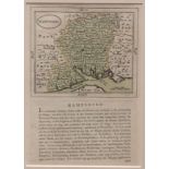
JOHN SELLER: HAMPSHIRE, engraved hand coloured map circa 1787, approx 120 x 140mm, text below and
JOHN SELLER: HAMPSHIRE, engraved hand coloured map circa 1787, approx 120 x 140mm, text below and verso, double glazed frame
THOMAS MOULE: CAMBRIDGESHIRE, engraved hand coloured map circa 1850, approx 260 x 200mm, framed
THOMAS MOULE: CAMBRIDGESHIRE, engraved hand coloured map circa 1850, approx 260 x 200mm, framed and glazed + 4 other hand coloured and engraved Mo...
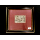
PIETER VAN DEN KEERE: CORNWALLIA, engraved hand coloured map circa 1627, approx 80 x 120mm, framed
PIETER VAN DEN KEERE: CORNWALLIA, engraved hand coloured map circa 1627, approx 80 x 120mm, framed and glazed
AUSTRALASIA AND POLYNESIA - AFRICA, two hand coloured engraved maps in one frame, ex-Ewing's General
AUSTRALASIA AND POLYNESIA - AFRICA, two hand coloured engraved maps in one frame, ex-Ewing's General Atlas circa 1825, each approx 180 x 215mm, fr...
J RUSSELL: IRELAND DIVIDED INTO PROVINCES AND COUNTIES FROM THE BEST AUTHORITIES, engraved hand
J RUSSELL: IRELAND DIVIDED INTO PROVINCES AND COUNTIES FROM THE BEST AUTHORITIES, engraved hand coloured map, 1802, approx 400 x 315mm, framed and...
THOMAS BOWEN: A NEW AND ACCURATE MAP OF ENGLAND, engraved hand coloured map circa 1770, approx 320 x
THOMAS BOWEN: A NEW AND ACCURATE MAP OF ENGLAND, engraved hand coloured map circa 1770, approx 320 x 220mm, framed and glazed
CHRISTOPHER CELLARIUS: GALLIA BELGICA, engraved hand coloured map circa 1744, approx 205 x 300mm
CHRISTOPHER CELLARIUS: GALLIA BELGICA, engraved hand coloured map circa 1744, approx 205 x 300mm
JOANNES BLAEU: LIONNOIS, FOREST, ET BEAUIOLOIS, engraved hand coloured map circa 1633, approx 370
JOANNES BLAEU: LIONNOIS, FOREST, ET BEAUIOLOIS, engraved hand coloured map circa 1633, approx 370 x 495mm, framed and glazed
HENRICUS HONDIUS: DOMINIUM VENETUM IN ITALIA, engraved hand coloured map circa 1627, approx 370 x
HENRICUS HONDIUS: DOMINIUM VENETUM IN ITALIA, engraved hand coloured map circa 1627, approx 370 x 500mm, framed and glazed
CHRISTOPHER CELLARIUS: AEGYPTUS ET CYRENAICA - AEGYPTI DELTA ET NILI OSTIA, 2 engraved hand coloured
CHRISTOPHER CELLARIUS: AEGYPTUS ET CYRENAICA - AEGYPTI DELTA ET NILI OSTIA, 2 engraved hand coloured maps circa 1729, each approx 200 x 300mm (2)
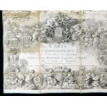
LOUIS-ANDRE DEPUIS: CARTE CHOROGRAPHE DES PAYS-BAS AUTRICHIENS..., 1777, large scale engraved
LOUIS-ANDRE DEPUIS: CARTE CHOROGRAPHE DES PAYS-BAS AUTRICHIENS..., 1777, large scale engraved dissected map, folding backed onto linen, 8 sections...
ORDNANCE SURVEY: NORFOLK (SOUTHERN DIVISION), L11,9,circa 1882, Wroxham, Rackheath etc, part hand
ORDNANCE SURVEY: NORFOLK (SOUTHERN DIVISION), L11,9,circa 1882, Wroxham, Rackheath etc, part hand coloured map, approx 660 x 960mm
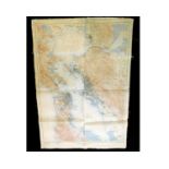
US GEOLOGICAL SURVEY: SAN FRANCISCO AND VICINITY, CALIFORNIA, large scale coloured map, 1915, backed
US GEOLOGICAL SURVEY: SAN FRANCISCO AND VICINITY, CALIFORNIA, large scale coloured map, 1915, backed onto linen, approx 1180 x 860mm
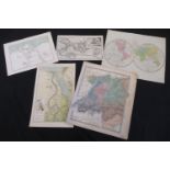
SET OF TWELVE MANUSCRIPT PEN, INK AND WATERCOLOUR MAPS by the cartographer RENE MIOT (b1895), maps
SET OF TWELVE MANUSCRIPT PEN, INK AND WATERCOLOUR MAPS by the cartographer RENE MIOT (b1895), maps mainly France including geological, textile ind...
THOMAS DUGDALE: SURREY, engraved map circa 1848, approx 180 x 230mm + SAMUEL NEELE: NORFOLK,
THOMAS DUGDALE: SURREY, engraved map circa 1848, approx 180 x 230mm + SAMUEL NEELE: NORFOLK, engraved hand coloured map circa 1819, approx 175 x 2...
C SMITH: A NEW MAP OF THE COUNTY OF LEICESTER, engraved hand coloured map, 1818, approx 435 x 490mm
C SMITH: A NEW MAP OF THE COUNTY OF LEICESTER, engraved hand coloured map, 1818, approx 435 x 490mm
![JOHN CARY: A MAP OF HARTFORDSHIRE [HERTFORDSHIRE] FROM THE BEST AUTHORITIES, engraved hand](https://portal-images.azureedge.net/auctions-2018/srkey10211/images/6f87d934-3c3d-4ad4-98bc-02ed69efa163.jpg?w=155&h=155)
JOHN CARY: A MAP OF HARTFORDSHIRE [HERTFORDSHIRE] FROM THE BEST AUTHORITIES, engraved hand coloured map, circa 1806, approx size 375 x 480mm
J D'ANVILLE: 2 hand coloured engraved maps, published R Laurie, 1821, GERMANY, FRANCE, ITALY, SPAIN,
J D'ANVILLE: 2 hand coloured engraved maps, published R Laurie, 1821, GERMANY, FRANCE, ITALY, SPAIN, BRITISH ISLES IN AN INTERMEDIATE CENTURY BETW...
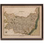
Packet: five Suffolk hand coloured engraved maps comprising PIGOT, [1840], approx size 220 x
Packet: five Suffolk hand coloured engraved maps comprising PIGOT, [1840], approx size 220 x 350mm, R CREIGHTON, [1831], approx size 225 x 300mm; ...
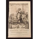
C J VOOGHT: DE NIEUWE GROOTE LICHTENDE ZEE-FACKEL..., engraved title page for atlas, 1687, printed
C J VOOGHT: DE NIEUWE GROOTE LICHTENDE ZEE-FACKEL..., engraved title page for atlas, 1687, printed area approx 490 x 290mm
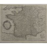
EMANUEL BOWEN: A NEW AND ACCURATE MAP OF FRANCE WITH ITS ACQUISITIONS COMPOSED FROM THE LATEST
EMANUEL BOWEN: A NEW AND ACCURATE MAP OF FRANCE WITH ITS ACQUISITIONS COMPOSED FROM THE LATEST SURVEYS, engraved map circa 1752, inset Harbour of ...