Filtered by:
- Category
- List
- Grid
A subscription to the Price Guide is required to view results for auctions ten days or older. Click here for more information

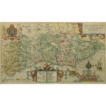
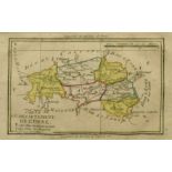
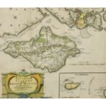
A collection of miscellaneous maps, including one of the 'Isle of Man', unframed (12).
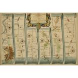
John Ogilby, circa 1698, The Road from London to St. Davids in com. Pembroke, circa 1698, hand
John Ogilby, circa 1698, The Road from London to St. Davids in com. Pembroke, circa 1698, hand coloured engraved strip road map, sheet 14, 12" x 1...
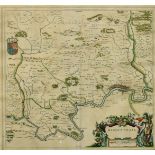
Johannes Blaeu, Hantonia sive Southantonensis comitatus vulgo Hant-shire, 17th Century, mounted,
Johannes Blaeu, Hantonia sive Southantonensis comitatus vulgo Hant-shire, 17th Century, mounted, unframed, 16.5" x 20".
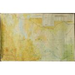
A collection of maps and plans including 'The Island and Forts of Saint Helena' circa 1817, unframed
A collection of maps and plans including 'The Island and Forts of Saint Helena' circa 1817, unframed (Qty). ...[more]
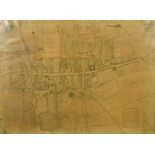
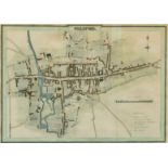
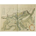
A Town plan of Guildford, Circa 1739, surveyed by Matt Richardson and engraved by John Harris,
A Town plan of Guildford, Circa 1739, surveyed by Matt Richardson and engraved by John Harris, faults, 20.5" x 29". ...[more]
Johannes Blaeu, 17th Century, 'Middle-Sexia', hand coloured and outlined, 15" x 16".
John Norden and John Speed - 'Sussex Described and Divided.....', 17th Century engraving, 15.5" x
John Norden and John Speed - 'Sussex Described and Divided.....', 17th Century engraving, 15.5" x 20".
Marco Secznagel, 'Salisburgensis Iurisdictionis', hand coloured 17th Century map of the region of
Marco Secznagel, 'Salisburgensis Iurisdictionis', hand coloured 17th Century map of the region of Salzburg, published by Ortelius, 15.25" x 18".
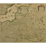
Frederic de Wit, 'Regni Poloniae et Ducatus Lithuaniae Voliniae, Podoliae, Ucraniae, Prussiae,
Frederic de Wit, 'Regni Poloniae et Ducatus Lithuaniae Voliniae, Podoliae, Ucraniae, Prussiae, Lovoniae, et Curlandiae descriptio', a 17th Century...
W & J Blaeu, 'Ducatus Limburgum Auctore Aegidio Martini', a hand-coloured 17th Century engraved
W & J Blaeu, 'Ducatus Limburgum Auctore Aegidio Martini', a hand-coloured 17th Century engraved map,15.25 x 19.75". ...[more]
John Harrison, a late 18th Century map of Great Britain, along with 'A New Map of The Counties Of
John Harrison, a late 18th Century map of Great Britain, along with 'A New Map of The Counties Of Orkney, Cathness, Sutherland, Ross & Cromarty', ...
An 18th/19th Century engraved map of Sicilian ports and harbours, 20.5" x 12".
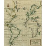
Herman Moll, 'A General Chart of the Sea Coast of Europe, Africa & America. According to E. Wright'
Herman Moll, 'A General Chart of the Sea Coast of Europe, Africa & America. According to E. Wright's' or Mercator's Projection...', 18th Century, ...
John Norden and William Kip, a hand-coloured map of Sussexia, 17th Century, hand colouring probably later, 10.25" x 16". ...[more]
Emanuel Bowen, 'An Accurate Map of the County of Sussex', mid/late 18th Century outline coloured
Emanuel Bowen, 'An Accurate Map of the County of Sussex', mid/late 18th Century outline coloured engraving, 20" x 27.5".
Christopher Saxton, engraved by William Hole, 'Northumbriae Comitatus olim sedes Otadinorum', 17th
Christopher Saxton, engraved by William Hole, 'Northumbriae Comitatus olim sedes Otadinorum', 17th Century map, 11" x 12", along with another 'Ebo...
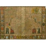
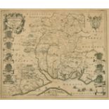
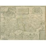
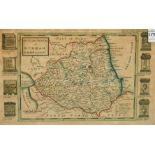
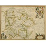
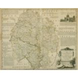
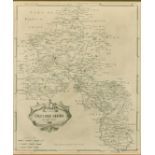
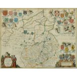
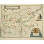
Cambridgshire described with the devision of the hundreds, the Townes situation with the Armes of
Cambridgshire described with the devision of the hundreds, the Townes situation with the Armes of the Colleges of that famous Universiti: by John ...
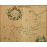
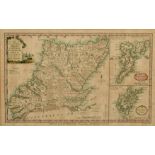
Greenuile Collins, A hand coloured engraved map/chart of Milford Haven, 18" x 22.75".
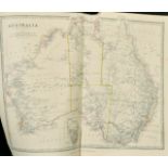
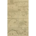
A collection of maps and engravings relating to Australia and The Antipodes, various sizes from 14.
A collection of maps and engravings relating to Australia and The Antipodes, various sizes from 14.25" x 18.75" to 4" x 5.25", (qty) (unframed). ...

Four small antiquarian maps, Middlesex, Shropshire, Glamorgan, Monmouthshire, 7.5" x 5.25" to 6.
Four small antiquarian maps, Middlesex, Shropshire, Glamorgan, Monmouthshire, 7.5" x 5.25" to 6.25" x 8.25", (unframed) (4).
Israel Silvestre (1621-1691) French, 'Veue de Chateau de Fontainebleau' and 'Prospectus Regiae
Israel Silvestre (1621-1691) French, 'Veue de Chateau de Fontainebleau' and 'Prospectus Regiae Fontis', A pair of engravings of French views, each...
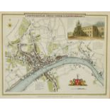
A Town Plan of Guildford, hand coloured engraving by J. Greig for "Excursions in the County of
A Town Plan of Guildford, hand coloured engraving by J. Greig for "Excursions in the County of Sussex". Published by Longman & Co, Paternoster Row...
Carte du Departement de L'Orne, circa 1795, hand coloured engraving, 4.5" x 7". ...[more]
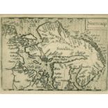
Nortcaep, a map of Scandinavia, 17th Century, engraving, 3.5" x 5".
Newcastle Upon Tyne & Gateshead, by G. Cole & J. Roper circa 1810, hand coloured engraving, 7.75"
Newcastle Upon Tyne & Gateshead, by G. Cole & J. Roper circa 1810, hand coloured engraving, 7.75" x 9.75". ...[more]
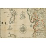
The smaller islands in the British ocean' by Robert Morden, early 18th Century, hand coloured
The smaller islands in the British ocean' by Robert Morden, early 18th Century, hand coloured engraving, a fragment, 10" x 11.5". ...[more]
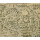
Belagerung und Einnehmun der Stadt und Vestung Manheim Anno 1622, a 17th Century engraving of the
Belagerung und Einnehmun der Stadt und Vestung Manheim Anno 1622, a 17th Century engraving of the Siege of Manheim, 10.5" x 12". ...[more]
Barkshire by Robert Morden, a hand-coloured engraving, 18th Century, 14" x 16.25". ...[more]
Secunda Pars Brabantiae cuius urbs primaria Bruxellae, by William Blaeu, 17th Century hand coloured engraving, 17" x 21". ...[more]
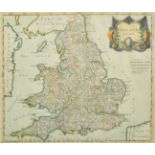
England by Robert Morden, hand coloured engraving, 18th Century, 14.75" x 16.75". ...[more]
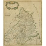
Northumberland by Robert Morden, hand coloured engraving, 18th Century, 17.25" x 14.25". ...[more]
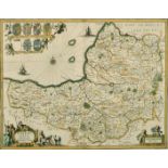
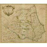
Somersettensis Comitatus: Somerset Shire, by Jan Jansson, hand coloured engraving, 17th Century,
Somersettensis Comitatus: Somerset Shire, by Jan Jansson, hand coloured engraving, 17th Century, 15.25" x 19.75".
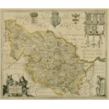
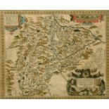
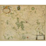
Ducatus Eboracensis Pars Occidentalis, The Westriding of Yorke Shire, by Johannes Blaeu, outline
Ducatus Eboracensis Pars Occidentalis, The Westriding of Yorke Shire, by Johannes Blaeu, outline coloured, 17th Century, 17" x 20.5".
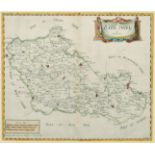
Herefordia Comitatus vernacule Hereford Shire, by Jan Jansson, outline coloured engraving, probably 17th Century, 15" x 20".
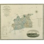
Map of the County of Surrey from an actual survey made in the years 1822 & 1823, published by
Map of the County of Surrey from an actual survey made in the years 1822 & 1823, published by Greenwood & Co, hand coloured engraving, 19th Centur...
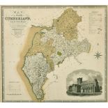
Map of the County of Cumberland from an actual survey made in the years 1821 & 1822, published by
Map of the County of Cumberland from an actual survey made in the years 1821 & 1822, published by Greenwood & Co, hand coloured engraving, 19th Ce...
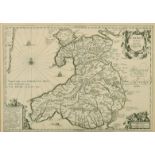
Cambriae typus, Auctore Humfredo Lhuydo, Jan Janssons, engraving, 17th Century, 14" x 19".
An accurate map of the county of Hereford...., by Emanuel Bowen, outline coloured, engraving, 18th
An accurate map of the county of Hereford...., by Emanuel Bowen, outline coloured, engraving, 18th Century, 17" x 20.5".
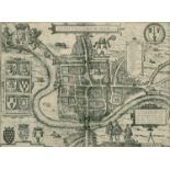
Cestria vulgo Chester, Angliae Civitas, by Braun and Hogenberg, engraving, probably 16th Century,
Cestria vulgo Chester, Angliae Civitas, by Braun and Hogenberg, engraving, probably 16th Century, 12.75" x 17.25".
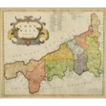
Cornwall, by Robert Morden, hand coloured engraving, 18th Century, 14.75" x 17". ...[more]
The County Palatine of Chester, by Robert Morden, outline coloured, engraving, 18th Century, 14" x
The County Palatine of Chester, by Robert Morden, outline coloured, engraving, 18th Century, 14" x 16.5". ...[more]
Oxfordshire, by Robert Morden, engraving, 18th Century, 17" x 14.25". ...[more]
Episcopatus Dunelmensis, vulgo the Bishoprick of Durham, by Robert Morden, outline coloured, 18th
Episcopatus Dunelmensis, vulgo the Bishoprick of Durham, by Robert Morden, outline coloured, 18th Century, 14.5" x 17".
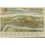
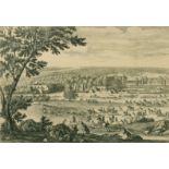
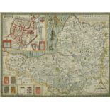
A View of London about the year 1560, by William Maitland, hand coloured engraving, 18th Century,
A View of London about the year 1560, by William Maitland, hand coloured engraving, 18th Century, 12.5" x 19". ...[more]
The Road from London to Chichester, by John Ogilby, sheet 39, hand coloured engraving, 17th Century,
The Road from London to Chichester, by John Ogilby, sheet 39, hand coloured engraving, 17th Century, 14" x 19". ...[more]
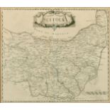
Suffolk, by Robert Morden, engraving, 18th Century, 14.5" x 17". ...[more]
Glocestria Ducatus Vulgo Glocestershire, by Blaeu, hand coloured engraving, 17th Century, 17" x
Glocestria Ducatus Vulgo Glocestershire, by Blaeu, hand coloured engraving, 17th Century, 17" x 20". ...[more]
Somerset-Shire Described, by John Speed, hand coloured engraving, 17th Century, 15" x 20".
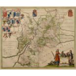
Comitatus Cantabrigiensis; vernacule Cambridgeshire, by Jan Jansson, hand coloured engraving, 17th
Comitatus Cantabrigiensis; vernacule Cambridgeshire, by Jan Jansson, hand coloured engraving, 17th Century, 16.5" x 20".
A group of 4 Kenyan maps published circa 1972 and one other of locations of coal mines in the UK,
A group of 4 Kenyan maps published circa 1972 and one other of locations of coal mines in the UK, rolled. ...[more]
A group of 5 18th Century maps of Ancient European States, published by Laurie and Whittle,
A group of 5 18th Century maps of Ancient European States, published by Laurie and Whittle, outline coloured, 22" x 29.5", rolled.
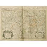
Alexis-Hubert Jaillot, 'Le Gouvernement General de Picardie' and 'Le Gouvernement General de L'
Alexis-Hubert Jaillot, 'Le Gouvernement General de Picardie' and 'Le Gouvernement General de L'Isle de France', two 17th/18th Century outline-colo...
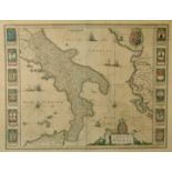
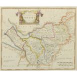
A 17th Century map 'Regno di Napoli', outline coloured, 15" x 19.5", along with 11 other maps, all
A 17th Century map 'Regno di Napoli', outline coloured, 15" x 19.5", along with 11 other maps, all unframed, a/f, (unframed) (12).
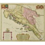
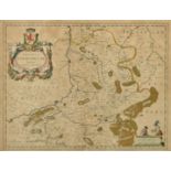
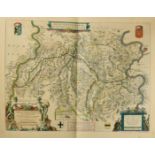
Johannes Blaeu, 'Illyricum Hodiernum Quod Scriptores communiter Sclavoniam', a hand-coloured 17th
Johannes Blaeu, 'Illyricum Hodiernum Quod Scriptores communiter Sclavoniam', a hand-coloured 17th Century map, 21" x 24", (unframed).
'Namurcum Comitatus Auctore Iohann Surhonio', after Blaeu, a 17th Century outline coloured map,
'Namurcum Comitatus Auctore Iohann Surhonio', after Blaeu, a 17th Century outline coloured map, 16" x 20.5", (unframed).
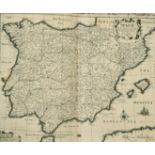
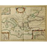
John Speed, 'Spaine', 17th Century, 16" x 21", (unframed).
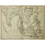
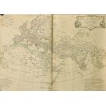
John Speed engraved by F. Lamb, 'A New Map of East India', 17th Century,17.5" x 22", (unframed).
John Speed engraved by F. Lamb, 'A New Map of East India', 17th Century,17.5" x 22", (unframed).
Willem Blaeu, 'Fossa Sanctae Mariae, quae et Eugeniana Dicitur vulgo de Nieuwe Grift', a hand-
Willem Blaeu, 'Fossa Sanctae Mariae, quae et Eugeniana Dicitur vulgo de Nieuwe Grift', a hand-coloured 17th Century map, 15" x 20", (unframed).
Pieter van den Keere, 'Argonautica' published by Jan Jansson, outline coloured 17th Century
Pieter van den Keere, 'Argonautica' published by Jan Jansson, outline coloured 17th Century engraving, 15" x 20", (unframed).
William Blaeu, 'Tabula Castelli ad Sandflitam, qua simul inundati agri, alluviones, fos , alvei,
William Blaeu, 'Tabula Castelli ad Sandflitam, qua simul inundati agri, alluviones, fos , alvei, qu Bergas ad Zomam et Antverpiam interjacent', a ...