Filtered by:
- Category
6 items
- List
- Grid
A subscription to the Price Guide is required to view results for auctions ten days or older. Click here for more information
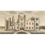

Lot 1095
A collection of 19th century and later local views including two of Cowdrey house and others of
A collection of 19th century and later local views including two of Cowdrey house and others of Chichester and Midhurst, various sizes, (7).
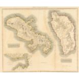
Lot 1154
A small collection of maps of islands including Dominica and Martinique and in the Pacific Ocean,
A small collection of maps of islands including Dominica and Martinique and in the Pacific Ocean, various sizes, (qty).
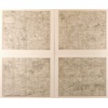
Lot 1155
London and environs circa 1802, A hand coloured map in four parts, each 20" x 24", overall frame
1155London and environs circa 1802, A hand coloured map in four parts, each 20" x 24", overall frame
London and environs circa 1802, A hand coloured map in four parts, each 20" x 24", overall frame dimensions 54" x 63".
Lot 1156
Pierre Van der Aa, Royaume du Grand Mogol , an 18th century hand coloured map, 11.25 x 13.75".
Pierre Van der Aa, Royaume du Grand Mogol , an 18th century hand coloured map, 11.25 x 13.75".
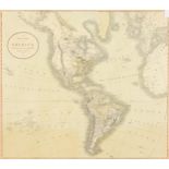
John Cary, c. 1806, A New Map Of America , hand coloured, 18 x 21 .
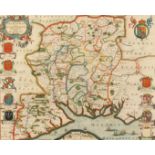
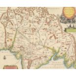
G. Blaeu, A 17th century map of Hampshire, hand coloured, 17 x 20.5 .