Filtered by:
- Category
- List
- Grid
A subscription to the Price Guide is required to view results for auctions ten days or older. Click here for more information
![[MAPS] GUTHRIE'S School Atlas, 1824; misc. other maps, Swiss Cantons etc. (Q).](https://portal-images.azureedge.net/auctions-2019/srjo10230/images/fe81985c-a7d2-4340-b832-aa42011cf519.jpg?w=155&h=155)

[MAPS] GUTHRIE'S School Atlas, 1824; misc. other maps, Swiss Cantons etc. (Q).
![[MAPS] coll'n of linen-backed folding maps, incl. "Shilling Guide Map", Somaliland, Schleswig-](https://portal-images.azureedge.net/auctions-2019/srjo10230/images/84996629-e177-47b9-aa25-aa42011cf58e.jpg?w=155&h=155)
[MAPS] coll'n of linen-backed folding maps, incl. "Shilling Guide Map", Somaliland, Schleswig-
[MAPS] coll'n of linen-backed folding maps, incl. "Shilling Guide Map", Somaliland, Schleswig-Holstein Geological map (1881), Persian Gulf, Ootaga...
![[MAP] b/w map of GUINEA, after G. Blaeu, 15.25 x 21 inches, f & g.](https://portal-images.azureedge.net/auctions-2019/srjo10230/images/2f4d6a8c-bd35-443c-80e9-aa42011cf8ad.jpg?w=155&h=155)
[MAP] b/w map of GUINEA, after G. Blaeu, 15.25 x 21 inches, f & g. ...[more]
![[MAPS] OGILBY (John) The Road from London to Portsmouth [from Camden's Britannia, 1698}, 44cms x](https://portal-images.azureedge.net/auctions-2019/srjo10230/images/1b574492-4bc0-4fd0-bce8-aa42011cfd39.jpg?w=155&h=155)
[MAPS] OGILBY (John) The Road from London to Portsmouth [from Camden's Britannia, 1698}, 44cms x
[MAPS] OGILBY (John) The Road from London to Portsmouth [from Camden's Britannia, 1698}, 44cms x 35cms, hand-colouring, f & g; KIP (William) Staff...
![[MAPS] q. of 19th c. folding maps of Norway, Sweden etc., in original printed card covers (Q).](https://portal-images.azureedge.net/auctions-2019/srjo10230/images/2382f05b-a3d9-4546-9240-aa42011d000a.jpg?w=155&h=155)
[MAPS] q. of 19th c. folding maps of Norway, Sweden etc., in original printed card covers (Q).
[MAPS] q. of 19th c. folding maps of Norway, Sweden etc., in original printed card covers (Q).
![[MAPS] q. of misc. 18th / 19th c. maps, unframed incl. St Helena (1823), London, U.S.A. (Q).](https://portal-images.azureedge.net/auctions-2019/srjo10230/images/68996800-52b6-4e39-a6c9-aa42011d014b.jpg?w=155&h=155)
[MAPS] q. of misc. 18th / 19th c. maps, unframed incl. St Helena (1823), London, U.S.A. (Q).
![[MAPS] coll'n of unframed maps & views, incl. Morden's Kent, h-col'd, trimmed; 2 x Kip views,](https://portal-images.azureedge.net/auctions-2019/srjo10230/images/23d37fab-db7d-485a-9b9a-aa42011d171e.jpg?w=155&h=155)
[MAPS] coll'n of unframed maps & views, incl. Morden's Kent, h-col'd, trimmed; 2 x Kip views,
[MAPS] coll'n of unframed maps & views, incl. Morden's Kent, h-col'd, trimmed; 2 x Kip views, etc. (Q). ...[more]
![[MAPS / LONDON] OVERALL (W.) Civitas Londinium, RALPH AGAS. A Survey of...London...The Facsimile](https://portal-images.azureedge.net/auctions-2019/srjo10230/images/f3e74e81-815b-4422-98af-aa42011d1871.jpg?w=155&h=155)
[MAPS / LONDON] OVERALL (W.) Civitas Londinium, RALPH AGAS. A Survey of...London...The Facsimile
[MAPS / LONDON] OVERALL (W.) Civitas Londinium, RALPH AGAS. A Survey of...London...The Facsimile by Edward J. Francis, 4to, linen-backed folding m...
![[MAPS / U.K.] SMITH (C.) A New Map of the County of Surrey...January 6th 1804, 2nd edition corrected](https://portal-images.azureedge.net/auctions-2019/srjo10230/images/c4c874f1-beac-4bc3-b2f8-aa42011d1c82.jpg?w=155&h=155)
[MAPS / U.K.] SMITH (C.) A New Map of the County of Surrey...January 6th 1804, 2nd edition corrected
[MAPS / U.K.] SMITH (C.) A New Map of the County of Surrey...January 6th 1804, 2nd edition corrected to 1808, engr. h-col'd folding linen-backed m...
![[MAPS] A New Map of Metropolitan Railways & Miscellaneous Improvements...for Session 1866, folding](https://portal-images.azureedge.net/auctions-2019/srjo10230/images/ff05d9bd-1eda-44aa-a23d-aa42011d1d46.jpg?w=155&h=155)
[MAPS] A New Map of Metropolitan Railways & Miscellaneous Improvements...for Session 1866, folding
[MAPS] A New Map of Metropolitan Railways & Miscellaneous Improvements...for Session 1866, folding linen-backed map, 87 x 78cms, cloth covers (a/f...
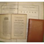
WATTS (I.) Knowledge of Heaven...First Principles of Astronomy...Explained by the Use of Globes
WATTS (I.) Knowledge of Heaven...First Principles of Astronomy...Explained by the Use of Globes and Maps...Seventh Edition, 8vo, 6 folding plates,...
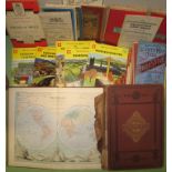
SHELL "Shilling" Guides, & q. of folding maps; & 2 small atlases (Q). ...[more]
![[ATLASES / MAPS] COLLINS' "Advanced Atlas consisting of 40 Maps," 4to, col. printed, ca. 1890?; a](https://portal-images.azureedge.net/auctions-2019/srjo10230/images/ac439404-cb0b-4c7a-b56e-aa42011d58e6.jpg?w=155&h=155)
[ATLASES / MAPS] COLLINS' "Advanced Atlas consisting of 40 Maps," 4to, col. printed, ca. 1890?; a
[ATLASES / MAPS] COLLINS' "Advanced Atlas consisting of 40 Maps," 4to, col. printed, ca. 1890?; a bound coll'n of county maps & a defective Bradsh...
![[MENAI BRIDGE etc.] Second [Third & Fifth] Report...on the Road from London to Holyhead, folio, 2](https://portal-images.azureedge.net/auctions-2019/srjo10230/images/eec093b2-24e4-477e-a932-aa42011d6b1b.jpg?w=155&h=155)
[MENAI BRIDGE etc.] Second [Third & Fifth] Report...on the Road from London to Holyhead, folio, 2
[MENAI BRIDGE etc.] Second [Third & Fifth] Report...on the Road from London to Holyhead, folio, 2 long folding maps, fine plate of proposed Menai ...
![[AUSTRALIA / WORLD] SINNETT (F.) Account of the Colony of South Australia, 8vo, pamphlet (upr,](https://portal-images.azureedge.net/auctions-2019/srjo10230/images/ab169e41-ca83-4d3a-b199-aa42011d96b3.jpg?w=155&h=155)
[AUSTRALIA / WORLD] SINNETT (F.) Account of the Colony of South Australia, 8vo, pamphlet (upr,
[AUSTRALIA / WORLD] SINNETT (F.) Account of the Colony of South Australia, 8vo, pamphlet (upr, wrapper detached), L., 1862; & misc. maps & atlases...
![[RUSSIA] MANSTEIN (Baron de) Memoirs of Russia...Second Edition, 4to, folding frontis. map, & 8](https://portal-images.azureedge.net/auctions-2019/srjo10230/images/12076941-4254-435d-b6bf-aa42011d9810.jpg?w=155&h=155)
[RUSSIA] MANSTEIN (Baron de) Memoirs of Russia...Second Edition, 4to, folding frontis. map, & 8
[RUSSIA] MANSTEIN (Baron de) Memoirs of Russia...Second Edition, 4to, folding frontis. map, & 8 other folding maps & plans, contemp. calf, minor f...