Filtered by:
- Category
- List
- Grid
A subscription to the Price Guide is required to view results for auctions ten days or older. Click here for more information
![[MAP] "CRUCHLEY's New Plan of London and its Environs," hand-col'd engr. map approx. 6 inches to 1](https://portal-images.azureedge.net/auctions-2018/srjo10215/images/12cbab21-2eb2-4204-9f16-a9a500b35d7e.jpg?w=155&h=155)

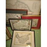
[MAP] "CRUCHLEY's New Plan of London and its Environs," hand-col'd engr. map approx. 6 inches to 1
[MAP] "CRUCHLEY's New Plan of London and its Environs," hand-col'd engr. map approx. 6 inches to 1 mile, approx. 53 x 56 inches, dissected & linen...
![[MAPS] small q. of double-page maps from Cruchley's General Atlas, 1843 (the versos repurposed as](https://portal-images.azureedge.net/auctions-2018/srjo10215/images/a4e6549a-59a0-4b3d-b1f5-a9a500b3d9a1.jpg?w=155&h=155)
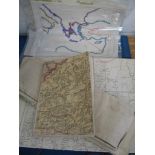
[MAPS] small q. of double-page maps from Cruchley's General Atlas, 1843 (the versos repurposed as
[MAPS] small q. of double-page maps from Cruchley's General Atlas, 1843 (the versos repurposed as scrap album leaves) incl. Hemisphere, China, N. ...
![[MAPS] 5 of 6 leaves of facsimile double-sided maps on parchment, publ. by Moleiro, 2003, after](https://portal-images.azureedge.net/auctions-2018/srjo10215/images/7c889937-331e-41e5-bced-a9a500b3de53.jpg?w=155&h=155)
[MAPS] 5 of 6 leaves of facsimile double-sided maps on parchment, publ. by Moleiro, 2003, after
[MAPS] 5 of 6 leaves of facsimile double-sided maps on parchment, publ. by Moleiro, 2003, after the 1519 originals from the "Atlas Miller," limite...
![[LONDON] BASSETT, CHRISTIAN & HODKINSON, Plan of the Parish of St Mary, KENSINGTON (etc.) engr. map,](https://portal-images.azureedge.net/auctions-2018/srjo10215/images/4a00b679-5c34-4dce-913c-a9a500b3f723.jpg?w=155&h=155)
[LONDON] BASSETT, CHRISTIAN & HODKINSON, Plan of the Parish of St Mary, KENSINGTON (etc.) engr. map,
[LONDON] BASSETT, CHRISTIAN & HODKINSON, Plan of the Parish of St Mary, KENSINGTON (etc.) engr. map, trimmed to border & laid down, later hand-col...
![[MAP] "The Far East General Map showing Communications, Political Boundaries, and Relief 1944" lge](https://portal-images.azureedge.net/auctions-2018/srjo10215/images/0f30c38d-2435-48e8-a708-a9a500b40f84.jpg?w=155&h=155)
[MAP] "The Far East General Map showing Communications, Political Boundaries, and Relief 1944" lge
[MAP] "The Far East General Map showing Communications, Political Boundaries, and Relief 1944" lge folding col. map, 39 x 60ins, Hydrographic Dept...
![[MAPS] q. of 19th c. folding maps of Norway, Sweden etc., in original printed card covers (Q).](https://portal-images.azureedge.net/auctions-2018/srjo10215/images/e650c809-00f9-4dfd-8a73-a9a500b41359.jpg?w=155&h=155)
[MAPS] q. of 19th c. folding maps of Norway, Sweden etc., in original printed card covers (Q).
[MAPS] q. of 19th c. folding maps of Norway, Sweden etc., in original printed card covers (Q).
MAPS, 5 misc. county maps, f. & g. (5). ...[more]
![[MAPS] h-col'd engr. map of part of India, by N. Sanson, 7.5 x 10 ins, f. & g; and ORTELIUS (A.) "](https://portal-images.azureedge.net/auctions-2018/srjo10215/images/33671230-9259-4475-b7ab-a9a500b43593.jpg?w=155&h=155)
[MAPS] h-col'd engr. map of part of India, by N. Sanson, 7.5 x 10 ins, f. & g; and ORTELIUS (A.) "
[MAPS] h-col'd engr. map of part of India, by N. Sanson, 7.5 x 10 ins, f. & g; and ORTELIUS (A.) "Belgii Veteris Typus," 1584 (or later) engr. map...
![[MAP] JANNSON, "Middlesexiae, cum Hertfordiae..." hand-col'd engr. map, trimmed with loss, 16 x 20](https://portal-images.azureedge.net/auctions-2018/srjo10215/images/8e04df8a-ed80-44a5-a2eb-a9a500b43b1a.jpg?w=155&h=155)
[MAP] JANNSON, "Middlesexiae, cum Hertfordiae..." hand-col'd engr. map, trimmed with loss, 16 x 20
[MAP] JANNSON, "Middlesexiae, cum Hertfordiae..." hand-col'd engr. map, trimmed with loss, 16 x 20 ins, f. & g. (1). ...[more]
![[MAP] "Laurie's Plan of London, Westminster, Southwark, & etc., 1823, 4," h-col'd engr. map, linen](https://portal-images.azureedge.net/auctions-2018/srjo10215/images/53c7c35a-6262-4b7a-9177-a9a500b43e5c.jpg?w=155&h=155)
[MAP] "Laurie's Plan of London, Westminster, Southwark, & etc., 1823, 4," h-col'd engr. map, linen
[MAP] "Laurie's Plan of London, Westminster, Southwark, & etc., 1823, 4," h-col'd engr. map, linen backed, dissected, no slipcase (1). ...[more]
![[LONDON UNDERGROUND] small folding col. printed card map printed by David Allen, 1932.](https://portal-images.azureedge.net/auctions-2018/srjo10215/images/eea74a63-9cde-4b81-a66e-a9a500b357bb.jpg?w=155&h=155)
[LONDON UNDERGROUND] small folding col. printed card map printed by David Allen, 1932.
![[MAP] WYLD (J.) publisher: "A New Map of Great Britain particularly shewing the Inland Navigation by](https://portal-images.azureedge.net/auctions-2018/srjo10215/images/ff7edd7b-919d-4bb3-a15d-a9a500b44c31.jpg?w=155&h=155)
[MAP] WYLD (J.) publisher: "A New Map of Great Britain particularly shewing the Inland Navigation by
[MAP] WYLD (J.) publisher: "A New Map of Great Britain particularly shewing the Inland Navigation by the Canals and Principal Rivers, With the Rai...
MAPS: box of misc. folding early 20th century maps of Africa, two manuscript maps & with a typed
MAPS: box of misc. folding early 20th century maps of Africa, two manuscript maps & with a typed thesis on 'The Kenya Native and his Response to ...
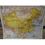
CHINA / MAPS: two large double-sided colour school wall maps of China and the Far East. 120 x 100
CHINA / MAPS: two large double-sided colour school wall maps of China and the Far East. 120 x 100 cm.
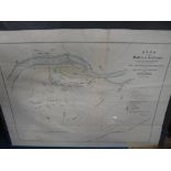
INDIA MAP/ SIKH WAR 1846: plan of the Battle of Sabraon, previously folded, 45 x 57 cm. (1).
![[VERSAILLES] coll'n of engr. views of Versailles & elsewhere, mostly h-col'd (Q).](https://portal-images.azureedge.net/auctions-2018/srjo10215/images/dab43684-8ea8-46fa-a762-a9a500b502fc.jpg?w=155&h=155)
[VERSAILLES] coll'n of engr. views of Versailles & elsewhere, mostly h-col'd (Q). ...[more]
![[ATLASES / MAPS] COLLINS' "Advanced Atlas consisting of 40 maps," 4to, col. printed, ca. 1890?; a](https://portal-images.azureedge.net/auctions-2018/srjo10215/images/6d7813ae-0aed-4608-8eed-a9a500b5150c.jpg?w=155&h=155)
[ATLASES / MAPS] COLLINS' "Advanced Atlas consisting of 40 maps," 4to, col. printed, ca. 1890?; a
[ATLASES / MAPS] COLLINS' "Advanced Atlas consisting of 40 maps," 4to, col. printed, ca. 1890?; a bound coll'n of county maps & a defective Bradsh...
![[BINDINGS] TREVELYAN (G. O.) The American Revolution, 5 vols, 8vo, maps, crushed red half morocco](https://portal-images.azureedge.net/auctions-2018/srjo10215/images/902fe528-2112-4866-bc09-a9a500b5f4e9.jpg?w=155&h=155)
[BINDINGS] TREVELYAN (G. O.) The American Revolution, 5 vols, 8vo, maps, crushed red half morocco
[BINDINGS] TREVELYAN (G. O.) The American Revolution, 5 vols, 8vo, maps, crushed red half morocco gilt, L., 1881-1907; & q. of mainly 19thc. leath...
SKELTON (R.) 250 years of map Making in the County of Sussex 1575-1825, atlas folio, stub-mounted
SKELTON (R.) 250 years of map Making in the County of Sussex 1575-1825, atlas folio, stub-mounted text & maps, cloth, printed label, Lympne/Chiche...
ARMENIA / GENOCIDE: VISCOUNT BRYCE, Government report of the treatment of Armenians in the Ottoman
ARMENIA / GENOCIDE: VISCOUNT BRYCE, Government report of the treatment of Armenians in the Ottoman Empire, 1915-16, folding map, without wrappers,...
![[ATLAS] Comparative Atlas of Ancient and Modern Geography...for the Use of Eton School, folio, engr.](https://portal-images.azureedge.net/auctions-2018/srjo10215/images/999cf5e7-1755-4370-9757-a9a500b6c1fd.jpg?w=155&h=155)
[ATLAS] Comparative Atlas of Ancient and Modern Geography...for the Use of Eton School, folio, engr.
[ATLAS] Comparative Atlas of Ancient and Modern Geography...for the Use of Eton School, folio, engr. title & list, 53 maps (numbered 1-27) h-col'd...
![[MAPS] SIMPSON (S.) compiler: The Agreeable Historian or Compleat English Traveller..., Vol. 2](https://portal-images.azureedge.net/auctions-2018/srjo10215/images/a7883b32-fbdd-4ea3-bd45-a9a500b31593.jpg?w=155&h=155)
[MAPS] SIMPSON (S.) compiler: The Agreeable Historian or Compleat English Traveller..., Vol. 2
[MAPS] SIMPSON (S.) compiler: The Agreeable Historian or Compleat English Traveller..., Vol. 2 only (with counties Norfolk - Yorkshire), 8vo, 20 f...
![[CHINA ATLAS] JOUAN (Rene) Geographie de la Chine, 4to atlas, maps & text, original printed](https://portal-images.azureedge.net/auctions-2018/srjo10215/images/42290f2e-ba14-4e40-a4fa-a9a500b73ee3.jpg?w=155&h=155)
[CHINA ATLAS] JOUAN (Rene) Geographie de la Chine, 4to atlas, maps & text, original printed wrappers, 3rd Edn., Shanghai, 1922. ...[more]
WALTER (R.) compiler: A Voyage Round the World in the Years MDCCXL, I, II, III, IV, by GEORGE
WALTER (R.) compiler: A Voyage Round the World in the Years MDCCXL, I, II, III, IV, by GEORGE ANSON .... The Second Edition, 8vo, 3 folding maps o...
COOK (Capt. James) & KING (Capt. James), A Voyage to the Pacific Ocean .... for making Discoveries
COOK (Capt. James) & KING (Capt. James), A Voyage to the Pacific Ocean .... for making Discoveries in the Northern Hemisphere.... To determine the...