Filtered by:
- Category
- List
- Grid
A subscription to the Price Guide is required to view results for auctions ten days or older. Click here for more information

Antiquarian Maps & Prints from 1614 - John Speed Atlas Front piece, 'The Theatre of the Empire of
Antiquarian Maps & Prints from 1614 - John Speed Atlas Front piece, 'The Theatre of the Empire of Great Britaine' and 'An exact Geography of the K...

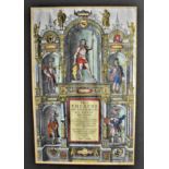
Antiquarian Maps and Prints - 1730 An Allegorical Front piece for the Atlas Novus Tabula Geographica, engraved coloured cartographic, mounted scare
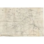
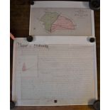
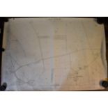
Great & Little Massingham Ordnance Survey Map 'with field names' inserted by hand. Measurements 55cm
Great & Little Massingham Ordnance Survey Map 'with field names' inserted by hand. Measurements 55cm x 36cm, tear on edge of map, good condition ...
Map of the Town of Swaffham and surrounding areas. Vintage measurements 61cm x 61cm, very good
Map of the Town of Swaffham and surrounding areas. Vintage measurements 61cm x 61cm, very good condition. Interesting item
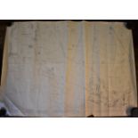
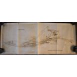
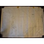
L.N.E.R Southern Area Chelmsford Survey Map dated 1936, lists proposed alterations. Measurements
L.N.E.R Southern Area Chelmsford Survey Map dated 1936, lists proposed alterations. Measurements 178cm x 47cm, slight creasing otherwise very good...
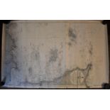
Hunstanton (Norfolk) Survey map 1905, measurements 104cm x 74cm. Small tears around edges of map
Hunstanton (Norfolk) Survey map 1905, measurements 104cm x 74cm. Small tears around edges of map otherwise good to very good condition
Sculthorpe & Fakenham (Norfolk) Survey Map dated 1946. Measurements 104cm x 74cm, very creased and
Sculthorpe & Fakenham (Norfolk) Survey Map dated 1946. Measurements 104cm x 74cm, very creased and sides tatty, poor condition ...[more]
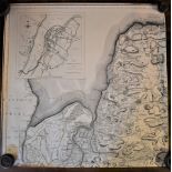
Norfolk Survey Map Second Edition 1905 - North Western Division, Walsingham Union and R.D. Measurements 104cm x 74cm, slight tear on edges otherwi...
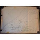
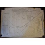
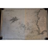
The Channel Islands - Adjacent Coast of France Survey Map, black and white edition first produced in
The Channel Islands - Adjacent Coast of France Survey Map, black and white edition first produced in 1909. Slight tear on edge of map, otherwise g...
A Map of 'All Saints Woodham' Woking Survey retro 1902, scale 6inches - 1 mile & documentation.
A Map of 'All Saints Woodham' Woking Survey retro 1902, scale 6inches - 1 mile & documentation. Measurement of the map 42cm x 29cm, documentation ...
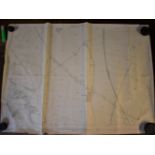
Bishop Stortford Railway Station and Track-Survey Map-Measurements 75cm x 31cm, very slight tear
Bishop Stortford Railway Station and Track-Survey Map-Measurements 75cm x 31cm, very slight tear other wise very good condition
Norfolk Survey Map Second Edition 1905 - Tatterset PH, North Western Division. Measurements 104cm
Norfolk Survey Map Second Edition 1905 - Tatterset PH, North Western Division. Measurements 104cm x 74cm-slight tear at top of map, otherwise good...
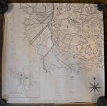
Survey Map 1910 Plans of the Town of Lynn and surrounding area. Measurements 61cm x 61cm known as
Survey Map 1910 Plans of the Town of Lynn and surrounding area. Measurements 61cm x 61cm known as Lynn Regis, very good condition-interesting item
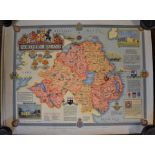
Maps (4) Northern Ireland, (2) Derbyshire, (2) interesting items very good condition. Measurements
Maps (4) Northern Ireland, (2) Derbyshire, (2) interesting items very good condition. Measurements 57cm x 45cm
France - The West Coast. Measurements 100cm x 68cm in good condition
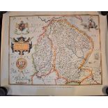
Maps (4) Wales - first printed 1684. Measurements 58cm x 50cm, Lincolnshire & Nottingham First
Maps (4) Wales - first printed 1684. Measurements 58cm x 50cm, Lincolnshire & Nottingham First printed 1576. Retro 1959 measurements 62cm x 49cm, ...
Ordnance Survey Map (Second Edition 1905) North Western Division Walsingham Union and R.D. Measurements 110cm x 73cm slight tear and damage around...
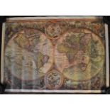
World Map (early) Retro First Published in Antwerp in 1596, at the time of the Dutch. Measurements
World Map (early) Retro First Published in Antwerp in 1596, at the time of the Dutch. Measurements 54cm x 38cm- very good condition
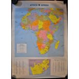
Map of Africa - measurements 78cm x 55cm. Good condition
Ordnance Survey Map - Northern Division Walsingham R.D. Revision of 1939, measures 103cm x 73cm,
Ordnance Survey Map - Northern Division Walsingham R.D. Revision of 1939, measures 103cm x 73cm, good condition
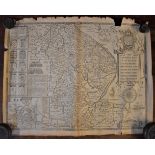
Antique Maps of Lincolnshire (2), measures 31cm x 25cm with index, the second measures 53cm x
Antique Maps of Lincolnshire (2), measures 31cm x 25cm with index, the second measures 53cm x 42cm (1610) both in poor condition
Coloured Print (Cecil Orr) Depicts Ted Kavanah & Cast-measurements 23cm x 18cm coloured print-slight
Coloured Print (Cecil Orr) Depicts Ted Kavanah & Cast-measurements 23cm x 18cm coloured print-slight folds down print-other wise very good conditi...
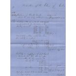
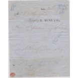
Stonham, Suffolk 1865-Receipt for rate made- for repairs of Highway in the said parish