Filtered by:
- Category
- List
- Grid
A subscription to the Price Guide is required to view results for auctions ten days or older. Click here for more information
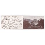

Scotland Crianearich Hotel RP two page Tariff card, view of Hotel and local map

Becontree 295 (London Borough of Barking and Dagenham) East London, Homestead Road, little activity.
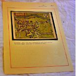
Antiquarian map - Colchester, small plan from Hermannidies small book entitled "Britannia Magna",
Antiquarian map - Colchester, small plan from Hermannidies small book entitled "Britannia Magna", Published in Amsterdam in 1661. Good

From West to East a Compendium of European Travel, published by H. Grube 1895 - 96. Some wear and
From West to East a Compendium of European Travel, published by H. Grube 1895 - 96. Some wear and tear to the cover, all maps and pages intact. Sc...
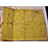
Coventry and Rugby National Grid Seventh Series Ordnance Survey - One-Inch Map Of Great Britain.
Coventry and Rugby National Grid Seventh Series Ordnance Survey - One-Inch Map Of Great Britain. Sheet 132 , published 1954. Good.
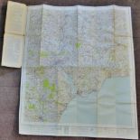
National Grid Ordnance Survey - One-Inch Map Of Great Britain. Sheet 176 Exeter, Published 1946.
National Grid Ordnance Survey - One-Inch Map Of Great Britain. Sheet 176 Exeter, Published 1946. Good.
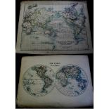
1889 CHART OF THE WORLD on MERCATORS PROJECTION 19”x14” (JOHNSON’S ATLAS)

ASTRONOMICAL MAPS 1889 Set of Astronomical Charts (Plates from Johnson’s Atlas) 19”x14” coloured
ASTRONOMICAL MAPS 1889 Set of Astronomical Charts (Plates from Johnson’s Atlas) 19”x14” coloured slight marginal stains on left side Very unusual ...
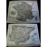
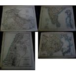
FRANCE 19”x14” 1889 (JOHNSON’S ATLAS) – Environs of Paris inset
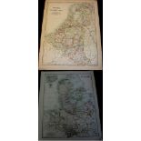
DENMARK 1889 14”x19” Iceland Faroes inset (JOHNSON’S ATLAS)
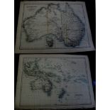
AUSTRALIA 1889 Antique Map 14”x19” Tasmania inset very fine (JOHNSON’S ATLAS)
INDIA 1889 Antique Map 19”x14” (JOHNSON’S ATLAS) very fine
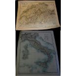
SWITZERLAND + The Alps of SAVOY + PIEDMONT 19”x14” 1889 (JOHNSON’S ATLAS)
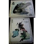
1889 ETHNOGRAPHIC MAP of GREAT BRITAIN AND IRELAND – Superb detailed antique map 14”x19” (JOHNSON’
1889 ETHNOGRAPHIC MAP of GREAT BRITAIN AND IRELAND – Superb detailed antique map 14”x19” (JOHNSON’S ATLAS) small stains lower border
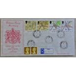
Great Britain - 1991 (17 Sep) Maps John O'Groats/Lands End C.D.s handstamps A.G.Bradbury official
Great Britain - 1991 (17 Sep) Maps John O'Groats/Lands End C.D.s handstamps A.G.Bradbury official FDC pair of covers p/a.

Box of maps- Great Britain etc, good condition