Filtered by:
- Category
- List
- Grid
This auctioneer has chosen to not publish their results. Please contact them directly for any enquiries.
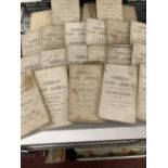

Maps: Military and exploration, 24 German, East Africa protectorate, folding maps WWI era. Most
Maps: Military and exploration, 24 German, East Africa protectorate, folding maps WWI era. Most marked OSO 1915, some earlier. Various sizes but m...
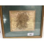
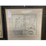
Antique Maps: Emmanuel Bowen hand coloured map of Wiltshire 1785, most likely taken from William
Antique Maps: Emmanuel Bowen hand coloured map of Wiltshire 1785, most likely taken from William Owen's General Magazine of arts and sciences. Fra...
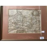
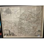
Maps: 16th cent. County Map of Berkshire by Christopher Saxton and William Hole, hand coloured,
Maps: 16th cent. County Map of Berkshire by Christopher Saxton and William Hole, hand coloured, two central vertical creases. Framed and glazed. 1...
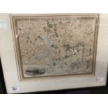
Maps: 19th cent. Map of Somersetshire by J & C Walker, with divisions and hundreds. 16½ins. x 13½
Maps: 19th cent. Map of Somersetshire by J & C Walker, with divisions and hundreds. 16½ins. x 13½ins. Plus 19th cent. Map, Plymouth and Davenport ...
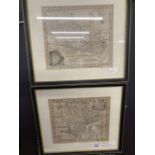
Maps: 18th cent. Two small County Maps by Emanuel Bowen, Devon divided into hundreds, and Berkshire,
Maps: 18th cent. Two small County Maps by Emanuel Bowen, Devon divided into hundreds, and Berkshire, both framed and glazed. 8ins. x 7ins.
Maps: 18th cent. County Map of Middlesex, hand coloured, depicting the hundreds. Produced by the
Maps: 18th cent. County Map of Middlesex, hand coloured, depicting the hundreds. Produced by the cartographer Robert Morden. Three central vertica...
maps: 18th cent. County Map of Somerset, with it's two divisions, hundreds, and with an inset of the
maps: 18th cent. County Map of Somerset, with it's two divisions, hundreds, and with an inset of the Ichnography of Bath pre-Royal Crescent. Produ...