Filtered by:
- Category
2 items
- List
- Grid
This auctioneer has chosen to not publish their results. Please contact them directly for any enquiries.
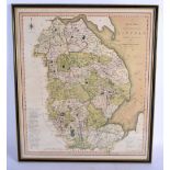

Lot 352
AN EARLY 19TH CENTURY NEW MAP OF THE COUNTRY OF LINCOLN printed for S Smith No 172 Strand January 6t
AN EARLY 19TH CENTURY NEW MAP OF THE COUNTRY OF LINCOLN printed for S Smith No 172 Strand January 6th 1801. Image 52 cm x 44 cm.
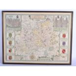
Lot 353
AN ANTIQUE MAP OF SURREY possibly 17th century, created by John Speed & engraved by Jodocus Hondius.
AN ANTIQUE MAP OF SURREY possibly 17th century, created by John Speed & engraved by Jodocus Hondius. Image 54 cm x 42 cm. ...[more]