Filtered by:
- Category
- List
- Grid
A subscription to the Price Guide is required to view results for auctions ten days or older. Click here for more information
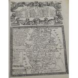

John Ogilvie London route maps etc in an album ...[more]
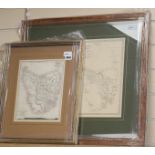
Two 19th century framed maps, including Western Australia/Van Dieman Island, originally published
Two 19th century framed maps, including Western Australia/Van Dieman Island, originally published and copyrighted by Baldwin & Cradock, 1833 (date...
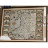
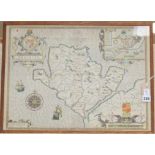
John Speed (1552-1629), a map of Wales published by John Sudbury and George Humble [1616 Latin
John Speed (1552-1629), a map of Wales published by John Sudbury and George Humble [1616 Latin text edition], from Speed's atlas 'The Theatre of t...
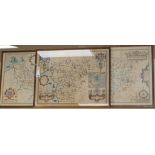
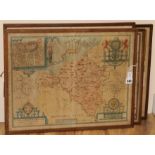
John Speed (1552-1629), three County maps of Wales, later hand-coloured, including 'Denbighshire',
John Speed (1552-1629), three County maps of Wales, later hand-coloured, including 'Denbighshire', published by John Sudbury and George Humble [16...
John Speed (1552-1629), a map of 'Anglesey - Antiently called Mona', later hand-coloured, published by John Sudbury and George Humble [1616 Latin ...
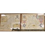
John Speed (1552-1629), two County maps of Wales, later hand-coloured, including 'Caernarvon' and '
John Speed (1552-1629), two County maps of Wales, later hand-coloured, including 'Caernarvon' and 'Breknoke', both published by Thomas Bassett and...
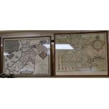
John Speed (1552-1629), two County maps of Wales, later hand-coloured, including 'Pembrokeshire',
John Speed (1552-1629), two County maps of Wales, later hand-coloured, including 'Pembrokeshire', published by Thomas Bassett and Richard Chiswell...
John Speed (1552-1629), four County maps of Wales, later hand-coloured, including 'Monmouth' and '
John Speed (1552-1629), four County maps of Wales, later hand-coloured, including 'Monmouth' and 'Caermarden', published by John Sudbury and Georg...