Filtered by:
- Category
- List
- Grid
A subscription to the Price Guide is required to view results for auctions ten days or older. Click here for more information

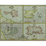
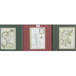
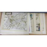
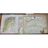
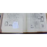
Scotland: Evia et Escia Scotis Evsdail - Eskdail a coloured map by Timothy Pont and published by
Scotland: Evia et Escia Scotis Evsdail - Eskdail a coloured map by Timothy Pont and published by Blaeu, circa 1654, in Spanish over Dutch, mounted...
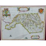
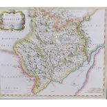
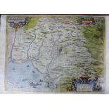
Glamorganshire: Glamorganensis comitatus vulgo, Johannes Blaeu, engraved map with contemporary
Glamorganshire: Glamorganensis comitatus vulgo, Johannes Blaeu, engraved map with contemporary hand colouring, this the Latin Edition with ships, ...
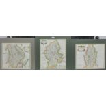
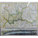
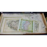
Robert Morden three and coloured engraved maps to include Oxford Shire for Camden Britannia 36 x
Robert Morden three and coloured engraved maps to include Oxford Shire for Camden Britannia 36 x 43cm, Midlesex, 43 x 38cm and Essex 43 x 38cm, b...
Robert Morden three hand coloured engraved maps to include Stafford Shire, 36 x 43cm, Leicester
Robert Morden three hand coloured engraved maps to include Stafford Shire, 36 x 43cm, Leicester Shire 43 x 38cm & Warwick Shire 43 x 38cm, all for...
Robert Morden two hand coloured engraved maps to include The County of Monmouth 42 x 36cm and The
Robert Morden two hand coloured engraved maps to include The County of Monmouth 42 x 36cm and The Bishoprick of Durham 43 x 38cm, for Camden's Br...
Robert Morden three hand coloured engraved maps to include Nottingham Shire, Lincoln shire, 43 x
Robert Morden three hand coloured engraved maps to include Nottingham Shire, Lincoln shire, 43 x 38cm and Stafford Shire 38 x 43cm, for Camden's B...
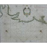
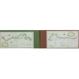
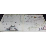
Hendrick Doncker (1625 - 1699) A sea chart of the East Coast of England from Northumberland to
Hendrick Doncker (1625 - 1699) A sea chart of the East Coast of England from Northumberland to Norfolk , circa 1666, 53 x 43cm, in a mount but un...
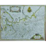
Russia (Russiae), North Part of Russia and Moscow, a hand coloured engraved map by Blaeu after Issac
Russia (Russiae), North Part of Russia and Moscow, a hand coloured engraved map by Blaeu after Issac Massa, circa 1650, with Dutch text verso, in ...
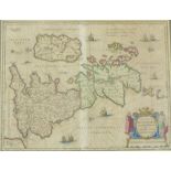
John Speed (1542 - 1629) Holy Island, Garnsey, Farne & Jarsey a hand coloured group of four maps
John Speed (1542 - 1629) Holy Island, Garnsey, Farne & Jarsey a hand coloured group of four maps on a single sheet, circa 1611, with English text ...
WITHDRAWN - Braun, Georg (1541 - 1622) & Franz Hogenberg (1538 - 1590), Edenburgum Scotaie Metropoli
WITHDRAWN - Braun, Georg (1541 - 1622) & Franz Hogenberg (1538 - 1590), Edenburgum Scotaie Metropolis, a 16th century hand coloured engraved map, ...
Andrew Bell for Encyclopedia Britannica, three coloured engraved maps to include Russia Moscovy,
Andrew Bell for Encyclopedia Britannica, three coloured engraved maps to include Russia Moscovy, circa 1797, 23 x 20cm, Asia & Africa, circa 1810,...
A Map of the New Roads from Westminster Bridge, an 18th century coloured map, engraved by John
A Map of the New Roads from Westminster Bridge, an 18th century coloured map, engraved by John Lodge, circa 1753, 36 x 23cm, in a mount but unfram...
A Plan of the River Salwarp and the Navigable Canal from Droitwich to the River Severn and another
A Plan of the River Salwarp and the Navigable Canal from Droitwich to the River Severn and another of the Navigable Canal from near the City of Co...
A collection of 18th century coloured Road Maps by Owen & Bowen, unframed (5) ...[more]
A collection of 18th century coloured Ward Maps of London by Thomas Bowen to include Lime Street,
A collection of 18th century coloured Ward Maps of London by Thomas Bowen to include Lime Street, Cripple Gate Ward & Portsoken Ward, 23 x 17.5cm,...
A collection of 18th century coloured Ward Maps of London by Thomas Bowen to include Coleman Street & Bassishaw, Bread Street Ward and Cordwaine...
Thomas Kitchin circa 1763 - 1782, a group of eight unframed coloured maps from The Shires & Regions of Scotland to include Stirling & Clackmannan,...
A quantity of 19th century English County coloured maps, by Robert Creighton and engraved by Lewis
A quantity of 19th century English County coloured maps, by Robert Creighton and engraved by Lewis for Topographical Dictionary, all in mounts but...
A quantity of 18th century engraved coloured maps of English County's, by Thomas Kitchin, in mounts but unframed (approx 27)
World maps, a collection of 18th century engraved coloured maps by Thomas Kitchin to include Africa,
World maps, a collection of 18th century engraved coloured maps by Thomas Kitchin to include Africa, Asia, Poland & Lithuania, Germany and Chart o...
The Counties of Banff & The Counties of Stirling & Clackmannan, a quantity of unframed reproduction maps, unframed (a lot) ...[more]
Nicolas Bellin group of four 18th century coloured maps to include Carte Du Detroit De Waegats ou de
Nicolas Bellin group of four 18th century coloured maps to include Carte Du Detroit De Waegats ou de Nassau, Partie de la Mer Glaciale, Carte du ...
Nicolas Bellin group of three 18th century coloured maps to include Carte des Isles Maldives & Carte
Nicolas Bellin group of three 18th century coloured maps to include Carte des Isles Maldives & Carte de l'Isle Celebs ou Macassar from Histoire Ge...
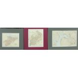
Gazatteer maps of Scotland by Bartholomew to include County of Linlithgow, Selkirk and Estuary of
Gazatteer maps of Scotland by Bartholomew to include County of Linlithgow, Selkirk and Estuary of The Clyde , various sizes - largest approx 39 ...
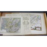
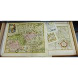
The Counties of England, a quantity of 19th century coloured maps drawn and engraved by Thomas
The Counties of England, a quantity of 19th century coloured maps drawn and engraved by Thomas Moule, various sizes - approx 26.5 x 20cm, in mount...
World Maps, a collection of 19th century coloured maps engraved by John Rapkin and published by John
World Maps, a collection of 19th century coloured maps engraved by John Rapkin and published by John Tallis, to include Northern Italy, Denmark, B...
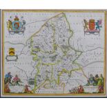
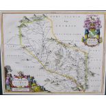
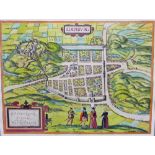
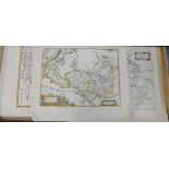
Staffordiensis comitatus; vulgo Stafford Shire by Blaeu, Amsterdam 1646, contemporary hand coloured map with French text verso, in a mount but unf...
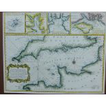
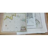
A Correct Chart of the English Channel From the No. Foreland to the Lands End on the Coast of
A Correct Chart of the English Channel From the No. Foreland to the Lands End on the Coast of England and from Calais to Brest on the Coast of Fra...
Johann Baptist Homann - Prospect of London and Westminster, (Regions, quae est circa Londinum), hand
Johann Baptist Homann - Prospect of London and Westminster, (Regions, quae est circa Londinum), hand coloured map to include Hertfordshire, with a...
Pieter Goos (1616 - 1675) two hand coloured sea charts to include Canaal Engeland en Vrancriick
Pieter Goos (1616 - 1675) two hand coloured sea charts to include Canaal Engeland en Vrancriick and Van't Canaal, hoemen, unframed, 59 x 60cm (2)
Ortellius: Hispalensis conventus a coloured engraved map by H. Chiaues, circa 1588, Spanish text
Ortellius: Hispalensis conventus a coloured engraved map by H. Chiaues, circa 1588, Spanish text verso, unframed and likely trimmed, 52 x 39cm
Audience de Guatimala, 17th century coloured engraved map from L'Amerique en Plusieure Cartes, 28
Audience de Guatimala, 17th century coloured engraved map from L'Amerique en Plusieure Cartes, 28 x 19cm together with Charte der Insel Otaheite, ...
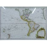
Janvier, L'Amerique, 18th century coloured map with strapwork cartouche, printed in Paris, 1783,
Janvier, L'Amerique, 18th century coloured map with strapwork cartouche, printed in Paris, 1783, contained within a glazed and giltwood frame, 46 ...
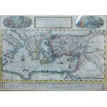
Peregrinationis Divi Pavli Typus Corographicus, Abraham Ortelius coloured map of the travels of St
Peregrinationis Divi Pavli Typus Corographicus, Abraham Ortelius coloured map of the travels of St Paul the Apostle through the Mediterranean, fra...
France maps to include Lymoges, Blaeu Amsterdam 1650 with Latin text verso, 51 x 40cm together
France maps to include Lymoges, Blaeu Amsterdam 1650 with Latin text verso, 51 x 40cm together with Episcopatus Metensis (province of Metz) De Wit...
British Isles: Insularum Brittanicarum accurata delineatio ex Geographics Conatibus, coloured map,
British Isles: Insularum Brittanicarum accurata delineatio ex Geographics Conatibus, coloured map, Amstelodani, Joannem Janssonium, after Ortelius...
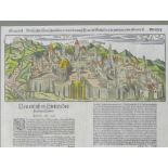
Die Statt Jerusalem, a coloured panoramic birds eye plan view with German text below, Sebastian
Die Statt Jerusalem, a coloured panoramic birds eye plan view with German text below, Sebastian Munster, in a glazed frame 40 x 39cm
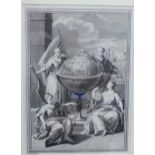
Globe of the World with four Classical female figures, monochrome print, engraved by Jan Punt, in
Globe of the World with four Classical female figures, monochrome print, engraved by Jan Punt, in glazed frame 16 x 22cm
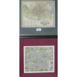
A pair of framed reproduction coloured maps to include Dublin & Edinburgh, in glazed frames, 27 x
A pair of framed reproduction coloured maps to include Dublin & Edinburgh, in glazed frames, 27 x 22cm (2) ...[more]
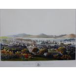
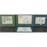
Views in Scotland by John Clark to include The Town of Greenock, The Town of Dunkeld and The Town of
Views in Scotland by John Clark to include The Town of Greenock, The Town of Dunkeld and The Town of Hamilton, three coloured prints, 64 x 50cm (3...
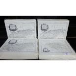
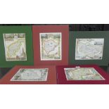
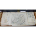
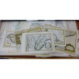
Regional Maps of Scotland - A quantity of unframed Timothy Pont for Bleau, Maps 1654 - 1662, (15)
Regional Maps of Scotland - A quantity of unframed Timothy Pont for Bleau, Maps 1654 - 1662, (15) ...[more]
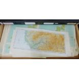
Scotland - A quantity of early 20th century ordnance survey maps, Bartholomew
Russian in Europe and Asia and Tartary - A quantity of unframed maps and charts (a lot)
Canada, Arctic and Russian North America - A quantity of unframed maps and charts
Central and South America, with the West Indies - A quantity of unframed maps and charts to include a Plan of Success Bay, Guyane, Paraguay etc., ...
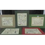
A quantity of unframed reproduction regional maps of Scotland by Timothy Pont / Blaeu, (a lot)
A quantity of unframed reproduction regional maps of Scotland by Timothy Pont / Blaeu, (a lot)
Scotland - The Chief Harbours in the Island of Orkney, Captain William Bond, together with a collection of Timothy Pont / Blaeu 17th century unfra...
Africa - A quantity of unframed maps and charts to include Libya, Numidia and Senegal, etc., (a lot) ...[more]
Italy - A quantity of unframed maps and charts to include Italian States, together with Corsica,
Italy - A quantity of unframed maps and charts to include Italian States, together with Corsica, Sardinia and Sicily (a lot)
America - A quantity of unframed maps and charts to include 'California', 'Tennessee', etc., (a lot)
America - A quantity of unframed maps and charts to include 'California', 'Tennessee', etc., (a lot)
Belgium and The Netherlands - A quantity of unframed maps and charts to include South Flanders,
Belgium and The Netherlands - A quantity of unframed maps and charts to include South Flanders, Visscher/Schenk and Gelderland / Holland, by Blaeu...
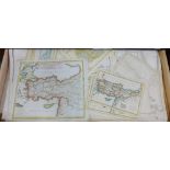
Turkey and Greece - A quantity of unframed maps and charts to include Bulgaria, Romania and Hungary etc., (a lot) ...[more]
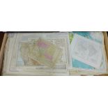
England - A quantity of unframed maps and charts to include East Anglia by Samson and Lambeth and
England - A quantity of unframed maps and charts to include East Anglia by Samson and Lambeth and Christ Church with the River Thames and Kent by ...
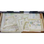
Scotland - A quantity of unframed County Maps and Areas (a lot)
Scotland - A quantity of unframed Atlas Maps by Bartholomew (a lot) ...[more]
Asia - A quantity of unframed maps and charts to include India, Japan, China and the East Indies
Asia - A quantity of unframed maps and charts to include India, Japan, China and the East Indies etc,. (a lot)
A quantity of Counties of England and Wales / Blaeu reproduction maps (a lot) ...[more]
Scotland - A quantity of Atlas of Scotland for County Atlas Maps to include Buteshire, Linlithgowshire and Dumfriesshire etc, together with the Ea...
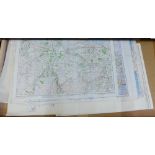
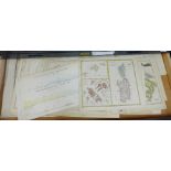
A quantity of unframed Ordnance Survey Maps of Great Britain, (a lot)
A quantity of unframed Maps and Charts of the World to include 'Different Projection' and 'Physical Geography' etc., (a lot)