Filtered by:
- Category
- List
- Grid
A subscription to the Price Guide is required to view results for auctions ten days or older. Click here for more information
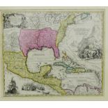

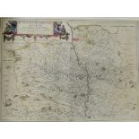
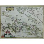
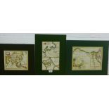
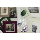
Johann Baptist Homann - Regni Mexicani seu Novae Hispaniae, hand coloured map, in glazed frame, 58 x
Johann Baptist Homann - Regni Mexicani seu Novae Hispaniae, hand coloured map, in glazed frame, 58 x 49cm
Laurent - Carte Du Kamtchatka peninsula in Russia, 18th century coloured map, in a mount but unframed, 30 x 52cm
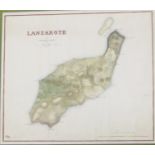
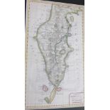
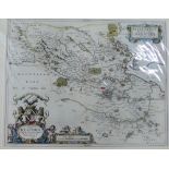
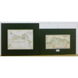
Peloponnesus a 19th century coloured map, printed by Nuttall, Fisher & Dixon 41 x 26cm together with
Peloponnesus a 19th century coloured map, printed by Nuttall, Fisher & Dixon 41 x 26cm together with Lanzarote published by Carl Mare, Berlin, 36 ...
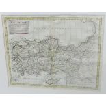
Antonio Zatta - Asia Minor, in suas Parte seu Provincias divisa Venetiis coloured map, in a glazed
Antonio Zatta - Asia Minor, in suas Parte seu Provincias divisa Venetiis coloured map, in a glazed frame, 42 x 33cm
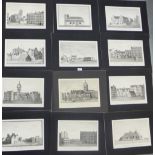
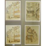
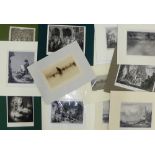
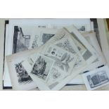
Set of twelve T.G Stevenson stone lithograph prints of Edinburgh streets and buildings to include
Set of twelve T.G Stevenson stone lithograph prints of Edinburgh streets and buildings to include Bristo Street, St Giles Church, Foot of the West...
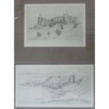
Freddie Theys (Belgium) Two copper plate engravings to include Inverness Castle & Dunnottar Castle, in mounts but unframed, largest 39 x 21cm (2...
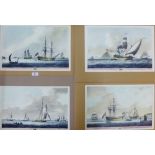
Four hand coloured nautical lithograph prints, in mounts but unframed 43 x 28cm (4)
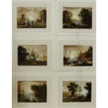
After Claude Lorraine Set of six pastoral and harbour scenes coloured engraved prints, in mounts but
After Claude Lorraine Set of six pastoral and harbour scenes coloured engraved prints, in mounts but unframed 27 x 21cm (6) ...[more]
Set of four James Drummond Old Closes of Edinburgh coloured stone lithographs, in mounts but unframed, 29 x 39cm (4)
Vincenzo Maria Coronelli hand coloured map of Doncherca (Dunkirk) circa 1700, in a mount but unframed 45 x 28cm
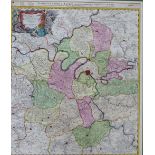
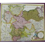
Germany, Mansfel Diae Comi Tatvs De Scriptio, auctore Tilemanno Stella, a hand coloured map by
Germany, Mansfel Diae Comi Tatvs De Scriptio, auctore Tilemanno Stella, a hand coloured map by Abraham Orlelius, in a mount but unframed, 44 x 38c...
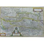
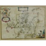
Austria, Archidvcatvs auctore Wolfgango Lazio, a hand coloured map by Blaeu, in a mount but unframed, 56 x 38cm
Glottiana Praefectvra Inferior CVM Baronia Glascvensi, Timothy Pont, antique printed map, in amount but unframed, 55 x 40cm
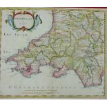
Robert Morden coloured map of South Wales, in a mount but unframed 43 x 37cm
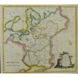
J. Barber coloured map of Russia or Moscovy in Europe, in a mount but unframed, 39 x 35cm
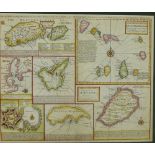
Emanuel Bowen African Islands in the Mediterranean, Atlantic and Ethiopic Oceans, coloured map, in a
Emanuel Bowen African Islands in the Mediterranean, Atlantic and Ethiopic Oceans, coloured map, in a mount but unframed 43 x 35cm
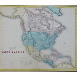
Gall & Inglis, 19th century coloured Map of North America, in a mount but unframed 55 x 46cm ...[more]
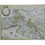
Agri Parisiensis, (Paris) coloured map by Johann Baptiste Homanno, circa 1710, in amount but unframed 50 x 58cm
Carte de la Siberie coloured map by S. Bellin, in a mount but unframed 47 x 30cm
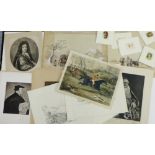
Art Journal steel engravings to include The Royal Sisters, Scottish Lassies & Queen Victoria, etc,
Art Journal steel engravings to include The Royal Sisters, Scottish Lassies & Queen Victoria, etc, in mounts but unframed (4) ...[more]
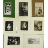
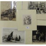
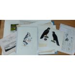
A collection of etchings and copper plate engravings to include Raeburn, Milton and Sangster etc,
A collection of etchings and copper plate engravings to include Raeburn, Milton and Sangster etc, all in mounts but unframed (8)
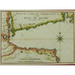
Plan de la Baye de Chedabouctou, Havre de Milfort (Canada) by Bellin, in a mount but unframed 29 x
Plan de la Baye de Chedabouctou, Havre de Milfort (Canada) by Bellin, in a mount but unframed 29 x 21cm
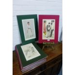
A carton containing a quantity of Vanity Fair coloured prints, all in mounts (approx 38)
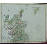
Early 19th century Charte von Scotland by August Stieler, Weimar 1804, in a mount but unframed 55
Early 19th century Charte von Scotland by August Stieler, Weimar 1804, in a mount but unframed 55 x 46.5cm
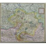
18th century coloured map of Saxoniae (North Germany) by Johann Baptise Homann, in a mount but
18th century coloured map of Saxoniae (North Germany) by Johann Baptise Homann, in a mount but unframed 57 x 48cm
Scotland - Sterlinensis a hand coloured map by Timothy Pont and published by Blaeu, circa 1654,
Scotland - Sterlinensis a hand coloured map by Timothy Pont and published by Blaeu, circa 1654, mounted but unframed 52 x 42cm
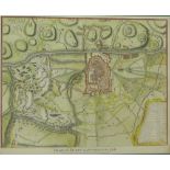
18th century colour engraved Plan of Turin as Besieged in 1706, for Mr Tindal's Continuation of Mr
18th century colour engraved Plan of Turin as Besieged in 1706, for Mr Tindal's Continuation of Mr Rapin's History of England, in a mount but unf...
The Upper Ward of Clyds-Dayl, coloured map by Timothy Pont, in a giltwood frame under glass, 53 x
The Upper Ward of Clyds-Dayl, coloured map by Timothy Pont, in a giltwood frame under glass, 53 x 38cm
Timothy Pont coloured map of Lorna cum insulis vicinis et provinciis eidem conterminis, published by
Timothy Pont coloured map of Lorna cum insulis vicinis et provinciis eidem conterminis, published by Johannes Blaeu, framed under glass 54 x 40cm
Comitatus Northvmbria, (Northumbria and Durham) coloured map, framed under glass 52 x 43cm
Timothy Pont hand coloured map of Nithia Vicecomitatus, framed under glass, 55 x 40cm
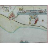
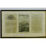
18th century hand coloured engraved chart, Prospect of Leith from the East for Capt Greenvile
18th century hand coloured engraved chart, Prospect of Leith from the East for Capt Greenvile Collins, framed under glass, 47 x 46cm
Karstia Carniola, Histria et Windorum Marchia, coloured map by Gerhard Mercatore, published by
Karstia Carniola, Histria et Windorum Marchia, coloured map by Gerhard Mercatore, published by Blaeu, framed under glass, 51 x 40cm
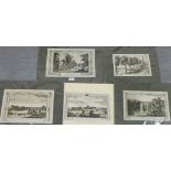
Five engraved prints to include Walpoole's British traveller, etc (in mounts but unframed (5)
Five engraved prints to include Walpoole's British traveller, etc (in mounts but unframed (5)
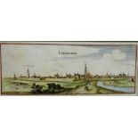
Levwarden, Holland, a 16th century hand coloured map by Braun & Hogenberg, in a mount but unframed
Levwarden, Holland, a 16th century hand coloured map by Braun & Hogenberg, in a mount but unframed 37 x 15cm ...[more]
Tienen, Belgium, a 16th century hand coloured map by Braun & Hogenberg, in a mount but unframed 42 x
Tienen, Belgium, a 16th century hand coloured map by Braun & Hogenberg, in a mount but unframed 42 x 35cm ...[more]
Egypt with Lybia, coloured map by R.W Searle for Mr Rollins Ancient History circa 1780, A Bird's Eye
Egypt with Lybia, coloured map by R.W Searle for Mr Rollins Ancient History circa 1780, A Bird's Eye View of the situation of Carthage circa 1780 ...
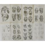
Set of eight copper engravings, The System of Midwifery by C. Cooke, circa 1795 (8)
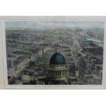
View of London From St Paul's, Looking Eastward, a coloured print by J Sulman for the Illustrated
View of London From St Paul's, Looking Eastward, a coloured print by J Sulman for the Illustrated News, 50 x 35cm
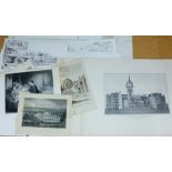
Relics of Ancient Architecture & Other Picturesque Scenes in Glasgow, Published and Lithographed
Relics of Ancient Architecture & Other Picturesque Scenes in Glasgow, Published and Lithographed by Miller & Buchanan, 1849 ...[more]
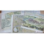
North British Railway (Edinburgh to Berwick) circa 1870 together with Reduced Plan of Reservoirs and
North British Railway (Edinburgh to Berwick) circa 1870 together with Reduced Plan of Reservoirs and Aqueduct near Greenock, circa 1827, in mounts...
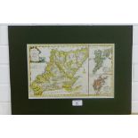
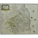
New Map of the Counties of Orkney, Cathness, Sutherland, Ross & Cromarty, 18th century coloured
New Map of the Counties of Orkney, Cathness, Sutherland, Ross & Cromarty, 18th century coloured map by T. Conder, published by Alex Hogg, in mount...
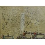
George Bickham engraved Birds Eye View of Dorsetshire with two pages of text, circa 1754, in
George Bickham engraved Birds Eye View of Dorsetshire with two pages of text, circa 1754, in glazed Hogarth frame, size overall 61 x 37cm
Quantity of engraved copper plates (a lot)
Quantity of coloured engraved prints to include Wm Daniel, Turner and Cassells etc., (a lot)
Quantity of coloured engraved prints to include Wm Daniel, Turner and Cassells etc., (a lot)
Quantity of copper and steel engraved prints to include Wilkie, etc., (a lot)
Four unframed etchings to include Orange Wharf, London, M.W. Ridley, (5)
Front View of the Royal Palace of Holyrood House, circa 1781, Somerville Land coloured print and '
Front View of the Royal Palace of Holyrood House, circa 1781, Somerville Land coloured print and 'Printers Proof' copper plate etching, circa 1908...
Dutch Scene copper plate etching, and two others to include 'A Winters Landscape' and 'A Scientist
Dutch Scene copper plate etching, and two others to include 'A Winters Landscape' and 'A Scientist by W. Hole', largest 22 x 15cm, (3)
Calum Duncan McCafferty New Palm House, Royal Botanics, Edinburgh Ltd edition print No. 15/100,
Calum Duncan McCafferty New Palm House, Royal Botanics, Edinburgh Ltd edition print No. 15/100, signed in pencil, 38 x 23m ...[more]
Discovery of the Straits of Magellan in 1520, coloured print for the Illustrated News together
Discovery of the Straits of Magellan in 1520, coloured print for the Illustrated News together with a steel engraving 'The Morning After the Wreck...
Panoramic View of Paris with the Louvre and Rue de Rivoili completed, an engraved coloured print
Panoramic View of Paris with the Louvre and Rue de Rivoili completed, an engraved coloured print 53 x 36cm
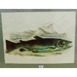
After William Jardine, Ltd Edition coloured lithograph, 61 x 44cm
Quantity of unframed prints and boo plates, etc (a lot)
A collection of unframed prints, etc (a lot)
Quantity of unframed engravings and prints etc., (a lot - a/f)
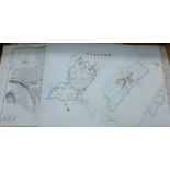
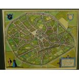
Scotland - a quantity of unframed Town and City Plans, to include Plan of Dunkeld, Glasgow, Ayr
Scotland - a quantity of unframed Town and City Plans, to include Plan of Dunkeld, Glasgow, Ayr and suburbs etc., (a lot - a/f)
A quantity of unframed engraved prints and others, etc. (a lot)
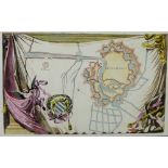
Military - a quantity of unframed map and plans of fortified cities to include A View of Casal, a
Military - a quantity of unframed map and plans of fortified cities to include A View of Casal, a Very Strong City and Castle in Italy, etc., (a l...
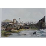
A quantity of unframed reproduction prints 'The Back of Old Leith Pier' (a lot)